Old Maps of Suffield, Connecticut for Hiking & Exploration
Hike through history with 94 historic maps of Suffield. Explore old trails, ghost towns, and forgotten backroads — perfect for outdoor adventurers and local explorers.
- Rediscover forgotten places: Map out old mining camps, roads, and footpaths that no longer exist on modern maps.
- Layer with modern tools: Combine with LiDAR or satellite views to plan hikes through historical terrain.
- Made for exploration: Popular among hikers, overlanders, and local history lovers.
Use these maps to find adventure and explore the hidden past of Suffield.
Suffield, CT maps
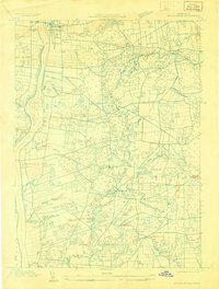
(94)- 1886 Map of Springfield
 1886 Springfield1886 Print · USGSThe Connecticut River valley thrives as a rail and industrial powerhouse at the end of the nineteenth century. Genealogists and researchers can trace local families and industry in hubs like Chicopee Falls, Ireland Parish, and the growing streetscapes of Brightwood.
 - 1887 Map of Granville
 1887 Granville1887 Print · USGSHampden County's river valleys and rugged uplands are captured here in the late nineteenth century as industry and railroads transformed the terrain. Trace family-named landmarks and infrastructure like Ore Hill, the Borden Br. Res., and the Boston and Albany Railroad.
 - 1889 Map of Springfield
 1889 Springfield1889 Print · USGSThe Connecticut River valley thrives as an industrial powerhouse in the 1880s, fueled by a dense network of water power and rail. Genealogists and historians can trace the foundations of Holyoke and Springfield, or find smaller settlements like Baptist Village and Mittineague.
 - 1889 Map of Granville
 1889 Granville1889 Print · USGSThe hill towns of Hampden County are shown here in the late nineteenth century, capturing a period of upland farming and early industrial rail. Researchers can trace the Boston and Albany Railroad through the Westfield River valley or locate family sites in North Blandford and East Granville.
 - 1892 Map of Hartford
 1892 Hartford1892 Print · USGSGreater Hartford in the early 1890s is captured here as a bustling corridor of river commerce and expanding rail lines. Researchers can trace the ancestral locations of Warehouse Point, locate the historic Bissel Ferry, and follow the old Hartford Division tracks.8 unique versions available
 - 1892 Map of Granby
 1892 Granby1892 Print · USGSThe Farmington River valley during the 1890s reveals a landscape of industrial hubs and steep ridges connected by a dense rail network. Researchers can trace historic landmarks like Satan's Kingdom and the routes of the Central New England and Western Railroad.8 unique versions available
 - 1893 Map of Springfield
 1893 Springfield1893 Print · USGSThe Pioneer Valley at the end of the nineteenth century centers on the bustling riverfronts of Springfield and Holyoke. Genealogists and historians can trace the rail-connected neighborhoods of Indian Orchard, the distinct Shakers settlement, and early industries along the Chicopee River.
 - 1893 Map of Granville
 1893 Granville1893 Print · USGSHampden County and the northern Connecticut border are captured here in the late nineteenth century as the regional rail network matured. Genealogists and local historians can trace the early homesteads and hamlets of Blandford, Granville, and West Parish, while locating landmarks like Ore Hill and Salmon Falls.
 - 1895 Map of Springfield
 1895 Springfield1895 Print · USGSThe Connecticut River valley thrives in the late 1800s as a powerhouse of rail-side industry and varied agricultural settlements. Researchers can trace the early layouts of Ireland Parish, the Shaker community, and the mills of Chicopee Falls.11 unique versions available
 - 1895 Map of Granville
 1895 Granville1895 Print · USGSWestern Massachusetts and northern Connecticut hill towns are captured in the 1890s, revealing a landscape of remote mountain hamlets and early river railroads. Genealogists can trace family holdings near East Granville, North Blandford, and the distinct peaks of Liberty Hill or Winchell Mtn.8 unique versions available
 - 1896 Map of Holyoke
 1896 Holyoke1896 Print · USGSThe Pioneer Valley and the eastern Berkshire foothills thrive in the 1890s as a complex network of industrial towns and upland farming communities. Historians can trace early infrastructure through the Bisbee Mill, the Agricultural College, and the prominent Ox Bow on the Connecticut River.
 - 1897 Map of Holyoke
 1897 Holyoke1897 Print · USGSThe Pioneer Valley and surrounding highlands thrive in the 1890s, caught here at the height of the region's industrial and agricultural development. Genealogists and historians can trace family roots through dozens of hill towns and river settlements, from Agricultural College in Amherst to the mills of Holyoke and the remote tracks of the Athol Br. R. R..
 - 1901 Map of Holyoke
 1901 Holyoke1901 Print · USGSThe Pioneer Valley and surrounding highlands thrive at the turn of the century, showing a landscape defined by mill towns and early rail networks. Genealogists and historians can trace old homesteads and local landmarks like Bisbee Mill, South Ferry, and the Agricultural College.4 unique versions available
 - 1906 Map of Farmington
 1906 Farmington1906 Print · USGSCentral Connecticut at the turn of the century is a landscape of river-powered industry and rail-connected towns. Researchers can trace historic river crossings like Bissell Ferry and explore early village centers including Collinsville, Satans Kingdom, and Pine Meadow.2 unique versions available
 - 1920 Map of Springfield
 1920 Springfield1920 Print · USGSGreater Springfield and the Pioneer Valley are captured here during a period of intense industrial and rail expansion. Genealogists and local historians can trace the foundations of neighborhoods like Indian Orchard, locate the Shaker Sta, or study the early rail alignments of the Boston and Albany RR.
 - 1928 Map of Windsor Locks
 1928 Windsor Locks1928 Print · USGSThe northern Connecticut River Valley is captured here in the late 1920s during a period of industrial and agricultural prosperity. Researchers can trace the path of the New York New Haven and Hartford railroad through Windsor Locks and Poquonock.
 - 1928 Map of Long Meadow
 1928 Long Meadow1928 Print · USGSNorth-central Connecticut and the Massachusetts border are captured here in the late twenties, showing the region's transition into the modern era. Genealogists can trace the rail-and-river network through Thompsonville and find the site of Shaker Sta.
 - 1928 Map of Broad Brook
 1928 Broad Brook1928 Print · USGSNorthern Connecticut’s river valley and fertile uplands are preserved here as they appeared in the late twenties. Genealogists and local historians can trace family-named hubs like Sadd's Mills and Osborne or locate old crossings at Warehouse Point.
 - 1928 Map of Mittineague
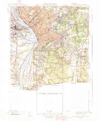
 1928 Mittineague1928 Print · USGSThe Connecticut and Massachusetts borderlands appear here in the late twenties during an early aerial survey of the region. Researchers can trace the path of the N Y N H & H railroad through Suffield and locate rural landmarks like Buck Hill and Still Brook.
 - 1933 Map of Feeding Hills
 1933 Feeding Hills1933 Print · USGSThe Lower Pioneer Valley in the early thirties reveals a landscape shaped by the ridge of Proven Mountain and the winding Westfield River. Genealogists and historians can locate legacy institutions like the Westfield State Sanatorium and trace local neighborhoods from Frog Bottom to Feeding Hills.
 - 1933 Map of Longmeadow
 1933 Longmeadow1933 Print · USGSThe Connecticut River valley thrives in the early 1930s as a hub of industry, education, and transport. Researchers can trace historic family plots at Springfield Cemetery or locate old rail hubs like Union Station and the Longmeadow Sta.
 - 1937 Map of Southwick
 1937 Southwick1937 Print · USGSHampden County's borderlands are captured in the late 1930s, showing the early infrastructure and rural character of this Massachusetts-Connecticut corridor. Local historians can trace old transit lines like the New York and New Haven Road and identify ancestral sites at Granville Cem or the Northeast Cem.
 - 1938 Map of West Springfield
 1938 West Springfield1938 Print · USGSHampden County's river valleys and ridgelines are captured here in the 1930s during a period of steady institutional and residential growth. Genealogists and local historians can trace the foundations of WESTFIELD and AGAWAM, locating family landmarks like Shea Corner, St James Ch, and the Suffield Street Sch.3 unique versions available
 - 1938 Map of Springfield South
 1938 Springfield South1938 Print · USGSSpringfield and its southern neighbors appear here in the late 1930s, showing a bustling industrial city and its growing suburbs before postwar change. Researchers can trace historic rail lines through Union Sta or locate family plots in Oak Grove Cemetery and St Michaels Cemetery.3 unique versions available
 - 1939 Map of Springfield South
 1939 Springfield South1939 Print · USGSThe Pioneer Valley hums with industrial and civic energy in the late thirties as rail hubs and river crossings define the landscape. Trace the urban layout of Springfield through landmarks like the U S Armory, Union Sta, and Oak Grove Cemetery.2 unique versions available
Showing maps 1-25 of 94
Top cities near Suffield
- Springfield historical maps
- Hartford historical maps
- West Hartford historical maps
- Manchester historical maps
- Chicopee historical maps
- East Hartford historical maps
See more
Top neighborhoods of Suffield
- Suffield Depot historical maps
- West Suffield historical maps
- Rising Corner historical maps
- Ebbs Corner historical maps
- Halladay Corner historical maps
- Suffield Historic District historical maps
See more
Frequently asked questions
- What are the different types of historical maps available for Suffield?
- What is the oldest map of Suffield?
- Where can I purchase historical maps of Suffield for my home or office?
- Where can I download high-res historical maps of Suffield?
- Are there historical topographic maps available for Suffield?
- Is there historical aerial imagery available for Suffield?
- Where are historical maps of Suffield sourced from?