Old Maps of Southbury, Connecticut for Hiking & Exploration
Hike through history with 48 historic maps of Southbury. Explore old trails, ghost towns, and forgotten backroads — perfect for outdoor adventurers and local explorers.
- Rediscover forgotten places: Map out old mining camps, roads, and footpaths that no longer exist on modern maps.
- Layer with modern tools: Combine with LiDAR or satellite views to plan hikes through historical terrain.
- Made for exploration: Popular among hikers, overlanders, and local history lovers.
Use these maps to find adventure and explore the hidden past of Southbury.
Southbury, CT maps
(48)- 1889 Map of Derby
 1889 Derby1889 Print · USGSThe industrial Naugatuck Valley hums with activity in the late Victorian era as railroads and river power drive the growth of Connecticut's mill towns. Genealogists can trace family holdings near John Johnson Hill or explore the early street layouts of BIRMINGHAM, ANSONIA, and SEYMOUR.
 - 1891 Map of Derby
 1891 Derby1891 Print · USGSThe industrial Naugatuck Valley and the rural hills of Oxford come to life in the late nineteenth century. Genealogists and historians can trace the early footprints of Birmingham, Ansonia, and Derby or locate outlying hamlets like Quaker Farms and Red City.
 - 1892 Map of Danbury
 1892 Danbury1892 Print · USGSFairfield County thrived as a railroad and industrial hub in the late nineteenth century. Genealogists and researchers can trace old neighborhoods in Danbury and Bethel, or locate landmarks like the Putnam Monument and Sandy Hook Station.11 unique versions available
 - 1892 Map of New Milford
 1892 New Milford1892 Print · USGSLitchfield County in the late nineteenth century is defined by the steep valleys of the Housatonic and Shepaug rivers. Genealogists and researchers can trace the rail-and-river economy through landmarks like Housatonic Railroad, Boardmans Bridge, and Washington Green.
 - 1893 Map of Waterbury
 1893 Waterbury1893 Print · USGSWestern Connecticut in the late nineteenth century was defined by the industrial pulse of the Naugatuck valley and the quiet hills to its west. Genealogists and historians can trace the early rail alignments of the Northern R. R. and locate family landmarks like White Deer Rocks or the village of Hotchkissville.2 unique versions available
 - 1893 Map of New Milford
 1893 New Milford1893 Print · USGSLitchfield County's river valleys and hills are captured here in the late nineteenth century, showing the region's development before modern expansion. Genealogists can trace the rail-and-river network through historic depots like Merwinsville and old village centers including Washington Green and Bridgewater.2 unique versions available
 - 1893 Map of Derby, 1898 Print
 1893 Derby1898 Print · USGSLower Naugatuck Valley industry and rural hill towns are captured in detail during the 1890s as the rail network reached its peak. Researchers can trace the industrial hearts of Birmingham and Derby or locate old crossings like Zoar Bridge and Pines Bridge.9 unique versions available
 - 1904 Map of New Milford
 1904 New Milford1904 Print · USGSLitchfield County at the close of the nineteenth century is defined by the industrial valleys of the Housatonic River and the rural reaches of Washington. Researchers can trace the era's infrastructure through landmarks like Kent Furnace, the Berkshire Division rail line, and the village at Roxbury Station.8 unique versions available
 - 1904 Map of Waterbury
 1904 Waterbury1904 Print · USGSThe Naugatuck River valley's industrial peak and the surrounding Litchfield Hills are captured here at the start of the twentieth century. Researchers can trace the early rail networks of the Naugatuck Division and find old local landmarks like Reynolds Bridge, Quassapaug Pond, and Hotchkissville.8 unique versions available
 - 1904 Map of Litchfield
 1904 Litchfield1904 Print · USGSThe Litchfield Hills at the turn of the century are shown here as a landscape of iron heritage and river-powered industry. Genealogists and historians can locate old industrial sites like Kent Furnace, ancestral homes near Sharon Valley, and early rail stops at Limerock Sta..3 unique versions available
 - 1915 Map of Danbury, 1921 Print
 1915 Danbury1921 Print · USGSFairfield County in the early twentieth century was a hub of railway activity and village life. Genealogists and historians can trace the tracks of the Housatonic Railroad and locate local landmarks like the Fair Grounds or the Putnam Monument.
 - 1947 Map of Hartford, 1955 Print
 1947 Hartford1955 Print · USGSSouthern New England and the Hudson Valley are shown in detail during the post-war expansion era. Genealogists and researchers can trace local landmarks from the State Capitol and Yale University to the Stratford Lighthouse and Woodlawn Cem.2 unique versions available
 - 1948 Map of Hartford
 1948 Hartford1948 Print · USGSSouthern New England is captured here in the late 1940s, showcasing a landscape of thriving industrial cities and developing parkways. Genealogists and historians can trace the rail networks of the New York New Haven and Hartford RR or locate coastal defense sites like Fort Terry and Camp Shanks.2 unique versions available
 - 1948 Map of Woodbury, 1953 Print
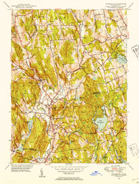 1948 Woodbury1953 Print · USGSLitchfield and New Haven County towns thrive at mid-century amidst a complex network of river valleys and glacial hills. Genealogists and historians can trace family plots in North Cem or explore the early campus footprints of the Taft Sch and Regina Laudis Priory.
 - 1949 Map of Roxbury
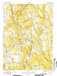 1949 Roxbury1949 Print · USGSLitchfield County in the late 1940s is centered here on the winding Shepaug River and its rail-and-road network. Genealogists and local historians can trace family locations near Center Cem, Roxbury Sta, and the heights of Mine Hill.2 unique versions available
 - 1950 Map of Woodbury
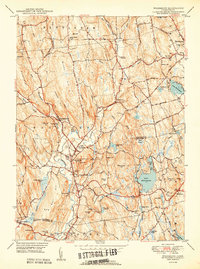 1950 Woodbury1950 Print · USGSWoodbury and Watertown are captured in the late 1940s, showing a Connecticut landscape of river valleys and institutional landmarks. Researchers can trace historic cemeteries like North Cem and school grounds such as Taft Sch near Lake Quassapaug.2 unique versions available
 - 1953 Map of Newtown, 1955 Print
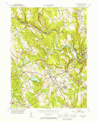 1953 Newtown1955 Print · USGSFairfield and New Haven Counties appear here in the early fifties, showing a region defined by river valleys and institutional growth. Researchers can locate family sites at Saint Rose Cem, trace the rail lines through Hawleyville, or explore the grounds of the Fairfield State Hospital.3 unique versions available
 - 1953 Map of Southbury, 1956 Print
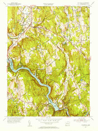 1953 Southbury1956 Print · USGSThe Housatonic valley in the early fifties shows a landscape transitioning between rural life and riverfront recreation. Genealogists can locate family names at Pine Hill Cem and Jacks Hill Cem or trace the early bounds of Kettletown State Park.3 unique versions available
 - 1955 Map of Woodbury, 1956 Print
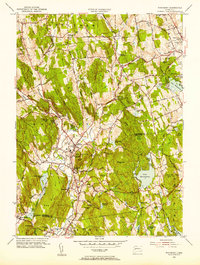 1955 Woodbury1956 Print · USGSMid-century Woodbury and its surrounding hills appear here during a period of steady growth along the Pomperaug River. Researchers can trace old family sites and local landmarks like Regina Laudis Priory, Lake Quassapaug, and the Taft Sch.5 unique versions available
 - 1955 Map of Roxbury, 1956 Print
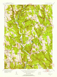 1955 Roxbury1956 Print · USGSThe Shepaug River valley remains a rural stronghold in the mid-fifties, dominated by small villages and hill farms. Genealogists can trace family landmarks like Judds Bridge and Burnham Sch, or locate ancestral plots at Old Leavonworth Cem.5 unique versions available
 - 1961 Map of Hartford
 1961 Hartford1961 Print · USGSSouthern New England and the Hudson Valley are shown here in the mid-fifties, capturing a landscape of booming coastal cities and interior hill towns. Researchers can trace the legacy of the New York New Haven and Hartford rail corridor and find strategic sites like Camp Shanks and Fort Michie.
 - 1962 Map of Hartford, 1971 Print
 1962 Hartford1971 Print · USGSSouthern New England and the Hudson Valley are shown in the early sixties, as suburban growth reached into the foothills. Trace the path of the New York New Haven & Hartford RR and find landmarks like Camp Nathan Hale and Gillette Castle State Park.3 unique versions available
 - 1963 Map of Newtown, 1965 Print
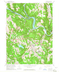 1963 Newtown1965 Print · USGSFairfield and New Haven Counties appear here in the early sixties, as the river valleys and rail lines continued to shape local industry and institutional life. Researchers can trace the grounds of the Fairfield State Hospital and find family sites at Lands End Cem or Newtown Village Cem.4 unique versions available
 - 1964 Map of Southbury, 1966 Print
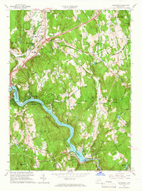 1964 Southbury1966 Print · USGSThe Housatonic River valley in the mid-sixties shows a landscape of rising ridges and riverside settlements. Researchers can locate family landmarks like Brookside Cem, the South Britain Consolidated Sch, and the Stevenson Dam Powerplant.5 unique versions available
 - 1965 Map of Hartford
 1965 Hartford1965 Print · USGSSouthern New England and the Hudson Valley are shown here during the mid-sixties expansion of the Interstate era. Trace the path of the New York New Haven & Hartford RR or locate historic landmarks like West Point Military Reservation and the Merritt Parkway.2 unique versions available
Showing maps 1-25 of 48
Top cities near Southbury
- Waterbury historical maps
- Danbury historical maps
- Milford historical maps
- Stratford historical maps
- Shelton historical maps
- Trumbull historical maps
See more
Top neighborhoods of Southbury
- Cedar Land historical maps
- Heritage Village historical maps
- Kettletown historical maps
- Lakeside historical maps
- Heritage Village historical maps
- Southford historical maps
See more
Frequently asked questions
- What are the different types of historical maps available for Southbury?
- What is the oldest map of Southbury?
- Where can I purchase historical maps of Southbury for my home or office?
- Where can I download high-res historical maps of Southbury?
- Are there historical topographic maps available for Southbury?
- Is there historical aerial imagery available for Southbury?
- Where are historical maps of Southbury sourced from?