Old Maps of Pomfret, Connecticut
Explore 50 old maps of Pomfret, spanning from 1889 to today. These high-resolution historic maps reveal how streets, neighborhoods, landmarks, and natural features evolved over time — perfect for genealogy, metal detecting, research, and local history exploration.
What you can do with these maps:
- See how Pomfret changed over time: Compare historical maps to modern-day views to trace roads, homesites, rail lines & more.
- View detailed metadata: Each map includes creators, publishers, year, scale, and archive source.
- Overlay maps with satellite & LiDAR: Visualize the past alongside modern tools to explore terrain & human change.
- Trusted historical sources: Maps sourced from the USGS, Library of Congress, and other archives.
- Access maps your way: View online, download high-res files, or order prints for personal or research use.
Start exploring old maps of Pomfret to uncover forgotten places, hidden landmarks, and the deep history beneath your feet.
Pomfret, CT maps
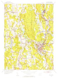
(50)- 1889 Map of Putnam
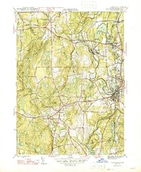
 1889 Putnam1889 Print · USGSThe industrial Quinebaug Valley comes alive in the late 1880s, showcasing a landscape of riverside mill towns and critical rail junctions. Genealogists can trace family roots through specific locales like Danielsonville, Putnam Heights P.O., and Thompson Station.
 - 1892 Map of Woodstock
 1892 Woodstock1892 Print · USGSNortheastern Connecticut at the close of the nineteenth century was a landscape of river-powered mill villages and independent farmsteads. Genealogists and historians can trace the paths between Mansfield Center, Phoenixville, and the New York and New England Railroad stops.6 unique versions available
 - 1893 Map of Putnam
 1893 Putnam1893 Print · USGSNortheastern Connecticut and the Rhode Island borderlands are documented here in the 1890s as the rail-and-river economy reached its peak. Researchers can trace historic mill villages like Ballouville, follow the New York and New England Railroad, or locate family sites near Danielsonville.8 unique versions available
 - 1919 Map of Putnam
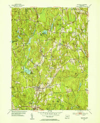
 1919 Putnam1919 Print · USGSWindham County and the Rhode Island borderlands are captured here during a period of heavy rail reliance and mill town growth. Researchers can trace the New York and New England Railroad through Pomfret Station or locate local landmarks like Cooke Store and Poutis Landing.
 - 1921 Map of Woodstock
 1921 Woodstock1921 Print · USGSWindham County villages and highland ridges are captured here during the early twentieth century, showing a landscape of small mill towns and glacial ponds. Researchers can trace the path of the New York New Haven and Hartford Railroad or locate family roots in Atwoodville, Phoenixville, or Mansfield Hollow.
 - 1943 Map of Putnam, 1944 Print
 1943 Putnam1944 Print · USGSThe Connecticut and Rhode Island borderlands are captured here during the wartime era, showing a landscape defined by textile river towns and sprawling state forests. Trace the industrial rail corridor of the New York New Haven and Hartford through Putnam, Danielson, and Moosup.
 - 1944 Map of Hampton
 1944 Hampton1944 Print · USGSWindham County during the mid-forties reveals a rural Connecticut landscape of rail-connected villages and state forest land. Trace the path of the New York New Haven and Hartford railroad to find Hampton Sta, the Elliotts Sch, and the North Cem.2 unique versions available
 - 1945 Map of Eastford
 1945 Eastford1945 Print · USGSWindham County at the close of the Second World War remains a patchwork of dense woodlands and small agrarian villages. Genealogists and historians can trace family roots through local landmarks like Ridge Cem, Arke Sch, and the riverside settlement of Phoenixville.2 unique versions available
 - 1945 Map of Putnam
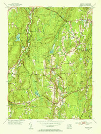
 1945 Putnam1945 Print · USGSWindham County at the close of the Second World War shows a landscape of busy river towns and prominent private academies. Researchers can trace the New York New Haven and Hartford rail line past Putnam Academy and Annhurst College.2 unique versions available
 - 1946 Map of Danielson
 1946 Danielson1946 Print · USGSMid-century Windham County is shown here during a period of industrial transition along the Quinebaug River. Local historians can trace the rail-side developments of Goodyear and Danielson, find the State Orphanage, or locate old landmarks like the Creamery and Pomfret Sta.2 unique versions available
 - 1947 Map of Providence, 1948 Print
 1947 Providence1948 Print · USGSSouthern New England is captured in the mid-1940s, showing a landscape defined by busy industrial ports and expanding military installations. Researchers can trace the rail lines of the N.Y. N.H. & H. RR or locate coastal defenses like Fort Adams and Quonset Point.5 unique versions available
 - 1947 Map of Hartford, 1955 Print
 1947 Hartford1955 Print · USGSSouthern New England and the Hudson Valley are shown in detail during the post-war expansion era. Genealogists and researchers can trace local landmarks from the State Capitol and Yale University to the Stratford Lighthouse and Woodlawn Cem.2 unique versions available
 - 1948 Map of Hartford
 1948 Hartford1948 Print · USGSSouthern New England is captured here in the late 1940s, showcasing a landscape of thriving industrial cities and developing parkways. Genealogists and historians can trace the rail networks of the New York New Haven and Hartford RR or locate coastal defense sites like Fort Terry and Camp Shanks.2 unique versions available
 - 1948 Map of Providence, 1951 Print
 1948 Providence1951 Print · USGSSouthern New England’s coastal reaches are captured here in the late 1940s, from the industrial heart of Providence to the tip of Provincetown. Genealogists and historians can trace rail lines like the Central Vermont Railway and locate active military sites such as Otis Air Force Base and Fort Rodman.
 - 1953 Map of Eastford, 1954 Print
 1953 Eastford1954 Print · USGSWindham County at the start of the 1950s remains a landscape of deep forests and quiet villages. Genealogists and historians can trace the foundations of local life through the Red and White Sch, the Old Cem, and the winding path of the Still River.5 unique versions available
 - 1953 Map of Hampton, 1955 Print
 1953 Hampton1955 Print · USGSWindham County in the mid-fifties is a landscape of established hill towns and rail-connected hamlets. Genealogists and historians can trace family locations through Elliotts School, local burial sites like Litchfield Cemetery, and the path of the New York New Haven and Hartford line.5 unique versions available
 - 1955 Map of Danielson, 1956 Print
 1955 Danielson1956 Print · USGSEastern Connecticut towns and industrial villages thrive along the Quinebaug River and railroad in the mid-fifties. Trace the development of Danielson and Brooklyn while locating landmarks like Putnam Wolf Den and the Sacred Heart Convent.7 unique versions available
 - 1955 Map of Putnam, 1956 Print
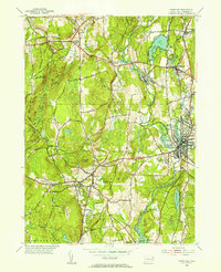
 1955 Putnam1956 Print · USGSWindham County communities thrive along the Quinebaug River at mid-century as industry and education shape the landscape. Genealogists and historians can trace the legacy of local institutions like Woodstock Academy and the New York New Haven and Hartford rail corridor.6 unique versions available
 - 1957 Map of Providence
 1957 Providence1957 Print · USGSCoastal New England at the height of the mid-century era shows a landscape shaped by maritime industry and Cold War defense. Genealogists and historians can trace the reach of the New York, New Haven & Hartford RR and locate legacy sites like Fort Adams and Quonset Point Naval Air Station.
 - 1958 Map of Providence
 1958 Providence1958 Print · USGSThe Rhode Island and Massachusetts coastlines are shown in detail during the late 1950s, from the urban cores to the tips of the islands. Researchers can trace the mid-century footprint of Quonset Point Naval Air Station, the defense works at Fort Adams, and the rail network of the New York, New Haven and Hartford RR.
 - 1961 Map of Hartford
 1961 Hartford1961 Print · USGSSouthern New England and the Hudson Valley are shown here in the mid-fifties, capturing a landscape of booming coastal cities and interior hill towns. Researchers can trace the legacy of the New York New Haven and Hartford rail corridor and find strategic sites like Camp Shanks and Fort Michie.
 - 1962 Map of Hartford, 1971 Print
 1962 Hartford1971 Print · USGSSouthern New England and the Hudson Valley are shown in the early sixties, as suburban growth reached into the foothills. Trace the path of the New York New Haven & Hartford RR and find landmarks like Camp Nathan Hale and Gillette Castle State Park.3 unique versions available
 - 1963 Map of Providence
 1963 Providence1963 Print · USGSSouthern New England's coastal and industrial heartland is captured here in the early sixties, from the Rhode Island mainland to the far reaches of the Cape. Researchers can trace mid-century growth in Providence or locate landmarks on Marthas Vineyard and Nantucket Island.
 - 1965 Map of Hartford
 1965 Hartford1965 Print · USGSSouthern New England and the Hudson Valley are shown here during the mid-sixties expansion of the Interstate era. Trace the path of the New York New Haven & Hartford RR or locate historic landmarks like West Point Military Reservation and the Merritt Parkway.2 unique versions available
 - 1983 Map of Eastford, 1984 Print
 1983 Eastford1984 Print · USGSWindham County at the start of the eighties remains a landscape of deep forests and quiet crossroads settlements. Genealogists and hikers can trace old family burial grounds like North Ashford Cem or explore the recreational history of Crystal Pond and Lake Bungee.
Showing maps 1-25 of 50
Top cities near Pomfret
- Coventry historical maps
- Mansfield historical maps
- Windham historical maps
- Webster historical maps
- Killingly historical maps
- Southbridge historical maps
See more
Top neighborhoods of Pomfret
- Abington historical maps
- Pomfret Center historical maps
- Elliotts historical maps
- Pomfret Street Historic District historical maps
- Pomfret Landing historical maps
Frequently asked questions
- What are the different types of historical maps available for Pomfret?
- What is the oldest map of Pomfret?
- Where can I purchase historical maps of Pomfret for my home or office?
- Where can I download high-res historical maps of Pomfret?
- Are there historical topographic maps available for Pomfret?
- Is there historical aerial imagery available for Pomfret?
- Where are historical maps of Pomfret sourced from?