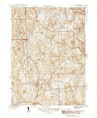
1945 Map of Eastford
USGS Topo · Published 1945About this map
The Still River and Bigelow Brook drain this mid-century landscape in Windham County, where small villages like Eastford, Phoenixville, and West Woodstock remain connected by winding rural roads. The map reveals a community structured around its water bodies and topography, featuring landmarks such as Camp Woodstock on Black Pond and Camp Keemosahbee on the shores of Crystal Pond. The northern reaches include parts of the Natchaug State Forest, while local education is represented by the Red and White Sch and the Arke Sch. This survey provides a clear view of the area's agricultural and social fabric before later modern development, evidenced by the numerous cemeteries including Bungee Cem and Grove Cem that served these historic townships.
Find a feature on this map
58 named features on this map. Tap any name to fly to it.
Don’t see what you’re looking for? This feature index may not catch every label — zoom into the map to look around manually.
Map Details
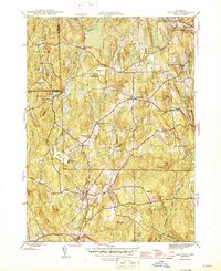
Editions of this 1945 Eastford Map
2 editions found
Other maps of this area

1887 · Brookfield
USGS Topo · 1:62,500

1889 · Webster
USGS Topo · 1:62,500

1889 · Putnam
USGS Topo · 1:62,500

1890 · Brookfield
USGS Topo · 1:62,500

1892 · Woodstock
USGS Topo · 1:62,500

1892 · Webster
USGS Topo · 1:62,500

1893 · Putnam
USGS Topo · 1:62,500

1893 · Brookfield
USGS Topo · 1:62,500

1908 · Quinsigamond
USGS Topo · 1:125,000

1908 · Ware
USGS Topo · 1:125,000