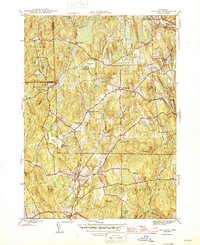
1945 Map of Eastford
USGS Topo · Published 1945About this map
The Still River and its numerous tributaries, including Bungee Brook and Bradford Brook, carve a complex network through the rural landscape of eastern Connecticut. During this mid-century period, the area around Eastford and West Woodstock remains primarily defined by small settlements and institutional camps like Camp Woodstock and Camp Keemosahbee. The distribution of local landmarks such as the Red and White Sch and the Arke Sch suggests a community structure still tied to traditional district education and local gathering points. The rugged hills, ranging from Bungee Hill to Pisgah Hill, are interspersed with significant water bodies like Crystal Pond and Chamberlain Pond, illustrating a terrain that naturally limited large-scale urban development. Public land preservation is already established at the Nathaniel Lyon State Forest, while the presence of the Bridge Cen and Grove Cem provides valuable data for those tracing local family lineages in Windham County.
Find a feature on this map
62 named features on this map. Tap any name to fly to it.
Don’t see what you’re looking for? This feature index may not catch every label — zoom into the map to look around manually.
Map Details
Editions of this 1945 Eastford Map
2 editions found
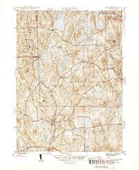
Other maps of this area

1887 · Brookfield
USGS Topo · 1:62,500

1889 · Webster
USGS Topo · 1:62,500

1889 · Putnam
USGS Topo · 1:62,500

1890 · Brookfield
USGS Topo · 1:62,500

1892 · Woodstock
USGS Topo · 1:62,500

1892 · Webster
USGS Topo · 1:62,500

1893 · Putnam
USGS Topo · 1:62,500

1893 · Brookfield
USGS Topo · 1:62,500

1908 · Quinsigamond
USGS Topo · 1:125,000

1908 · Ware
USGS Topo · 1:125,000