2020s Maps of Stonington, Connecticut
Explore 8 historic maps of Stonington from the 2020s. These maps offer a rare glimpse into what life looked like during the 2020s — showing old roads, neighborhoods, homes, and landmarks that have changed or disappeared over time.
Whether you're researching your family's past, planning a metal detecting trip, or studying how Stonington's landscape evolved across the 2020s, these high-resolution maps are a powerful tool for exploring the history of this region.
- Focus on a specific era: All maps on this page are from the 2020s, giving you a focused view of this time period.
- See what’s changed: Compare century-old streets, trails, and buildings to today's modern landscape using overlays and satellite layers.
- Research with precision: Use these maps for genealogy, historical research, land use analysis, or educational projects.
- View, download, or print: Maps are fully viewable online in high resolution, and can be downloaded or printed for your own records.
Start exploring Stonington's history through authentic maps from the 2020s. This is your window into the past.
Stonington, CT maps
(8)- 2021 Map of Old Mystic, 2021 Print
 2021 Old Mystic2021 Print · USGSCovers Stonington, including Groton, Ledyard, and other nearby areas
 - 2021 Map of Watch Hill, 2021 Print
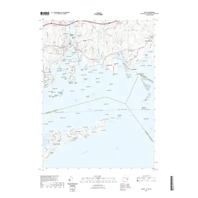
 2021 Watch Hill2021 Print · USGSCovers Stonington, including Southold, Westerly, and other nearby areas
 - 2021 Map of Mystic, 2021 Print
 2021 Mystic2021 Print · USGSCovers Stonington, including Groton, Southold, and other nearby areas
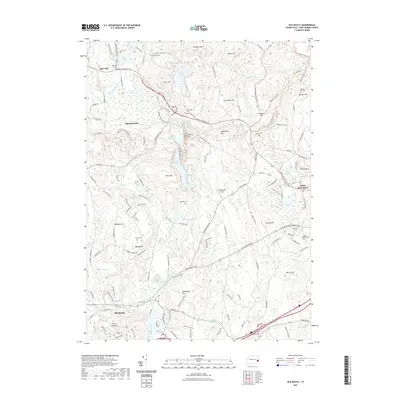
 - 2021 Map of Ashaway, 2021 Print
 2021 Ashaway2021 Print · USGSCovers Stonington, including Westerly, Hopkinton, and other nearby areas
 - 2024 Map of Watch Hill, 2024 Print
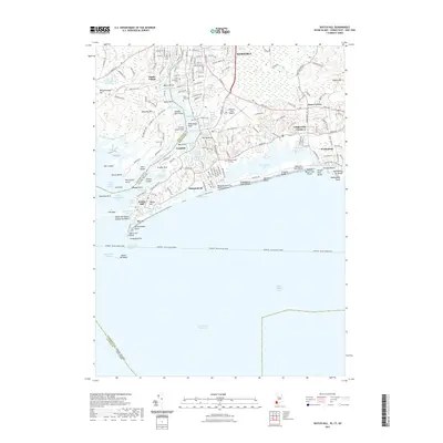
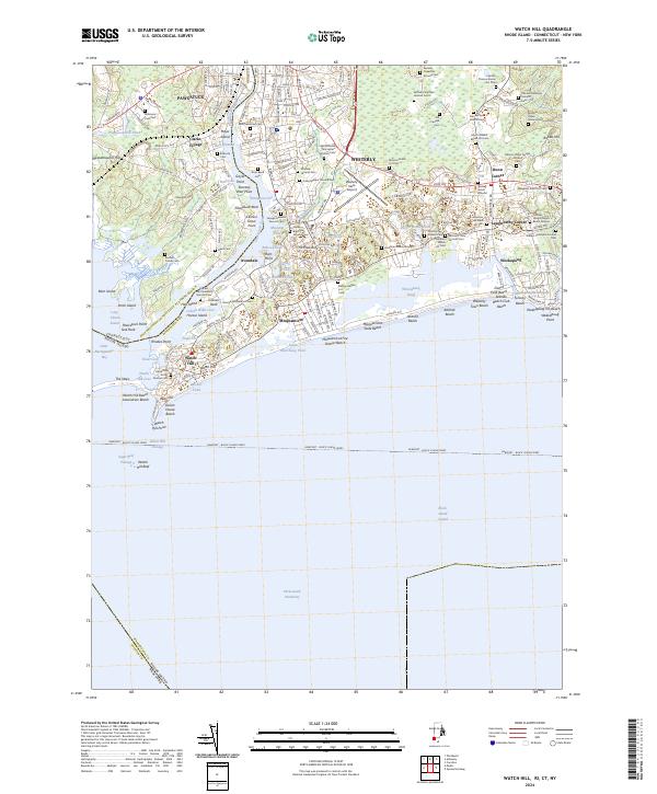 2024 Watch Hill2024 Print · USGSThe coastal border of Rhode Island and Connecticut comes alive in this survey of the shoreline as it appeared in 2024. Genealogists can trace scores of family burial sites like the Quaker Burial Ground and Saint Sebastian Cem near the Pawcatuck River.
 - 2024 Map of Old Mystic, 2024 Print
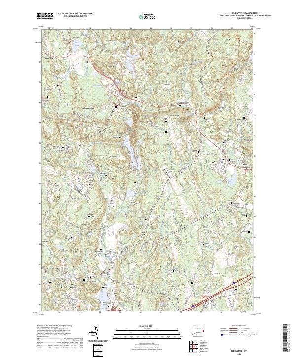 2024 Old Mystic2024 Print · USGSSoutheastern Connecticut’s heritage is preserved here in the complex terrain surrounding the Mystic River and the hills of North Stonington. Researchers can locate dozens of family burial grounds including Latham - Hallet Cem, and trace the paths through Mashantucket.
 - 2024 Map of Mystic, 2024 Print
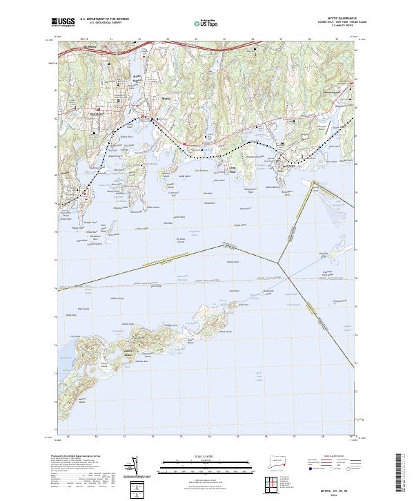 2024 Mystic2024 Print · USGSThe Connecticut coast near the Rhode Island border is captured here in detail, showcasing the historic maritime hubs of Mystic and Stonington. Trace family roots and local history at Elm Grove Cem, Stonington Cem, and the specialized docks of Noank.
 - 2024 Map of Ashaway, 2024 Print
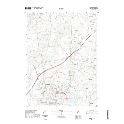
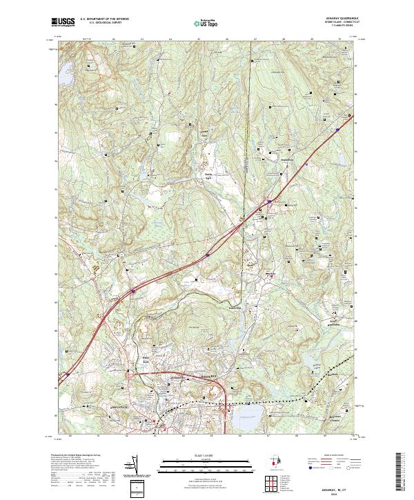 2024 Ashaway2024 Print · USGSThe Rhode Island and Connecticut borderlands along the Pawcatuck River maintain their historic character in this modern survey. Genealogists and local historians can locate dozens of family burial sites, including the Francis Tanner Lot Cem, Burton Lot Cem, and Kindal Oatley Lot Cem.
End of results
Showing maps 1-8 of 8
Top cities near Stonington
- Norwich historical maps
- Groton historical maps
- East Hampton historical maps
- New London historical maps
- Southold historical maps
- Montville historical maps
See more
Top neighborhoods of Stonington
- Clarks Village historical maps
- Pawcatuck historical maps
- Mystic historical maps
- Stonington historical maps
- Wequetequock historical maps
- Lords Point historical maps
See more
Frequently asked questions
- What are the different types of historical maps available for Stonington?
- What is the oldest map of Stonington?
- Where can I purchase historical maps of Stonington for my home or office?
- Where can I download high-res historical maps of Stonington?
- Are there historical topographic maps available for Stonington?
- Is there historical aerial imagery available for Stonington?
- Where are historical maps of Stonington sourced from?