1950s Maps of Waterford, Connecticut
Explore 5 historic maps of Waterford from the 1950s. These maps offer a rare glimpse into what life looked like during the 1950s — showing old roads, neighborhoods, homes, and landmarks that have changed or disappeared over time.
Whether you're researching your family's past, planning a metal detecting trip, or studying how Waterford's landscape evolved across the 1950s, these high-resolution maps are a powerful tool for exploring the history of this region.
- Focus on a specific era: All maps on this page are from the 1950s, giving you a focused view of this time period.
- See what’s changed: Compare century-old streets, trails, and buildings to today's modern landscape using overlays and satellite layers.
- Research with precision: Use these maps for genealogy, historical research, land use analysis, or educational projects.
- View, download, or print: Maps are fully viewable online in high resolution, and can be downloaded or printed for your own records.
Start exploring Waterford's history through authentic maps from the 1950s. This is your window into the past.
Waterford, CT maps
(5)- 1952 Map of Uncasville
 1952 Uncasville1952 Print · USGSThe Thames River corridor in the early fifties shows a fascinating mix of Ivy League rowing traditions and major state institutions. Trace family roots at Poquetanuck and Ledyard Center, or locate landmarks like the Yale Boathouse and the Norwich State Hospital.2 unique versions available
 - 1958 Map of Niantic, 1959 Print
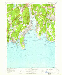 1958 Niantic1959 Print · USGSThe Connecticut coast at the dawn of the interstate era shows a mix of summer colonies and institutional history. Trace the development of Niantic and East Lyme through landmarks like the State Military Camp, Millstone Quarry, and the New London Airport.3 unique versions available
 - 1958 Map of Montville, 1959 Print
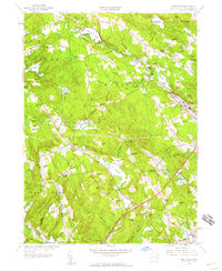 1958 Montville1959 Print · USGSMontville and East Lyme are captured during a period of steady mid-century growth along the Salem Turnpike and rural crossroads. Genealogists and historians can trace family-named landmarks and old burial sites like Whitaker Cem, Oakdale Fox Cem, and Chapel Hill.4 unique versions available
 - 1958 Map of Uncasville, 1960 Print
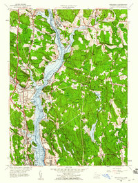 1958 Uncasville1960 Print · USGSNew London County's riverfront is captured here in the late fifties, showcasing the vital military and rail corridor along the Thames. Genealogists and historians can trace families near Uncasville, the Submarine Base, and Mohegan Ch.3 unique versions available
 - 1958 Map of New London, 1960 Print
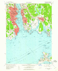 1958 New London1960 Print · USGSNew London and Groton sit at the center of this late-fifties coastal survey, showcasing the maritime infrastructure of the Thames River. Researchers can trace historic boundaries at Fort Trumbull or locate family plots in Cedar Grove Cemetery.3 unique versions available
End of results
Showing maps 1-5 of 5
Top cities near Waterford
- Norwich historical maps
- Groton historical maps
- East Hampton historical maps
- New London historical maps
- Southold historical maps
- Montville historical maps
See more
Top neighborhoods of Waterford
- Seaside historical maps
- Graniteville historical maps
- Manitock Spring historical maps
- Morningside Park historical maps
- Pleasure Beach historical maps
- Sandy Point historical maps
See more
Frequently asked questions
- What are the different types of historical maps available for Waterford?
- What is the oldest map of Waterford?
- Where can I purchase historical maps of Waterford for my home or office?
- Where can I download high-res historical maps of Waterford?
- Are there historical topographic maps available for Waterford?
- Is there historical aerial imagery available for Waterford?
- Where are historical maps of Waterford sourced from?