1900s (20th Century) Maps of New Fairfield, Connecticut
Explore 24 historic maps of New Fairfield from the 1900s (20th Century). These maps offer a rare glimpse into what life looked like during the 1900s — showing old roads, neighborhoods, homes, and landmarks that have changed or disappeared over time.
Whether you're researching your family's past, planning a metal detecting trip, or studying how New Fairfield's landscape evolved across the 1900s, these high-resolution maps are a powerful tool for exploring the history of this region.
- Focus on a specific era: All maps on this page are from the 1900s, giving you a focused view of this time period.
- See what’s changed: Compare century-old streets, trails, and buildings to today's modern landscape using overlays and satellite layers.
- Research with precision: Use these maps for genealogy, historical research, land use analysis, or educational projects.
- View, download, or print: Maps are fully viewable online in high resolution, and can be downloaded or printed for your own records.
Start exploring New Fairfield's history through authentic maps from the 1900s. This is your window into the past.
New Fairfield, CT maps
(24)- 1901 Map of Clove
 1901 Clove1901 Print · USGSDutchess County and the Connecticut borderlands are captured here at the close of the nineteenth century as the rail corridors began to shape local commerce. Genealogists can trace family holdings and old junctions from Dover Plains to Stormville and Moores Mill.11 unique versions available
 - 1904 Map of New Milford
 1904 New Milford1904 Print · USGSLitchfield County at the close of the nineteenth century is defined by the industrial valleys of the Housatonic River and the rural reaches of Washington. Researchers can trace the era's infrastructure through landmarks like Kent Furnace, the Berkshire Division rail line, and the village at Roxbury Station.8 unique versions available
 - 1904 Map of Litchfield
 1904 Litchfield1904 Print · USGSThe Litchfield Hills at the turn of the century are shown here as a landscape of iron heritage and river-powered industry. Genealogists and historians can locate old industrial sites like Kent Furnace, ancestral homes near Sharon Valley, and early rail stops at Limerock Sta..3 unique versions available
 - 1915 Map of Danbury, 1921 Print
 1915 Danbury1921 Print · USGSFairfield County in the early twentieth century was a hub of railway activity and village life. Genealogists and historians can trace the tracks of the Housatonic Railroad and locate local landmarks like the Fair Grounds or the Putnam Monument.
 - 1928 Map of Carmel
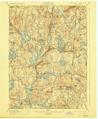 1928 Carmel1928 Print · USGSNear the New York and Connecticut border during the late 1920s, this landscape shows a network of massive reservoirs built to serve the city. Genealogists and historians can trace rail-era developments like the New York and Harlem RR and locate sites such as the Tilly Foster Mine and Farmers Mills.5 unique versions available
 - 1943 Map of Brewster, 1956 Print
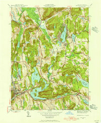 1943 Brewster1956 Print · USGSThe New York and Connecticut borderlands appear here in the 1940s, showcasing a landscape defined by the Croton Watershed's massive reservoirs. Researchers can trace ancestral locations from Sodom to Milltown, or locate landmarks like Big Elm Sch and Beaver Bog Ch.2 unique versions available
 - 1945 Map of Pawling, 1956 Print
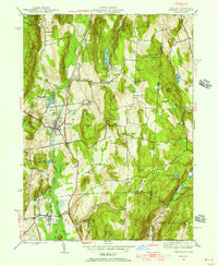 1945 Pawling1956 Print · USGSDutchess County at the close of the Second World War reveals a landscape of high ridges and significant wetlands along the New York-Connecticut border. Genealogists and local historians can trace legacy landmarks including the Quaker Hill Meeting House, the village of Pawling, and the vast expanse of The Great Swamp.2 unique versions available
 - 1946 Map of Brewster
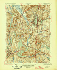 1946 Brewster1946 Print · USGSThe New York and Connecticut state line is defined by massive reservoirs and rural crossroads in the mid-forties. Genealogists can trace family legacies through Union Cem, Big Elm Sch, and the uniquely named settlement of Sodom.2 unique versions available
 - 1947 Map of Pawling
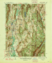 1947 Pawling1947 Print · USGSDutchess County at the edge of Connecticut was a landscape of highland ridges and river valleys in the late 1940s. Genealogists can locate family landmarks such as Hurd Sch, Akins Corners, and the historic Quaker Hill Meeting House.2 unique versions available
 - 1947 Map of Hartford, 1955 Print
 1947 Hartford1955 Print · USGSSouthern New England and the Hudson Valley are shown in detail during the post-war expansion era. Genealogists and researchers can trace local landmarks from the State Capitol and Yale University to the Stratford Lighthouse and Woodlawn Cem.2 unique versions available
 - 1948 Map of Hartford
 1948 Hartford1948 Print · USGSSouthern New England is captured here in the late 1940s, showcasing a landscape of thriving industrial cities and developing parkways. Genealogists and historians can trace the rail networks of the New York New Haven and Hartford RR or locate coastal defense sites like Fort Terry and Camp Shanks.2 unique versions available
 - 1951 Map of New Milford
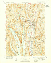 1951 New Milford1951 Print · USGSLitchfield County's river valleys and reservoirs are captured here in the early fifties, showing the area's transition into a regional recreation hub. Trace the heritage of New Milford and Sherman through landmarks like the Lime Kiln, Candlewood Cave, and the Boardman Sch.2 unique versions available
 - 1953 Map of Danbury, 1955 Print
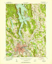 1953 Danbury1955 Print · USGSMid-century Danbury and its surrounding hills show a landscape shaped by the waters of Lake Candlewood and the Still River. Trace the early development of Candlewood Isle, the historic Danbury Fairgrounds, and the State Teachers College.2 unique versions available
 - 1955 Map of New Milford, 1956 Print
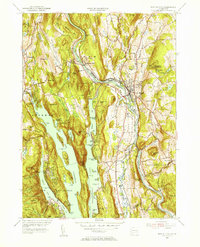 1955 New Milford1956 Print · USGSMid-century Litchfield County comes into focus as New Milford grows along the Housatonic. Genealogists and historians can trace family plots at Holy Cross Cem and Quaker Cem, or locate the Canterbury Sch and Candlewood Cave.9 unique versions available
 - 1958 Map of Pawling, 1960 Print
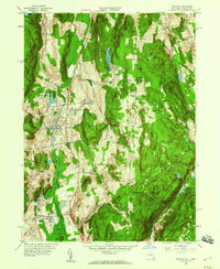 1958 Pawling1960 Print · USGSDutchess County and eastern Connecticut are mapped here in the late fifties, showing the region as the Harlem Valley railroad corridor remained central to local life. Genealogists can trace family landmarks and schools like Trinity-Pawling Sch, the Meeting House on Quaker Hill, and old junctions at Hurd Corners.4 unique versions available
 - 1958 Map of Brewster, 1960 Print
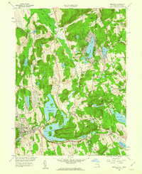 1958 Brewster1960 Print · USGSThe New York and Connecticut borderlands come alive in the late fifties as rail lines and new highways intersect among the Croton reservoirs. Genealogists and historians can trace old community ties in Sodom, Milltown, and the lakeside homes around Putnam Lake.5 unique versions available
 - 1961 Map of Hartford
 1961 Hartford1961 Print · USGSSouthern New England and the Hudson Valley are shown here in the mid-fifties, capturing a landscape of booming coastal cities and interior hill towns. Researchers can trace the legacy of the New York New Haven and Hartford rail corridor and find strategic sites like Camp Shanks and Fort Michie.
 - 1962 Map of Hartford, 1971 Print
 1962 Hartford1971 Print · USGSSouthern New England and the Hudson Valley are shown in the early sixties, as suburban growth reached into the foothills. Trace the path of the New York New Haven & Hartford RR and find landmarks like Camp Nathan Hale and Gillette Castle State Park.3 unique versions available
 - 1963 Map of Danbury, 1965 Print
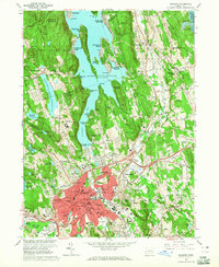 1963 Danbury1965 Print · USGSMid-century Danbury and its surrounding lakefront communities are caught here at a peak of postwar growth. Genealogists and local historians can trace the development of Candlewood Isle, locate the historic Old Main St Cem, or study the grounds of the Danbury Fairgrounds.4 unique versions available
 - 1965 Map of Hartford
 1965 Hartford1965 Print · USGSSouthern New England and the Hudson Valley are shown here during the mid-sixties expansion of the Interstate era. Trace the path of the New York New Haven & Hartford RR or locate historic landmarks like West Point Military Reservation and the Merritt Parkway.2 unique versions available
 - 1985 Map of Waterbury, 1986 Print
 1985 Waterbury1986 Print · USGSThe Western Connecticut highlands and the Hudson Valley are captured in the mid-1980s, showing a landscape of deep forests and industrial river towns. Genealogists can trace family connections from Waterbury up through Litchfield and Torrington, while exploring the vast Barkhamsted Reservoir and Candlewood Lake basins.
 - 1986 Map of Bridgeport
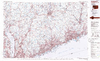 1986 Bridgeport1986 Print · USGSSpanning the New York and Connecticut border in the mid-eighties, this survey shows the dense rail and parkway network connecting the Hudson to the Sound. Researchers can trace the massive New Croton Reservoir system or locate landmarks like the West Point U.S. Military Academy.3 unique versions available
 - 1993 Map of Waterbury
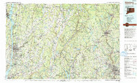 1993 Waterbury1993 Print · USGSWestern Connecticut and the Hudson Valley appear in the early nineties as a landscape of established industrial cities and deep forest preserves. Researchers can trace the rail corridors of the Metro-North Railroad or locate family sites near the Taft School and Riverside Cemetery.
 - 1998 Map of Pawling, 2000 Print
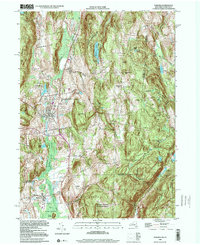 1998 Pawling2000 Print · USGSThe Harlem Valley and Quaker Hill highlands come into focus at the end of the century, showing the borderlands between New York and Connecticut. Researchers can trace the path of the Appalachian National Scenic Trail or locate family roots near Hurd Corners and Akins Corners.
End of results
Showing maps 1-24 of 24
Top cities near New Fairfield
- Danbury historical maps
- Trumbull historical maps
- Carmel historical maps
- East Fishkill historical maps
- Ridgebury historical maps
- Somers historical maps
See more
Top neighborhoods of New Fairfield
- Candlewood Corner historical maps
- Hollywyle Park historical maps
- Knollcrest historical maps
- Bigelow Corners historical maps
- Ball Pond historical maps
- Taylor Corners historical maps
See more
Frequently asked questions
- What are the different types of historical maps available for New Fairfield?
- What is the oldest map of New Fairfield?
- Where can I purchase historical maps of New Fairfield for my home or office?
- Where can I download high-res historical maps of New Fairfield?
- Are there historical topographic maps available for New Fairfield?
- Is there historical aerial imagery available for New Fairfield?
- Where are historical maps of New Fairfield sourced from?