Old Maps of Ward 8, Washington for Genealogy
Trace your family roots with 34 historic maps of Ward 8. These high-res maps reveal old neighborhoods, homesites, landmarks, and streets — helping you uncover where your ancestors lived and how the area evolved over time.
- Explore historic neighborhoods: Identify where your relatives may have lived in the 1800s or 1900s.
- Compare maps over time: Trace the changes in streets, buildings, and landmarks for multi-generational research.
- Perfect for genealogy & ancestry research: Used by family historians and researchers to map out lineage and migration.
These maps are an incredible resource for exploring your personal connection to Ward 8's past.
Ward 8, Washington maps
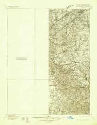
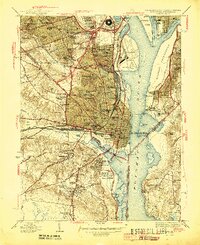
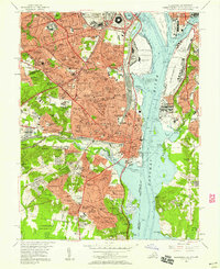
(34)- 1890 Map of Mt. Vernon
 1890 Mt. Vernon1890 Print · USGSCovers Ward 8, including Washington, Arlington, and other nearby areas
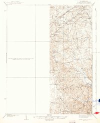
 - 1891 Map of Mt. Vernon
 1891 Mt. Vernon1891 Print · USGSCovers Ward 8, including Washington, Arlington, and other nearby areas
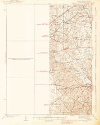
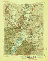
 - 1894 Map of Mt. Vernon, 1904 Print
 1894 Mt. Vernon1904 Print · USGSCovers Ward 8, including Washington, Arlington, and other nearby areas6 unique versions available
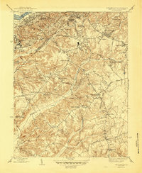
 - 1897 Map of Mt. Vernon
 1897 Mt. Vernon1897 Print · USGSCovers Ward 8, including Washington, Arlington, and other nearby areas2 unique versions available
 - 1899 Map of Patuxent
 1899 Patuxent1899 Print · USGSCovers Ward 8, including Washington, Waldorf, and other nearby areas3 unique versions available
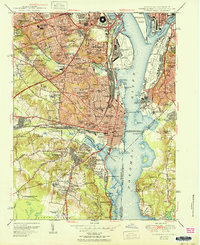
 - 1900 Map of Washington
 1900 Washington1900 Print · USGSCovers Ward 8, including Washington, Arlington, and other nearby areas2 unique versions available
 - 1906 Map of Patuxent
 1906 Patuxent1906 Print · USGSCovers Ward 8, including Washington, Waldorf, and other nearby areas4 unique versions available
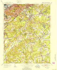
 - 1934 Map of Upper Marlboro (east half)
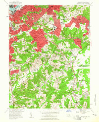
 1934 Upper Marlboro (east half)1934 Print · USGSCovers Ward 8, including Washington, Silver Spring, and other nearby areas2 unique versions available
 - 1937 Map of Upper Marlboro
 1937 Upper Marlboro1937 Print · USGSCovers Ward 8, including Washington, Silver Spring, and other nearby areas
 - 1938 Map of Upper Marlboro
 1938 Upper Marlboro1938 Print · USGSCovers Ward 8, including Washington, Silver Spring, and other nearby areas3 unique versions available
 - 1945 Map of Anacostia
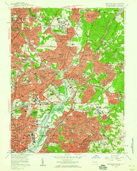
 1945 Anacostia1945 Print · USGSCovers Ward 8, including Washington, Clinton, and other nearby areas3 unique versions available
 - 1945 Map of Alexandria
 1945 Alexandria1945 Print · USGSCovers Ward 8, including Washington, Alexandria, and other nearby areas
 - 1945 Map of Washington West
 1945 Washington West1945 Print · USGSCovers Ward 8, including Washington, Arlington, and other nearby areas
 - 1945 Map of Washington East
 1945 Washington East1945 Print · USGSCovers Ward 8, including Washington, Silver Spring, and other nearby areas
 - 1948 Map of Washington
 1948 Washington1948 Print · USGSCovers Ward 8, including Washington, Arlington, and other nearby areas2 unique versions available
 - 1951 Map of Washington East
 1951 Washington East1951 Print · USGSCovers Ward 8, including Washington, Silver Spring, and other nearby areas
 - 1951 Map of Washington West
 1951 Washington West1951 Print · USGSCovers Ward 8, including Washington, Arlington, and other nearby areas
 - 1951 Map of Alexandria
 1951 Alexandria1951 Print · USGSCovers Ward 8, including Washington, Alexandria, and other nearby areas
 - 1951 Map of Anacostia
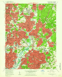
 1951 Anacostia1951 Print · USGSCovers Ward 8, including Washington, Clinton, and other nearby areas
 - 1956 Map of Anacostia
 1956 Anacostia1956 Print · USGSCovers Ward 8, including Washington, Clinton, and other nearby areas2 unique versions available
 - 1956 Map of Alexandria, 1958 Print
 1956 Alexandria1958 Print · USGSCovers Ward 8, including Washington, Alexandria, and other nearby areas
 - 1956 Map of Washington West, 1958 Print
 1956 Washington West1958 Print · USGSCovers Ward 8, including Washington, Arlington, and other nearby areas
 - 1956 Map of Washington East, 1959 Print
 1956 Washington East1959 Print · USGSCovers Ward 8, including Washington, Silver Spring, and other nearby areas
 - 1957 Map of Washington East, 1962 Print
 1957 Washington East1962 Print · USGSCovers Ward 8, including Washington, Silver Spring, and other nearby areas
 - 1957 Map of Washington, 1966 Print
 1957 Washington1966 Print · USGSCovers Ward 8, including Washington, Arlington, and other nearby areas5 unique versions available
Showing maps 1-25 of 34
Frequently asked questions
- What are the different types of historical maps available for Ward 8?
- What is the oldest map of Ward 8?
- Where can I purchase historical maps of Ward 8 for my home or office?
- Where can I download high-res historical maps of Ward 8?
- Are there historical topographic maps available for Ward 8?
- Is there historical aerial imagery available for Ward 8?
- Where are historical maps of Ward 8 sourced from?