Old Maps of Altha, Florida for Metal Detecting
Plan your next treasure hunt with 21 historic maps of Altha. Find old homesites, ghost towns, trails, and gathering spots that may be lost to time — perfect for identifying promising metal detecting locations.
- Locate forgotten sites: Uncover places like long-lost settlements, abandoned rail lines, or gathering spots.
- Plan better hunts: Use map overlays combined with LiDAR or satellite views to narrow in on historically rich areas.
- Made for detectorists: Thousands of hobbyists use these maps to discover relics, coins, and hidden history.
Use these historic maps to boost your research and find new opportunities beneath the surface of Altha.
Altha, FL maps
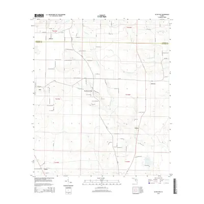
(21)- 1952 Map of Altha West, 1953 Print
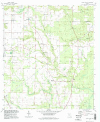
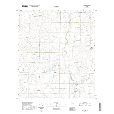
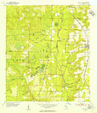 1952 Altha West1953 Print · USGSThe Chipola River valley and the town of Altha are captured here in the early fifties, documenting a landscape of rural schoolhouses and family cemeteries. Genealogists can trace sites like Old Shiloh Cem, Alliance Sch, and the Marianna and Blountstown rail line.
 - 1952 Map of Altha East, 1953 Print
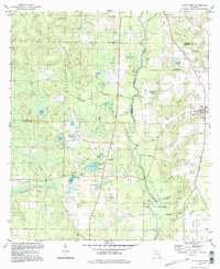
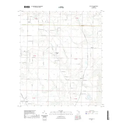
 1952 Altha East1953 Print · USGSCalhoun and Jackson counties appear in the early 1950s, showing the rural communities of the Florida Panhandle before modern development. Genealogists can trace family landmarks like Henderson Mill, Barton Cem, and several country churches including Sunny Hill Ch.
 - 1954 Map of Tallahassee, 1967 Print
 1954 Tallahassee1967 Print · USGSThe Florida Panhandle and South Georgia are captured here during a period of mid-century growth and military expansion. Researchers can trace the development of Panama City, the footprint of Tyndall Air Force Base, and the rail lines of the Atlantic Coast Line.4 unique versions available
 - 1959 Map of Tallahassee
 1959 Tallahassee1959 Print · USGSFlorida's Panhandle and the Big Bend region appear here in the mid-fifties, showing a landscape defined by its great river systems and developing coast. Trace the early layout of Panama City, the expansive Apalachicola National Forest, and the coastal St Marks Lighthouse.
 - 1960 Map of Tallahassee
 1960 Tallahassee1960 Print · USGSThe Florida Panhandle and southern Georgia are captured here in the mid-twentieth century, showing a region defined by its rivers and military installations. Genealogists and historians can trace the growth of Tallahassee or locate coastal landmarks like the St Marks Lighthouse and Tyndall Air Force Base.
 - 1979 Map of Marianna, 1980 Print
 1979 Marianna1980 Print · USGSFlorida's northern panhandle and the neighboring Alabama-Georgia borderlands are captured here in the late seventies. Genealogists and local historians can trace family roots through settlements like Graceville and Cottondale or follow the historic Louisville and Nashville rail lines.2 unique versions available
 - 1982 Map of Altha East
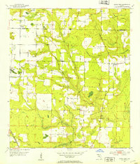
 1982 Altha East1982 Print · USGSThe rural border of Jackson and Calhoun counties is captured here in the early 1980s as a landscape of timber and wetlands. Local historians can trace the foundations of Alliance and Macedonia or locate family sites like Barton Cem and Henderson Mill.
 - 1982 Map of Altha West, 1983 Print
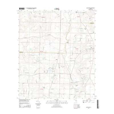
 1982 Altha West1983 Print · USGSNorth Florida’s riverine landscape is captured here in the early eighties, centered on the Chipola River and the rural town of Altha. Local researchers can trace family landmarks like Ritchards Cem and Page Ch, or follow the path of the Old Railroad Grade.
 - 1988 Map of Tallahassee
 1988 Tallahassee1988 Print · USGSThe Florida Panhandle and South Georgia are captured here in the late eighties, showing the expansion of the regional highway network and coastal growth. Genealogists and historians can trace rail lines like the Seaboard System Railroad or locate family roots in Blountstown, Graceville, or Crawfordville.2 unique versions available
 - 1994 Map of Altha East, 1998 Print
 1994 Altha East1998 Print · USGSThe Florida Panhandle's rural landscape is preserved here as it appeared in the 1990s, split by the Jackson and Calhoun county line. Genealogists and local historians can trace family roots through numerous sites like Ocheesee Cem, Corinth Ch, and the settlement at Alliance.
 - 1994 Map of Altha West, 1998 Print
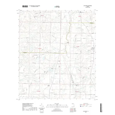
 1994 Altha West1998 Print · USGSThe Chipola River corridor near Altha comes into focus during the late twentieth century as timber and water define local life. Researchers can locate numerous rural burial grounds and churches, including Edenfield Cem, Shiloh Cem, and the Old Railroad Grade.
 - 2012 Map of Altha East, 2012 Print
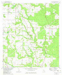
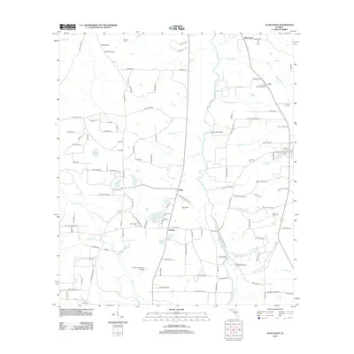
 2012 Altha East2012 Print · USGSCovers Altha, including Selman, Chipola, and other nearby areas
 - 2012 Map of Altha West, 2012 Print
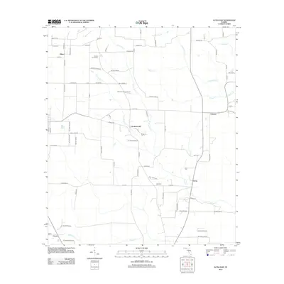
 2012 Altha West2012 Print · USGSCovers Altha, including Sink Creek, Cox, and other nearby areas
 - 2015 Map of Altha East, 2015 Print
 2015 Altha East2015 Print · USGSCovers Altha, including Selman, Chipola, and other nearby areas
 - 2015 Map of Altha West, 2015 Print
 2015 Altha West2015 Print · USGSCovers Altha, including Sink Creek, Cox, and other nearby areas
 - 2018 Map of Altha West, 2018 Print
 2018 Altha West2018 Print · USGSCovers Altha, including Sink Creek, Cox, and other nearby areas
 - 2018 Map of Altha East, 2018 Print
 2018 Altha East2018 Print · USGSCovers Altha, including Selman, Chipola, and other nearby areas
 - 2021 Map of Altha West, 2021 Print
 2021 Altha West2021 Print · USGSCovers Altha, including Sink Creek, Cox, and other nearby areas
 - 2021 Map of Altha East, 2021 Print
 2021 Altha East2021 Print · USGSCovers Altha, including Selman, Chipola, and other nearby areas
 - 2024 Map of Altha West, 2024 Print
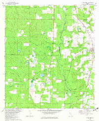
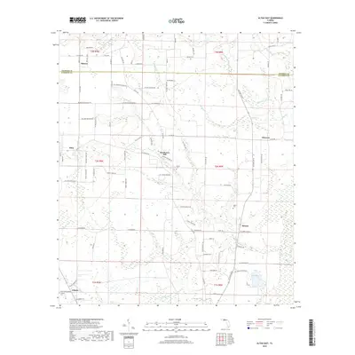
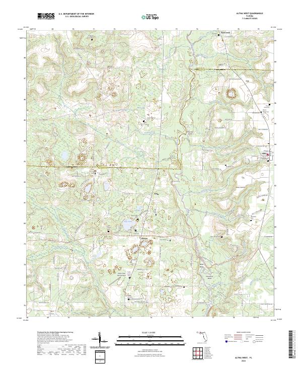 2024 Altha West2024 Print · USGSNorth of the Florida Panhandle's larger hubs, this 2024 landscape reveals a mosaic of small farming settlements and family cemeteries. Genealogists can trace local lineages through Maddox Cem, Farmer Family Cem, and Taylor Family Cem along the Chipola River basin.
 - 2024 Map of Altha East, 2024 Print
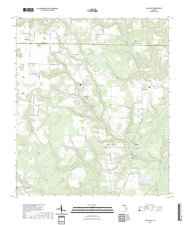 2024 Altha East2024 Print · USGSCalhoun and Jackson counties are mapped here in the modern era, showing a landscape of traditional Florida settlements and mill sites. Researchers can locate numerous burial grounds like O'Bryan Cemetery and the historic footprint of Henderson Mill.
End of results
Showing maps 1-21 of 21
Top cities near Altha
- Marianna historical maps
- Blountstown historical maps
- Sneads historical maps
- Bristol historical maps
- Cottondale historical maps
- Grand Ridge historical maps
Frequently asked questions
- What are the different types of historical maps available for Altha?
- What is the oldest map of Altha?
- Where can I purchase historical maps of Altha for my home or office?
- Where can I download high-res historical maps of Altha?
- Are there historical topographic maps available for Altha?
- Is there historical aerial imagery available for Altha?
- Where are historical maps of Altha sourced from?