Old Maps of Beacon Hills, Jacksonville for Academic Research
Study the evolution of Beacon Hills with 17 high-resolution historic maps. Whether you're teaching, researching, or modeling changes in land use, these maps provide essential visual documentation of urban, environmental, and geographic change.
- Analyze long-term change: Track patterns in development, transportation, and natural features.
- Ideal for environmental or urban studies: Support academic projects with primary historical map data.
- Use in the classroom or lab: Educators and researchers rely on these maps to bring historical context to life.
These maps are a powerful tool for teaching, research, and visualizing how Beacon Hills has changed over the decades.
Beacon Hills, Jacksonville maps
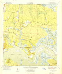
(17)- 1918 Map of Jacksonville
 1918 Jacksonville1918 Print · USGSJacksonville and the winding St. Johns River are shown here during the First World War, capturing the city's rail-and-river industrial core. Genealogists and researchers can trace early neighborhoods like Brooklyn and Murray Hill, or locate rural landmarks like Otto Chapel School and the Braddock School.5 unique versions available
 - 1948 Map of Jacksonville
 1948 Jacksonville1948 Print · USGSNortheast Florida and Southeast Georgia's coastal waterways and railroad towns are captured here in the years following the war. Genealogists can trace family connections through river towns like St Marys or identify long-standing military landmarks like Jacksonville NAS.
 - 1948 Map of Eastport, 1962 Print
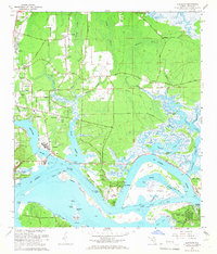
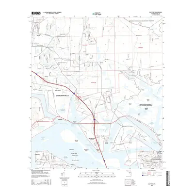
 1948 Eastport1962 Print · USGSCoastal Duval County comes to life in the late 1940s as a landscape of tidal marshes and riverfront hamlets along the St Johns River. Researchers can locate vanished landmarks like Quarantine Island or trace local history through the New Berlin Sch and Dunn Creek Cem.
 - 1950 Map of Eastport
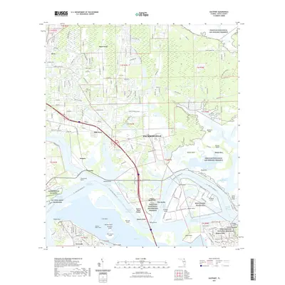
 1950 Eastport1950 Print · USGSCoastal Duval County comes alive in this mid-century survey of the riverbanks and tidal marshes north of the city. Genealogists can trace family footprints through community anchors like New Berlin, the Dunn Creek Cem, and churches such as Oak Grove Ch.
 - 1957 Map of Jacksonville, 1967 Print
 1957 Jacksonville1967 Print · USGSCoastal Florida and Georgia meet in the late fifties, showcasing a landscape of naval aviation, deep-water terminals, and barrier island communities. Researchers can trace the mid-century footprints of NAS Jacksonville, find small communities like Franklintown, and locate the historic Fort Clinch State Park.3 unique versions available
 - 1959 Map of Jacksonville
 1959 Jacksonville1959 Print · USGSNortheast Florida and Southeast Georgia are seen here in the late fifties, dominated by the maritime activity of the St Johns River and the Atlantic coast. Researchers can trace the mid-century layout of Jacksonville and identify sprawling military sites like Camp Blanding Military Reservation and Kings Bay Ammunition Terminal.
 - 1960 Map of Jacksonville
 1960 Jacksonville1960 Print · USGSCoastal Florida and Georgia meet in this mid-century portrait of a region shaped by naval power and the winding St Johns River. Researchers can trace the development of military sites like Cecil Field or locate historic rural landmarks such as Jerusalem Ch and Kings Ferry.
 - 1964 Map of Eastport, 1966 Print
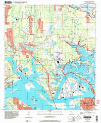
 1964 Eastport1966 Print · USGSNortheastern Jacksonville and the St. Johns River are captured in the mid-1960s, showing a landscape defined by saltwater marshes and developing riverfront industry. Genealogists and local historians can locate the Yellow Bluff Fort, Dunn Creek Cem, and old settlements like New Berlin.7 unique versions available
 - 1977 Map of Jacksonville, 1983 Print
 1977 Jacksonville1983 Print · USGSNortheast Florida during the late seventies shows a region defined by its deep-water naval bases and burgeoning riverfront suburbs. You can trace the rail networks of the Seaboard Coast Line, locate the Kingsley Plantation, and study the sprawling grounds of Cecil Field Naval Air Station.
 - 1980 Map of Jacksonville, 1984 Print
 1980 Jacksonville1984 Print · USGSThe Jacksonville metropolitan area and the Atlantic coast are captured here during a period of significant late-century growth. Researchers can trace the massive military footprints of Cecil Field and Mayport Naval Station alongside historic communities like Mandarin and Switzerland.
 - 1988 Map of Jacksonville
 1988 Jacksonville1988 Print · USGSCoastal Florida and Georgia are captured here during the late eighties, documenting the rapid growth of the First Coast and its vital military installations. Researchers can trace the development of beach communities like Fernandina Beach and Atlantic Beach or locate family landmarks near Mickler Landing and Orange Park.
 - 1994 Map of Eastport, 2003 Print
 1994 Eastport2003 Print · USGSThe northern reaches of Jacksonville are shown in the 1990s as a hub of maritime industry and military presence along the St Johns River. Researchers can trace local heritage at Yellow Bluff Fort State Historical Site or locate family sites near Polly Town and Oak Grove Ch.
 - 2012 Map of Eastport, 2012 Print
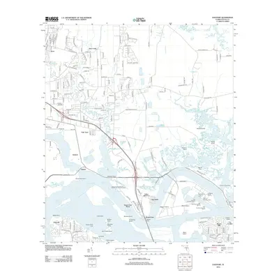 2012 Eastport2012 Print · USGSCovers Beacon Hills, including Jacksonville, Dames Point Manor, and other nearby areas
 - 2015 Map of Eastport, 2015 Print
 2015 Eastport2015 Print · USGSCovers Beacon Hills, including Jacksonville, Dames Point Manor, and other nearby areas
 - 2018 Map of Eastport, 2018 Print
 2018 Eastport2018 Print · USGSCovers Beacon Hills, including Jacksonville, Dames Point Manor, and other nearby areas
 - 2021 Map of Eastport, 2021 Print
 2021 Eastport2021 Print · USGSCovers Beacon Hills, including Jacksonville, Dames Point Manor, and other nearby areas
 - 2024 Map of Eastport, 2024 Print
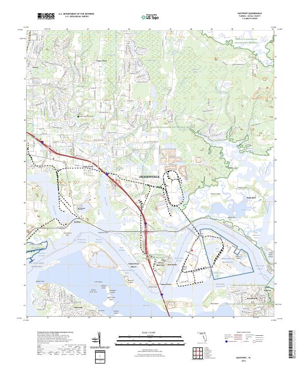 2024 Eastport2024 Print · USGSNortheastern Florida’s maritime and ecological landscape is documented here in the early twenty-first century. Genealogists and historians can locate old coastal settlements like New Berlin and Quinlan or trace family sites at Dunn Creek Cem and Yellow Bluff Fort.
End of results
Showing maps 1-17 of 17
Top cities near Beacon Hills
- Jacksonville historical maps
- Ponte Vedra Beach historical maps
- Jacksonville Beach historical maps
- Atlantic Beach historical maps
- Orange Park historical maps
- Neptune Beach historical maps
Frequently asked questions
- What are the different types of historical maps available for Beacon Hills?
- What is the oldest map of Beacon Hills?
- Where can I purchase historical maps of Beacon Hills for my home or office?
- Where can I download high-res historical maps of Beacon Hills?
- Are there historical topographic maps available for Beacon Hills?
- Is there historical aerial imagery available for Beacon Hills?
- Where are historical maps of Beacon Hills sourced from?