Old Maps of Goodbys, Jacksonville for Hiking & Exploration
Hike through history with 18 historic maps of Goodbys. Explore old trails, ghost towns, and forgotten backroads — perfect for outdoor adventurers and local explorers.
- Rediscover forgotten places: Map out old mining camps, roads, and footpaths that no longer exist on modern maps.
- Layer with modern tools: Combine with LiDAR or satellite views to plan hikes through historical terrain.
- Made for exploration: Popular among hikers, overlanders, and local history lovers.
Use these maps to find adventure and explore the hidden past of Goodbys.
Goodbys, Jacksonville maps
(18)- 1917 Map of Orange Park, 1957 Print
 1917 Orange Park1957 Print · USGSThe St. Johns River corridor comes to life in this early twentieth-century survey of the riverbanks between Jacksonville and Green Cove Springs. Genealogists can trace family footprints through rural sites like Swimming Pen School, Hibernia, and the Durbin P.O. long before suburban sprawl.
 - 1918 Map of Orange Park
 1918 Orange Park1918 Print · USGSThe St. Johns River corridor comes to life in the years following the Great War, showing the transition from riverine commerce to early rail and road networks. Genealogists can locate family landmarks like Neals Dock, Bethel Church, and the Deep Bottom School across three counties.5 unique versions available
 - 1948 Map of Jacksonville
 1948 Jacksonville1948 Print · USGSNortheast Florida and Southeast Georgia's coastal waterways and railroad towns are captured here in the years following the war. Genealogists can trace family connections through river towns like St Marys or identify long-standing military landmarks like Jacksonville NAS.
 - 1952 Map of Bayard, 1956 Print
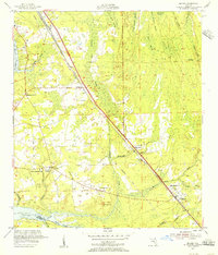 1952 Bayard1956 Print · USGSCoastal Duval County in the early fifties shows a landscape of expansive swamps and emerging highway settlements. Researchers can trace the roots of local communities through landmarks like Julington Cem, Allen Chapel, and the Stockade near Pablo Creek.
 - 1957 Map of Jacksonville, 1967 Print
 1957 Jacksonville1967 Print · USGSCoastal Florida and Georgia meet in the late fifties, showcasing a landscape of naval aviation, deep-water terminals, and barrier island communities. Researchers can trace the mid-century footprints of NAS Jacksonville, find small communities like Franklintown, and locate the historic Fort Clinch State Park.3 unique versions available
 - 1959 Map of Jacksonville
 1959 Jacksonville1959 Print · USGSNortheast Florida and Southeast Georgia are seen here in the late fifties, dominated by the maritime activity of the St Johns River and the Atlantic coast. Researchers can trace the mid-century layout of Jacksonville and identify sprawling military sites like Camp Blanding Military Reservation and Kings Bay Ammunition Terminal.
 - 1960 Map of Jacksonville
 1960 Jacksonville1960 Print · USGSCoastal Florida and Georgia meet in this mid-century portrait of a region shaped by naval power and the winding St Johns River. Researchers can trace the development of military sites like Cecil Field or locate historic rural landmarks such as Jerusalem Ch and Kings Ferry.
 - 1964 Map of Bayard, 1965 Print
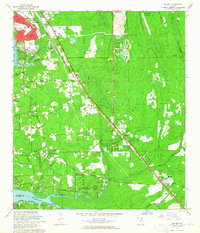 1964 Bayard1965 Print · USGSSoutheast of Jacksonville in the mid-1960s, the landscape was a mix of suburban growth and dense Florida wetlands. Genealogists and local historians can trace family-named sites like Burnett Bridge and Julington Cem, or locate historic schools and churches such as St Josephs Academy and Loretto Ch.3 unique versions available
 - 1977 Map of Jacksonville, 1983 Print
 1977 Jacksonville1983 Print · USGSNortheast Florida during the late seventies shows a region defined by its deep-water naval bases and burgeoning riverfront suburbs. You can trace the rail networks of the Seaboard Coast Line, locate the Kingsley Plantation, and study the sprawling grounds of Cecil Field Naval Air Station.
 - 1980 Map of Jacksonville, 1984 Print
 1980 Jacksonville1984 Print · USGSThe Jacksonville metropolitan area and the Atlantic coast are captured here during a period of significant late-century growth. Researchers can trace the massive military footprints of Cecil Field and Mayport Naval Station alongside historic communities like Mandarin and Switzerland.
 - 1988 Map of Jacksonville
 1988 Jacksonville1988 Print · USGSCoastal Florida and Georgia are captured here during the late eighties, documenting the rapid growth of the First Coast and its vital military installations. Researchers can trace the development of beach communities like Fernandina Beach and Atlantic Beach or locate family landmarks near Mickler Landing and Orange Park.
 - 1993 Map of Bayard
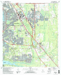 1993 Bayard1993 Print · USGSSoutheast Jacksonville in the early nineties shows a landscape of rapid suburban growth between the St Johns River and Julington Creek. Researchers can trace the development of Mandarin, locate the Julington Cem, and follow the historical path of the Florida East Coast RR.2 unique versions available
 - 1994 Map of Bayard, 2003 Print
 1994 Bayard2003 Print · USGSSouthern Duval County was undergoing rapid transformation in the mid-nineties as Jacksonville expanded toward the St. Johns River. Genealogists and local historians can trace established communities like Mandarin and Loretto alongside landmarks like Julington Cem and New Allen Chapel.
 - 2012 Map of Bayard, 2012 Print
 2012 Bayard2012 Print · USGSCovers Goodbys, including Jacksonville, Greenland, and other nearby areas
 - 2015 Map of Bayard, 2015 Print
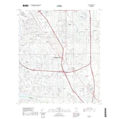
 2015 Bayard2015 Print · USGSCovers Goodbys, including Jacksonville, Greenland, and other nearby areas
 - 2018 Map of Bayard, 2018 Print
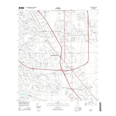
 2018 Bayard2018 Print · USGSCovers Goodbys, including Jacksonville, Greenland, and other nearby areas
 - 2021 Map of Bayard, 2021 Print
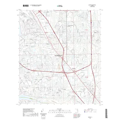 2021 Bayard2021 Print · USGSCovers Goodbys, including Jacksonville, Greenland, and other nearby areas
 - 2024 Map of Bayard, 2024 Print
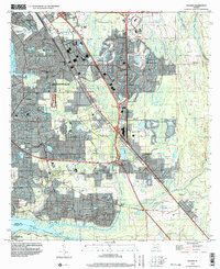
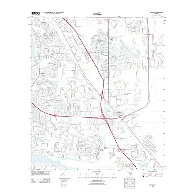
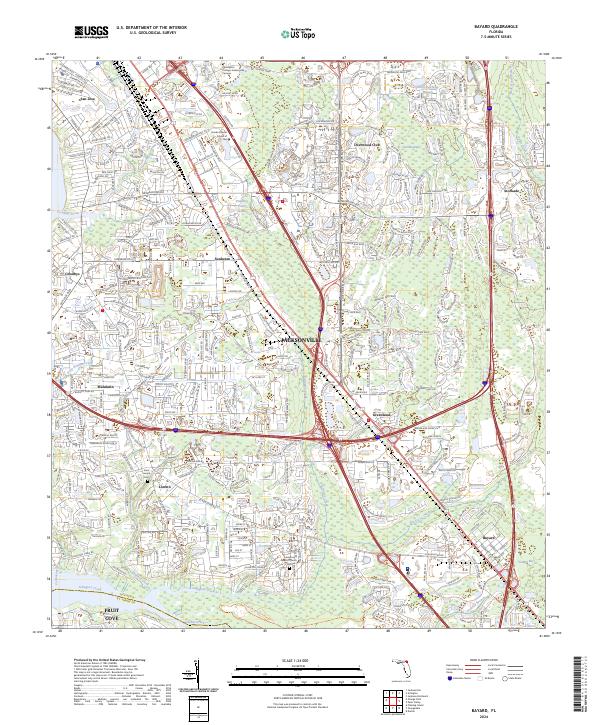 2024 Bayard2024 Print · USGSSouthern Jacksonville at the start of the 2020s shows a complex mix of historic riverfront settlements and modern commercial hubs. Genealogists and researchers can locate the Saint Joseph Cem and trace the paths of Oldfield Creek and Durbin Creek near Loretto.
End of results
Showing maps 1-18 of 18
Frequently asked questions
- What are the different types of historical maps available for Goodbys?
- What is the oldest map of Goodbys?
- Where can I purchase historical maps of Goodbys for my home or office?
- Where can I download high-res historical maps of Goodbys?
- Are there historical topographic maps available for Goodbys?
- Is there historical aerial imagery available for Goodbys?
- Where are historical maps of Goodbys sourced from?