Old Maps of Tuscan Oaks, Jacksonville for Genealogy
Trace your family roots with 18 historic maps of Tuscan Oaks. These high-res maps reveal old neighborhoods, homesites, landmarks, and streets — helping you uncover where your ancestors lived and how the area evolved over time.
- Explore historic neighborhoods: Identify where your relatives may have lived in the 1800s or 1900s.
- Compare maps over time: Trace the changes in streets, buildings, and landmarks for multi-generational research.
- Perfect for genealogy & ancestry research: Used by family historians and researchers to map out lineage and migration.
These maps are an incredible resource for exploring your personal connection to Tuscan Oaks's past.
Tuscan Oaks, Jacksonville maps
(18)- 1917 Map of Orange Park, 1957 Print
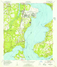
 1917 Orange Park1957 Print · USGSThe St. Johns River corridor comes to life in this early twentieth-century survey of the riverbanks between Jacksonville and Green Cove Springs. Genealogists can trace family footprints through rural sites like Swimming Pen School, Hibernia, and the Durbin P.O. long before suburban sprawl.
 - 1918 Map of Orange Park
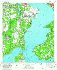
 1918 Orange Park1918 Print · USGSThe St. Johns River corridor comes to life in the years following the Great War, showing the transition from riverine commerce to early rail and road networks. Genealogists can locate family landmarks like Neals Dock, Bethel Church, and the Deep Bottom School across three counties.5 unique versions available
 - 1948 Map of Jacksonville
 1948 Jacksonville1948 Print · USGSNortheast Florida and Southeast Georgia's coastal waterways and railroad towns are captured here in the years following the war. Genealogists can trace family connections through river towns like St Marys or identify long-standing military landmarks like Jacksonville NAS.
 - 1952 Map of Orange Park, 1956 Print
 1952 Orange Park1956 Print · USGSOrange Park and Mandarin sit on opposite shores of the St. Johns River in the early fifties, caught between their agricultural roots and military growth. Genealogists and historians can trace family sites at Magnolia Cem, Bethel Ch, and the sprawling Jacksonville Naval Air Station.
 - 1957 Map of Jacksonville, 1967 Print
 1957 Jacksonville1967 Print · USGSCoastal Florida and Georgia meet in the late fifties, showcasing a landscape of naval aviation, deep-water terminals, and barrier island communities. Researchers can trace the mid-century footprints of NAS Jacksonville, find small communities like Franklintown, and locate the historic Fort Clinch State Park.3 unique versions available
 - 1959 Map of Jacksonville
 1959 Jacksonville1959 Print · USGSNortheast Florida and Southeast Georgia are seen here in the late fifties, dominated by the maritime activity of the St Johns River and the Atlantic coast. Researchers can trace the mid-century layout of Jacksonville and identify sprawling military sites like Camp Blanding Military Reservation and Kings Bay Ammunition Terminal.
 - 1960 Map of Jacksonville
 1960 Jacksonville1960 Print · USGSCoastal Florida and Georgia meet in this mid-century portrait of a region shaped by naval power and the winding St Johns River. Researchers can trace the development of military sites like Cecil Field or locate historic rural landmarks such as Jerusalem Ch and Kings Ferry.
 - 1964 Map of Orange Park, 1965 Print
 1964 Orange Park1965 Print · USGSGreater Jacksonville and the St. Johns River shores are captured here in the mid-sixties during a period of rapid naval and suburban growth. Researchers can trace the development of Orange Park, the massive Jacksonville Naval Air Station, and local landmarks like Laurel Grove Cem.5 unique versions available
 - 1977 Map of Jacksonville, 1983 Print
 1977 Jacksonville1983 Print · USGSNortheast Florida during the late seventies shows a region defined by its deep-water naval bases and burgeoning riverfront suburbs. You can trace the rail networks of the Seaboard Coast Line, locate the Kingsley Plantation, and study the sprawling grounds of Cecil Field Naval Air Station.
 - 1980 Map of Jacksonville, 1984 Print
 1980 Jacksonville1984 Print · USGSThe Jacksonville metropolitan area and the Atlantic coast are captured here during a period of significant late-century growth. Researchers can trace the massive military footprints of Cecil Field and Mayport Naval Station alongside historic communities like Mandarin and Switzerland.
 - 1988 Map of Jacksonville
 1988 Jacksonville1988 Print · USGSCoastal Florida and Georgia are captured here during the late eighties, documenting the rapid growth of the First Coast and its vital military installations. Researchers can trace the development of beach communities like Fernandina Beach and Atlantic Beach or locate family landmarks near Mickler Landing and Orange Park.
 - 1993 Map of Orange Park
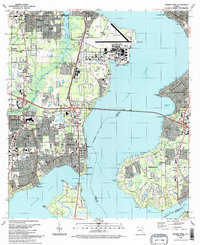 1993 Orange Park1993 Print · USGSThe riverfront communities of Clay and Duval counties were seeing significant suburban maturation in the early nineties. Genealogists and local historians can trace the development of Orange Park and Mandarin, locating landmarks like Magnolia Cem and the Jacksonville Naval Air Station.2 unique versions available
 - 1994 Map of Orange Park, 2002 Print
 1994 Orange Park2002 Print · USGSThe riverfront communities of Orange Park and Mandarin are shown in the 1990s as they expanded around the St Johns River. Researchers can trace old family sites at Magnolia Cem and Mandarin Cem or locate the sprawling Jacksonville Naval Air Station.
 - 2012 Map of Orange Park, 2012 Print
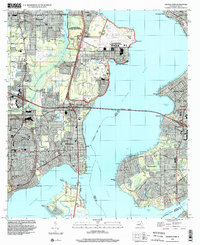
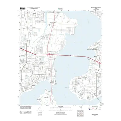 2012 Orange Park2012 Print · USGSCovers Tuscan Oaks, including Jacksonville, Orange Park, and other nearby areas
 - 2015 Map of Orange Park, 2015 Print
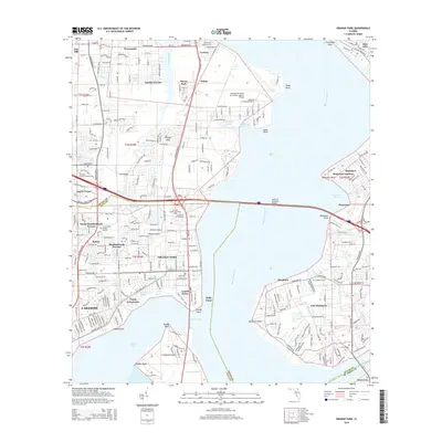 2015 Orange Park2015 Print · USGSCovers Tuscan Oaks, including Jacksonville, Orange Park, and other nearby areas
 - 2018 Map of Orange Park, 2018 Print
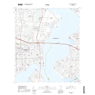 2018 Orange Park2018 Print · USGSCovers Tuscan Oaks, including Jacksonville, Orange Park, and other nearby areas
 - 2021 Map of Orange Park, 2021 Print
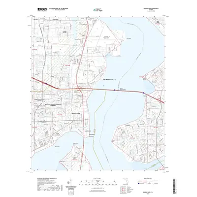 2021 Orange Park2021 Print · USGSCovers Tuscan Oaks, including Jacksonville, Orange Park, and other nearby areas
 - 2024 Map of Orange Park, 2024 Print
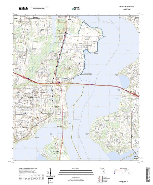 2024 Orange Park2024 Print · USGSThe Saint Johns River and its surrounding coastal communities are captured here in the early twenty-first century. Genealogists and local historians can trace family plots at Mandarin Cem or Magnolia Cem and explore the sprawling layout of NAS Jacksonville FL.
End of results
Showing maps 1-18 of 18
Frequently asked questions
- What are the different types of historical maps available for Tuscan Oaks?
- What is the oldest map of Tuscan Oaks?
- Where can I purchase historical maps of Tuscan Oaks for my home or office?
- Where can I download high-res historical maps of Tuscan Oaks?
- Are there historical topographic maps available for Tuscan Oaks?
- Is there historical aerial imagery available for Tuscan Oaks?
- Where are historical maps of Tuscan Oaks sourced from?