1900s (20th Century) Maps of Rich Bay, Florida
Explore 8 historic maps of Rich Bay from the 1900s (20th Century). These maps offer a rare glimpse into what life looked like during the 1900s — showing old roads, neighborhoods, homes, and landmarks that have changed or disappeared over time.
Whether you're researching your family's past, planning a metal detecting trip, or studying how Rich Bay's landscape evolved across the 1900s, these high-resolution maps are a powerful tool for exploring the history of this region.
- Focus on a specific era: All maps on this page are from the 1900s, giving you a focused view of this time period.
- See what’s changed: Compare century-old streets, trails, and buildings to today's modern landscape using overlays and satellite layers.
- Research with precision: Use these maps for genealogy, historical research, land use analysis, or educational projects.
- View, download, or print: Maps are fully viewable online in high resolution, and can be downloaded or printed for your own records.
Start exploring Rich Bay's history through authentic maps from the 1900s. This is your window into the past.
Rich Bay, FL maps
(8)- 1954 Map of Tallahassee, 1967 Print
 1954 Tallahassee1967 Print · USGSThe Florida Panhandle and South Georgia are captured here during a period of mid-century growth and military expansion. Researchers can trace the development of Panama City, the footprint of Tyndall Air Force Base, and the rail lines of the Atlantic Coast Line.4 unique versions available
 - 1959 Map of Tallahassee
 1959 Tallahassee1959 Print · USGSFlorida's Panhandle and the Big Bend region appear here in the mid-fifties, showing a landscape defined by its great river systems and developing coast. Trace the early layout of Panama City, the expansive Apalachicola National Forest, and the coastal St Marks Lighthouse.
 - 1960 Map of Tallahassee
 1960 Tallahassee1960 Print · USGSThe Florida Panhandle and southern Georgia are captured here in the mid-twentieth century, showing a region defined by its rivers and military installations. Genealogists and historians can trace the growth of Tallahassee or locate coastal landmarks like the St Marks Lighthouse and Tyndall Air Force Base.
 - 1963 Map of Havana South, 1964 Print
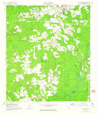 1963 Havana South1964 Print · USGSGadsden County at the start of the 1960s shows a landscape defined by the Seaboard Air Line and the winding Ochlockonee River. Genealogists and local historians can trace rural communities through landmarks like China Hill Ch, Pine Park Sch, and the Nicholson-Freeman Cem.
 - 1978 Map of Bainbridge, 1980 Print
 1978 Bainbridge1980 Print · USGSIn the late seventies, this Georgia-Florida borderland was defined by the confluence of the Flint and Chattahoochee rivers. Trace the region's infrastructure via the Seaboard Coast Line Railroad and find sites like Bainbridge State Hospital.
 - 1982 Map of Havana South, 1983 Print
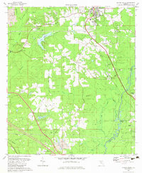 1982 Havana South1983 Print · USGSGadsden County in the early eighties shows a transition from rural timber and mining lands toward expanding residential and aviation hubs. Genealogists and local historians can locate several family-named sites like Ferrell Cem and Hopewell Cem, or trace the rail-side settlements of Scotland and Gibson.
 - 1988 Map of Tallahassee
 1988 Tallahassee1988 Print · USGSThe Florida Panhandle and South Georgia are captured here in the late eighties, showing the expansion of the regional highway network and coastal growth. Genealogists and historians can trace rail lines like the Seaboard System Railroad or locate family roots in Blountstown, Graceville, or Crawfordville.2 unique versions available
 - 1994 Map of Havana South, 1998 Print
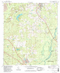 1994 Havana South1998 Print · USGSGadsden County in the 1990s was a landscape where tobacco-growing history met the wild wetlands of the Ochlockonee. Local historians can trace old homesteads near Scotland and Gibson, or locate family sites like Nicholson-Freeman Cem and St James Ch.
End of results
Showing maps 1-8 of 8
Top cities near Rich Bay
- Tallahassee historical maps
- Quincy historical maps
- Midway historical maps
- Havana historical maps
- Attapulgus historical maps
Frequently asked questions
- What are the different types of historical maps available for Rich Bay?
- What is the oldest map of Rich Bay?
- Where can I purchase historical maps of Rich Bay for my home or office?
- Where can I download high-res historical maps of Rich Bay?
- Are there historical topographic maps available for Rich Bay?
- Is there historical aerial imagery available for Rich Bay?
- Where are historical maps of Rich Bay sourced from?