Old Maps of Glades County, Florida for Academic Research
Study the evolution of Glades County with 154 high-resolution historic maps. Whether you're teaching, researching, or modeling changes in land use, these maps provide essential visual documentation of urban, environmental, and geographic change.
- Analyze long-term change: Track patterns in development, transportation, and natural features.
- Ideal for environmental or urban studies: Support academic projects with primary historical map data.
- Use in the classroom or lab: Educators and researchers rely on these maps to bring historical context to life.
These maps are a powerful tool for teaching, research, and visualizing how Glades County has changed over the decades.
Glades County, FL maps
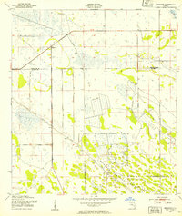
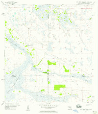
(154)- 1952 Map of Okeechobee NW, 1954 Print
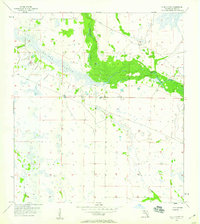
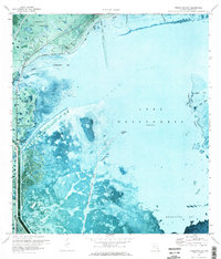
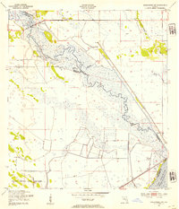 1952 Okeechobee NW1954 Print · USGSThe Florida Everglades and Kissimmee basin are captured here in the early 1950s, documenting a landscape of complex water management and indigenous lands. Researchers can trace the original winding course of the Kissimmee River and its proximity to the Brighton Seminole Indian Reservation and Paradise Run.3 unique versions available
 - 1952 Map of Okeechobee, 1954 Print
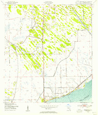
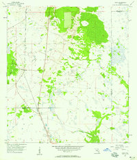
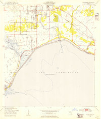 1952 Okeechobee1954 Print · USGSThe northern shores of Lake Okeechobee and the city of Okeechobee are shown in detail during the early 1950s. Researchers can trace the Seaboard Air Line tracks through settlements like Cypress Quarters and Sherman, alongside the emerging Levee system.4 unique versions available
 - 1953 Map of Brighton NW, 1954 Print
 1953 Brighton NW1954 Print · USGSFlorida's interior wetlands underwent a dramatic transformation in the early fifties as new water management projects took hold. Researchers can trace the massive dredging efforts along the Indian Prairie Canal and find remote outposts like Cabbage Island or several isolated Windmill sites.3 unique versions available
 - 1953 Map of Brighton SW, 1954 Print
 1953 Brighton SW1954 Print · USGSThe Florida Everglades interior at the start of the fifties shows a landscape of expansive wetlands and early water control projects. Researchers can trace the original extent of the Brighton Seminole Indian Reservation and the course of Gator Slough.3 unique versions available
 - 1953 Map of Brighton, 1954 Print
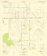
 1953 Brighton1954 Print · USGSThe Florida prairie interior comes into focus during the early 1950s, showing the early engineering of the South Florida drainage system. Local historians can trace the early layout of the Brighton Seminole Indian Reservation and the path of the Indian Prairie Canal.2 unique versions available
 - 1953 Map of Brighton SE, 1954 Print
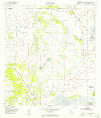
 1953 Brighton SE1954 Print · USGSThe Seminole tribal lands near Lake Okeechobee are documented here in the early fifties during a period of expanding water control. Researchers can locate the Brighton Indian Day Sch, the Indian Cem, and the settlement at Sarasota Colony.3 unique versions available
 - 1953 Map of Okeechobee SW, 1954 Print
 1953 Okeechobee SW1954 Print · USGSFlorida's marshy interior meets the vast waters of Lake Okeechobee in the early fifties, documenting a landscape reshaped by engineering. Trace the early boundaries of the Brighton Seminole Indian Reservation and the path of the Indian Prairie Canal.2 unique versions available
 - 1956 Map of Telegraph Swamp NE, 1957 Print
 1956 Telegraph Swamp NE1957 Print · USGSThe Florida interior at the mid-century mark appears here as a vast network of wetlands and seasonal drainages. Researchers can trace the original hydrological patterns of Rainey Slough and the Branch along the Charlotte and Glades county line.2 unique versions available
 - 1956 Map of West Palm Beach, 1964 Print
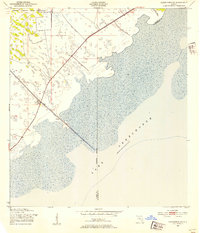
 1956 West Palm Beach1964 Print · USGSSouth Florida during the mid-fifties exhibits a fascinating balance between expanding coastal cities and the vast interior wetlands. Researchers can trace the development of inland settlements like Immokalee and Okeelanta or locate vanished landmarks like Chosen and Buckingham Cem.2 unique versions available
 - 1956 Map of Fort Pierce, 1965 Print
 1956 Fort Pierce1965 Print · USGSCentral and coastal Florida appear here during a period of rapid post-war growth and industrial expansion. Researchers can trace the mid-century rail-to-highway transition along the Sunshine State Parkway or locate old settlements like Ankona, Walton, and Indrio.4 unique versions available
 - 1957 Map of West Palm Beach
 1957 West Palm Beach1957 Print · USGSSouthern Florida in the mid-fifties reveals a landscape defined by massive drainage canals and the early expansion of the Gold Coast. Genealogists and historians can trace industrial outposts like the Sugar plant and Everglades Labor Center, or locate the Jupiter Auxiliary Air Force Base.
 - 1957 Map of Long Island Marsh SE, 1958 Print
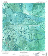
 1957 Long Island Marsh SE1958 Print · USGSThe Florida interior during the late fifties reveals a vast wetland where four counties meet amidst a landscape of sloughs and ranch land. Researchers can trace the path of the Old Railroad Grade and locate local landmarks such as Montgomery Ranch and Rainey Slough.3 unique versions available
 - 1957 Map of Venus, 1958 Print
 1957 Venus1958 Print · USGSThe rural interior of south-central Florida is captured here in the late fifties, centered on the small settlement of Venus. Trace the historic path of the Atlantic Coast Line railroad as it cuts through the marshlands and past Rattlesnake Branch.3 unique versions available
 - 1957 Map of Venus SW, 1958 Print
 1957 Venus SW1958 Print · USGSThe Highlands and Glades county line in the mid-1950s reveals a landscape shaped by water and early transportation efforts. Trace the remnants of an Old Railroad Grade and locate features like Old Venus and the crossing at Robins Bridge.3 unique versions available
 - 1957 Map of Telegraph Swamp SE, 1959 Print
 1957 Telegraph Swamp SE1959 Print · USGSThe Florida interior during the mid-1950s reveals a landscape where the corners of four counties meet among sprawling wetlands. Researchers can locate the Fort Denaud Cem and trace seasonal watercourses like Jacks Branch and Cypress Cr.3 unique versions available
 - 1958 Map of Fort Pierce
 1958 Fort Pierce1958 Print · USGSCentral and South Florida are captured here in the late fifties as the citrus and ranching interior met the modern highway era. Researchers can trace the early path of the Sunshine State Parkway and locate established rail depots in Sebring, Okeechobee, and Arcadia.
 - 1958 Map of West Palm Beach
 1958 West Palm Beach1958 Print · USGSSouth Florida in the late fifties was a land of transition between massive agricultural works and rapid coastal growth. Genealogists and historians can trace old canal networks, early rail lines like the Florida East Coast, and landmarks like the Moore Haven Lock or Jupiter Auxiliary Air Force Base.2 unique versions available
 - 1958 Map of La Belle NW, 1959 Print
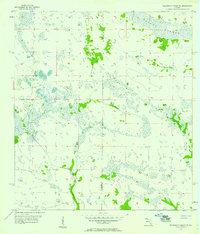
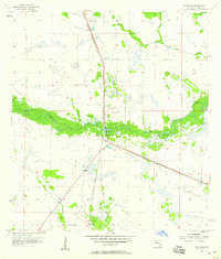
 1958 La Belle NW1959 Print · USGSFlorida's interior wetlands are captured in the late fifties, showcasing the complex hydrologic network of Glades County. Researchers can trace the natural courses of Fisheating Creek and Rainey Slough through this largely undeveloped landscape.3 unique versions available
 - 1958 Map of Goodno, 1959 Print
 1958 Goodno1959 Print · USGSThe Caloosahatchee River valley in the late fifties shows a landscape of cattle marshes and orange groves transitioning into managed water systems. Genealogists and historians can trace the community around Ortona, from the Ortona Cem and Indian Mound to the Old Railroad Grade.2 unique versions available
 - 1958 Map of La Belle, 1959 Print
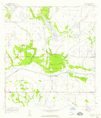
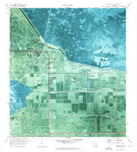
 1958 La Belle1959 Print · USGSThe Hendry and Glades county line comes alive in the late fifties, centered on the riverfront community of La Belle. Researchers can trace the early street grid of La Belle and the winding course of Pollywog Creek and the Caloosahatchee River.3 unique versions available
 - 1958 Map of Palmdale, 1959 Print
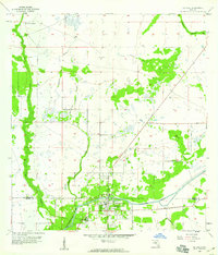
 1958 Palmdale1959 Print · USGSGlades County, Florida, is captured here in the late fifties as a landscape of remote rail stops and winding waterways. Genealogists and historians can locate the small communities of Palmdale, Harrisburg, and Hall City along the Atlantic Coast Line railroad.3 unique versions available
 - 1959 Map of Fort Pierce
 1959 Fort Pierce1959 Print · USGSCentral Florida and the Treasure Coast are shown here in the late fifties, during a period of steady citrus and coastal growth. Trace the historic routes of the Florida East Coast Ry or locate the boundaries of the Seminole Indian Reservation and Highlands Hammock State Park.3 unique versions available
 - 1970 Map of Moore Haven, 1976 Print
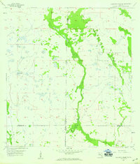
 1970 Moore Haven1976 Print · USGSThe northern edge of the Everglades comes into focus in the 1970s at the intersection of water and rail. Trace the historic layout of Moore Haven, its local landmarks like St Josephs Ch, and the vast Herbert Hoover Dyke system.2 unique versions available
 - 1970 Map of Lakeport, 1976 Print
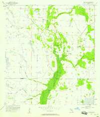
 1970 Lakeport1976 Print · USGSGlades County's marshy interior and the edge of Lake Okeechobee are shown here during the early 1970s. Local historians and genealogists can trace the Brighton Indian Reservation and ancestral sites like Fort Centre and the Indian Mounds.3 unique versions available
 - 1971 Map of Fisheating Bay, 1973 Print
 1971 Fisheating Bay1973 Print · USGSThe western shores of Lake Okeechobee are captured here in the early seventies, showing a landscape defined by massive water-engineering projects. Trace the engineering of the Herbert Hoover Dyke and find local landmarks like Lakeport and Sportsman Village.2 unique versions available
Showing maps 1-25 of 154
Top cities of Glades County
Frequently asked questions
- What are the different types of historical maps available for Glades County?
- What is the oldest map of Glades County?
- Where can I purchase historical maps of Glades County for my home or office?
- Where can I download high-res historical maps of Glades County?
- Are there historical topographic maps available for Glades County?
- Is there historical aerial imagery available for Glades County?
- Where are historical maps of Glades County sourced from?