Old Maps of Jasper, Florida for Hiking & Exploration
Hike through history with 18 historic maps of Jasper. Explore old trails, ghost towns, and forgotten backroads — perfect for outdoor adventurers and local explorers.
- Rediscover forgotten places: Map out old mining camps, roads, and footpaths that no longer exist on modern maps.
- Layer with modern tools: Combine with LiDAR or satellite views to plan hikes through historical terrain.
- Made for exploration: Popular among hikers, overlanders, and local history lovers.
Use these maps to find adventure and explore the hidden past of Jasper.
Jasper, FL maps
(18)- 1954 Map of Valdosta, 1967 Print
 1954 Valdosta1967 Print · USGSThe South Georgia and North Florida borderlands are captured here in the mid-fifties, showing the deep timber and wetland networks of the coastal plain. Researchers can trace the path of the Atlantic Coast Line through Valdosta or explore the interior of the Okefenokee Swamp.2 unique versions available
 - 1955 Map of Jasper, 1956 Print
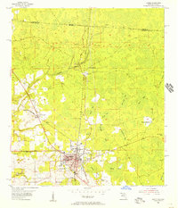 1955 Jasper1956 Print · USGSJasper and its surrounding borderlands are captured in the mid-fifties, showing a landscape of rail-connected towns and extensive swamp bays. Researchers can trace local genealogy through sites like Evergreen Cem, Nunn Cem, and the rural Kennedy Still settlement.3 unique versions available
 - 1958 Map of Valdosta
 1958 Valdosta1958 Print · USGSSouth Georgia and North Florida are captured here in the mid-fifties, showing the vast Okefenokee Swamp and the vital timber and rail corridors connecting the two states. Researchers can locate the footprint of Moody Air Force Base, trace the Live Oak Perry and Gulf railroad, or find early community sites like Bakers Mill and Paradise Church.
 - 1959 Map of Valdosta
 1959 Valdosta1959 Print · USGSThe Georgia-Florida borderlands in the mid-fifties reveal a landscape of massive blackwater swamps and emerging military aviation hubs. Genealogists and historians can trace rail-stop towns like Fargo and Stockton or explore the interior reaches of the Okefenokee Swamp and Billys Island.
 - 1961 Map of Hillcoat, 1963 Print
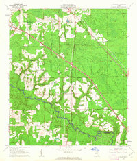 1961 Hillcoat1963 Print · USGSNorth Florida's river country is captured here in the early sixties, showing the intersection of heavy rail and rural settlement along the river. Genealogists can locate family landmarks like Nunn Cem and Mt Pleasant Ch near the historic Suwannee Springs.2 unique versions available
 - 1980 Map of Okefenokee Swamp, 1981 Print
 1980 Okefenokee Swamp1981 Print · USGSThe Georgia-Florida borderlands come to life in the early 1980s, centered on the immense wilderness of the Okefenokee Swamp. Genealogists and historians can trace rail-stop settlements like Fargo and Fruitland or explore the interior geography of Billys Island and Trail Ridge.
 - 1981 Map of Lake City
 1981 Lake City1981 Print · USGSNorth Florida and South Georgia are mapped in the early eighties as the region balanced forestry with growing infrastructure. Genealogists can trace family names and locations from Live Oak to Macclenny, or find cultural landmarks like the Stephen Foster State Folk Culture Center.2 unique versions available
 - 2011 Map of Jasper, 2011 Print
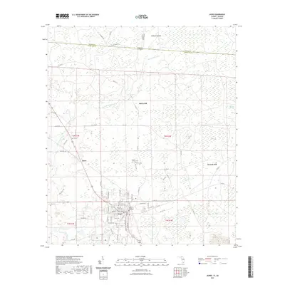
 2011 Jasper2011 Print · USGSCovers Jasper, including Kennedy Still, Bakers Mill, and other nearby areas
 - 2012 Map of Jasper, 2012 Print
 2012 Jasper2012 Print · USGSCovers Jasper, including Kennedy Still, Bakers Mill, and other nearby areas
 - 2012 Map of Hillcoat, 2012 Print
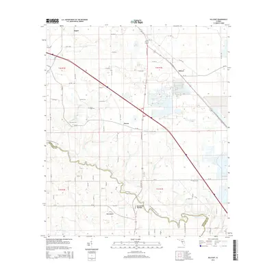
 2012 Hillcoat2012 Print · USGSCovers Jasper, including Suwannee, Marion, and other nearby areas
 - 2015 Map of Jasper, 2015 Print
 2015 Jasper2015 Print · USGSCovers Jasper, including Kennedy Still, Bakers Mill, and other nearby areas
 - 2015 Map of Hillcoat, 2015 Print
 2015 Hillcoat2015 Print · USGSCovers Jasper, including Suwannee, Marion, and other nearby areas
 - 2018 Map of Jasper, 2018 Print
 2018 Jasper2018 Print · USGSCovers Jasper, including Kennedy Still, Bakers Mill, and other nearby areas
 - 2018 Map of Hillcoat, 2018 Print
 2018 Hillcoat2018 Print · USGSCovers Jasper, including Suwannee, Marion, and other nearby areas
 - 2021 Map of Jasper, 2021 Print
 2021 Jasper2021 Print · USGSCovers Jasper, including Kennedy Still, Bakers Mill, and other nearby areas
 - 2021 Map of Hillcoat, 2021 Print
 2021 Hillcoat2021 Print · USGSCovers Jasper, including Suwannee, Marion, and other nearby areas
 - 2024 Map of Hillcoat, 2024 Print
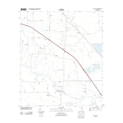
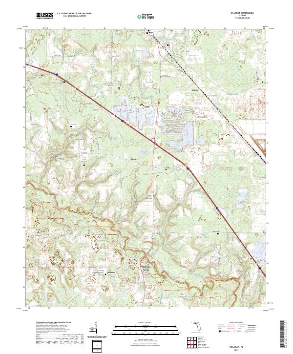 2024 Hillcoat2024 Print · USGSHamilton County at the head of the Suwannee River shows a landscape where historic rural settlements meet modern conservation. Researchers can trace family history through numerous burial sites like Marion Plantation Cem and the riverfront at Suwannee Springs.
 - 2024 Map of Jasper, 2024 Print
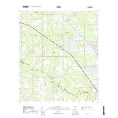
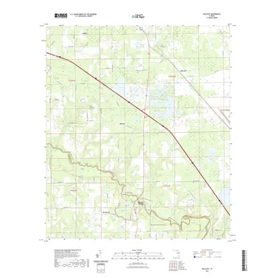
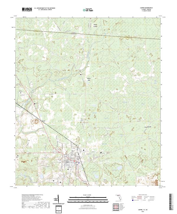 2024 Jasper2024 Print · USGSJasper and its surrounding wetlands are captured here in the early twenty-first century, showing the enduring rural layout of Hamilton County. Family historians can trace ancestral sites like Osborn Family Cem, Hebron Cem, and the historic Bakers Mill.
End of results
Showing maps 1-18 of 18
Top cities near Jasper
- Live Oak historical maps
- White Springs historical maps
- Jennings historical maps
- Lake Park historical maps
- Ellaville historical maps
Frequently asked questions
- What are the different types of historical maps available for Jasper?
- What is the oldest map of Jasper?
- Where can I purchase historical maps of Jasper for my home or office?
- Where can I download high-res historical maps of Jasper?
- Are there historical topographic maps available for Jasper?
- Is there historical aerial imagery available for Jasper?
- Where are historical maps of Jasper sourced from?