Old Maps of White Springs, Florida for Metal Detecting
Plan your next treasure hunt with 16 historic maps of White Springs. Find old homesites, ghost towns, trails, and gathering spots that may be lost to time — perfect for identifying promising metal detecting locations.
- Locate forgotten sites: Uncover places like long-lost settlements, abandoned rail lines, or gathering spots.
- Plan better hunts: Use map overlays combined with LiDAR or satellite views to narrow in on historically rich areas.
- Made for detectorists: Thousands of hobbyists use these maps to discover relics, coins, and hidden history.
Use these historic maps to boost your research and find new opportunities beneath the surface of White Springs.
White Springs, FL maps
(16)- 1954 Map of Valdosta, 1967 Print
 1954 Valdosta1967 Print · USGSThe South Georgia and North Florida borderlands are captured here in the mid-fifties, showing the deep timber and wetland networks of the coastal plain. Researchers can trace the path of the Atlantic Coast Line through Valdosta or explore the interior of the Okefenokee Swamp.2 unique versions available
 - 1958 Map of Valdosta
 1958 Valdosta1958 Print · USGSSouth Georgia and North Florida are captured here in the mid-fifties, showing the vast Okefenokee Swamp and the vital timber and rail corridors connecting the two states. Researchers can locate the footprint of Moody Air Force Base, trace the Live Oak Perry and Gulf railroad, or find early community sites like Bakers Mill and Paradise Church.
 - 1959 Map of Valdosta
 1959 Valdosta1959 Print · USGSThe Georgia-Florida borderlands in the mid-fifties reveal a landscape of massive blackwater swamps and emerging military aviation hubs. Genealogists and historians can trace rail-stop towns like Fargo and Stockton or explore the interior reaches of the Okefenokee Swamp and Billys Island.
 - 1961 Map of White Springs East, 1963 Print
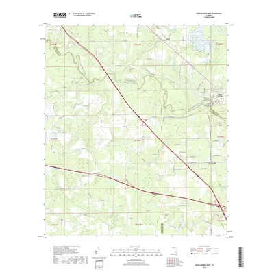
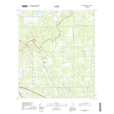
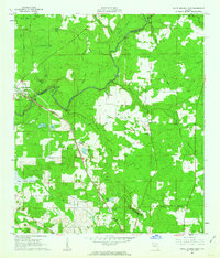 1961 White Springs East1963 Print · USGSAlong the Suwannee River in the early sixties, this area shows a rural landscape defined by deep swamps and timber-rich bayous. Genealogists can trace family footprints at Riverside Cem, the settlement of Winfield, and country landmarks like Falling Creek Ch.3 unique versions available
 - 1961 Map of White Springs West, 1963 Print
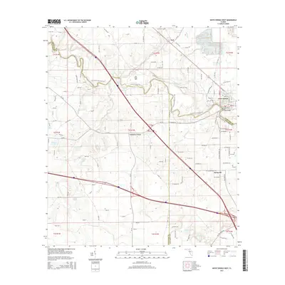
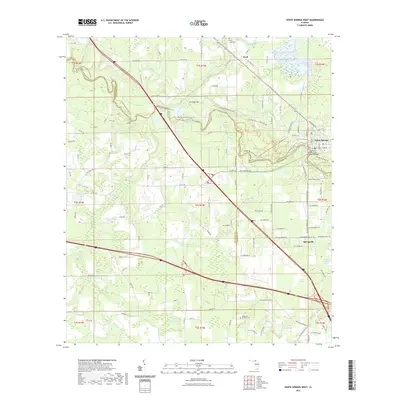
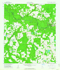 1961 White Springs West1963 Print · USGSThe Suwannee River country in the early sixties was a landscape of river-bend memorials and rural church communities. Genealogists can trace family footprints at Springville Ch or Swift Creek Cem, and locate landmarks like the Sailor Hotel and Bullock Lookout Tower.3 unique versions available
 - 1981 Map of Lake City
 1981 Lake City1981 Print · USGSNorth Florida and South Georgia are mapped in the early eighties as the region balanced forestry with growing infrastructure. Genealogists can trace family names and locations from Live Oak to Macclenny, or find cultural landmarks like the Stephen Foster State Folk Culture Center.2 unique versions available
 - 2012 Map of White Springs West, 2012 Print
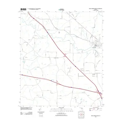 2012 White Springs West2012 Print · USGSCovers White Springs, including Springville, Facil, and other nearby areas
 - 2012 Map of White Springs East, 2012 Print
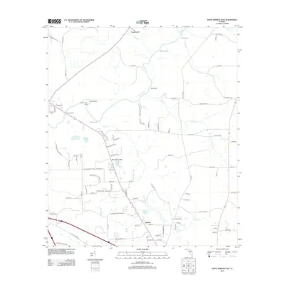 2012 White Springs East2012 Print · USGSCovers White Springs, including Winfield, Suwannee Valley, and other nearby areas
 - 2015 Map of White Springs West, 2015 Print
 2015 White Springs West2015 Print · USGSCovers White Springs, including Springville, Facil, and other nearby areas
 - 2015 Map of White Springs East, 2015 Print
 2015 White Springs East2015 Print · USGSCovers White Springs, including Winfield, Suwannee Valley, and other nearby areas
 - 2018 Map of White Springs West, 2018 Print
 2018 White Springs West2018 Print · USGSCovers White Springs, including Springville, Facil, and other nearby areas
 - 2018 Map of White Springs East, 2018 Print
 2018 White Springs East2018 Print · USGSCovers White Springs, including Winfield, Suwannee Valley, and other nearby areas
 - 2021 Map of White Springs West, 2021 Print
 2021 White Springs West2021 Print · USGSCovers White Springs, including Springville, Facil, and other nearby areas
 - 2021 Map of White Springs East, 2021 Print
 2021 White Springs East2021 Print · USGSCovers White Springs, including Winfield, Suwannee Valley, and other nearby areas
 - 2024 Map of White Springs West, 2024 Print
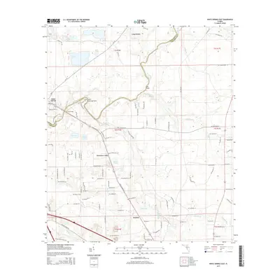
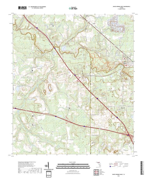 2024 White Springs West2024 Print · USGSThe Suwannee River valley near the border of Hamilton and Columbia Counties is shown here as it appears today. Researchers can trace family history through several local burial grounds, including Bryan Cem and Swift Creek Cem, or explore the area surrounding White Springs.
 - 2024 Map of White Springs East, 2024 Print
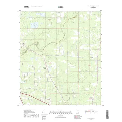
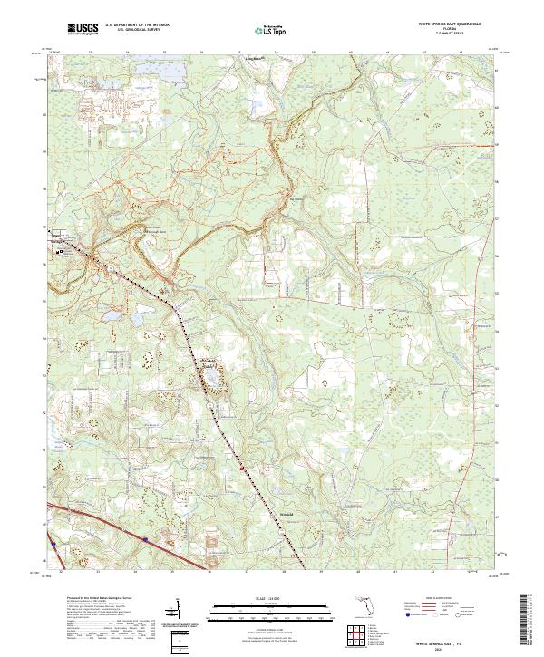 2024 White Springs East2024 Print · USGSThe Suwannee River and its famous rapids define this corner of North Florida in the modern era. Genealogists and hikers can trace the geography around White Springs, from the Riverside Cem to the winding paths of the Florida National Scenic Trl and Big Shoals.
End of results
Showing maps 1-16 of 16
Top cities near White Springs
- Lake City historical maps
- Live Oak historical maps
- Welborn historical maps
- Wellborn historical maps
- Jasper historical maps
Frequently asked questions
- What are the different types of historical maps available for White Springs?
- What is the oldest map of White Springs?
- Where can I purchase historical maps of White Springs for my home or office?
- Where can I download high-res historical maps of White Springs?
- Are there historical topographic maps available for White Springs?
- Is there historical aerial imagery available for White Springs?
- Where are historical maps of White Springs sourced from?