1950s Maps of Hardee County, Florida
Explore 25 historic maps of Hardee County from the 1950s. These maps offer a rare glimpse into what life looked like during the 1950s — showing old roads, neighborhoods, homes, and landmarks that have changed or disappeared over time.
Whether you're researching your family's past, planning a metal detecting trip, or studying how Hardee County's landscape evolved across the 1950s, these high-resolution maps are a powerful tool for exploring the history of this region.
- Focus on a specific era: All maps on this page are from the 1950s, giving you a focused view of this time period.
- See what’s changed: Compare century-old streets, trails, and buildings to today's modern landscape using overlays and satellite layers.
- Research with precision: Use these maps for genealogy, historical research, land use analysis, or educational projects.
- View, download, or print: Maps are fully viewable online in high resolution, and can be downloaded or printed for your own records.
Start exploring Hardee County's history through authentic maps from the 1950s. This is your window into the past.
Hardee County, FL maps
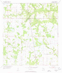
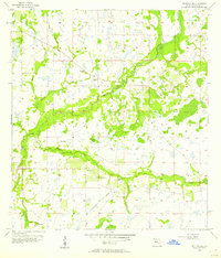
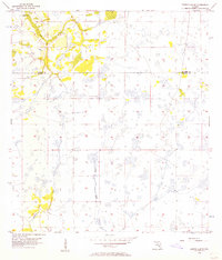
(25)- 1953 Map of Frostproof, 1954 Print
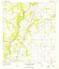
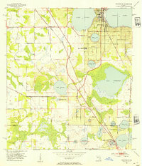 1953 Frostproof1954 Print · USGSFrostproof and the surrounding Florida lake country are shown in the early fifties as the region's citrus and rail economy flourished. Researchers can trace the junction of the Seaboard Air Line and find rural landmarks like Maxcy Quarters and Corinth Ch.5 unique versions available
 - 1953 Map of Avon Park, 1954 Print
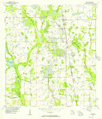
 1953 Avon Park1954 Print · USGSCovers Hardee County, including Avon Park, Highlands County, and other nearby areas4 unique versions available
 - 1953 Map of Crewsville SE, 1954 Print
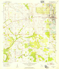
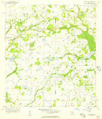
 1953 Crewsville SE1954 Print · USGSFlorida's interior wetlands and cattle country are captured here in the early fifties, showing a landscape defined by seasonal water. Researchers can trace the path of the Footman Trail and locate local landmarks like Niggertown Knoll and Hog Island Hammock.4 unique versions available
 - 1953 Map of Crewsville, 1954 Print
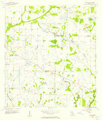
 1953 Crewsville1954 Print · USGSCovers Hardee County, including Crewsville, Highlands County, and other nearby areas4 unique versions available
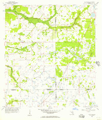
 - 1955 Map of Ft. Green, 1956 Print
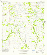
 1955 Ft. Green1956 Print · USGSHardee County in the mid-fifties is characterized by rural settlements and a landscape of hammocks and creeks. Genealogists can locate the Ft Green Post Office, Vandolah, and the Olive Branch Cem along the Seaboard Air Line railroad.3 unique versions available
 - 1955 Map of Bowling Green, 1956 Print
 1955 Bowling Green1956 Print · USGSCentral Florida's phosphate district comes into focus during the mid-fifties as industrial mining expands between Fort Meade and Bowling Green. Researchers can trace family roots at Fort Meade Cem or locate rural landmarks like Mount Pisgah Ch and the Atlantic Coast Line rail corridor.4 unique versions available
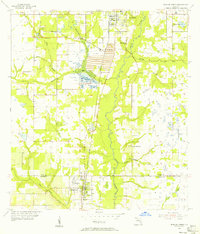
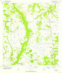
 - 1955 Map of Wauchula, 1956 Print
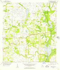
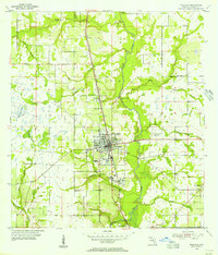 1955 Wauchula1956 Print · USGSMid-century Hardee County comes alive in this survey of the citrus and rail corridor along the Peace River. Researchers can trace the original street layout of Wauchula and find local landmarks like Wauchula Cem and Lake Dale Ch.4 unique versions available
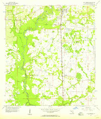
 - 1955 Map of Baird, 1956 Print
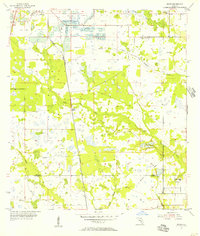 1955 Baird1956 Print · USGSPhosphate mining and rural prairie life intersect in this mid-century Florida interior. Genealogists and historians can locate the community at Brewster, trace the Seaboard Air Line, and find local landmarks like Welcome Ch and Pierce Lookout Tower.4 unique versions available
 - 1956 Map of Gardner, 1957 Print
 1956 Gardner1957 Print · USGSMid-century central Florida comes alive along the Peace River during this period of rural growth. Local historians can trace the old rail stops at Gardner and Brownville or locate family-named landmarks like McBride Branch and Walker Branch.3 unique versions available
 - 1956 Map of Ona, 1957 Print
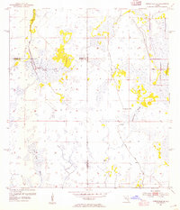
 1956 Ona1957 Print · USGSThe Hardee County interior in the mid-fifties is defined by the Seaboard Line railroad and a network of prairie wetlands. Genealogists can trace the rural communities of Ona and Bridges alongside family-named water features like Elder Br and Osborn Branch.3 unique versions available
 - 1956 Map of Edgeville, 1957 Print
 1956 Edgeville1957 Print · USGSManatee County in the mid-fifties remains a landscape of remote pine flats and cypress sloughs. Genealogists and historians can trace early inland settlements like Edgeville and Sandy or follow the winding courses of Wildcat Slough and Owen Creek.3 unique versions available
 - 1956 Map of Bereah, 1957 Print
 1956 Bereah1957 Print · USGSCentral Florida's phosphate mining and rural community life are captured here in the mid-1950s. Trace the industrial footprint of the Old Colony Mine or locate family roots at Mt Zion Ch, Eden Cem, and the settlement of Bereah.4 unique versions available
 - 1956 Map of Myakka Head, 1957 Print
 1956 Myakka Head1957 Print · USGSThe Florida interior along the Manatee and Hardee County line is captured here in the mid-1950s, showing a landscape of scattered hammocks and winding sloughs. Genealogists and local historians can locate the New Zion Ch and the settlement at Myakka Head among the headwaters of the Myakka River.4 unique versions available
 - 1956 Map of Sweetwater, 1957 Print
 1956 Sweetwater1957 Print · USGSHardee County in the mid-fifties is captured here as a landscape of groves and winding waterways centered on the settlement of Sweetwater. Genealogists and historians can trace family-named landmarks like Adeline Bay and locate an early Indian Mound along the banks of Charlie Creek.3 unique versions available
 - 1956 Map of Duette NE, 1957 Print
 1956 Duette NE1957 Print · USGSFour Florida counties meet in this mid-1950s survey of the interior wetlands and river headwaters near the settlement of Brewster. Researchers can locate rural landmarks like Bethlehem Ch and trace the winding paths of the Little Manatee River and Payne Creek.4 unique versions available
 - 1956 Map of Limestone, 1957 Print
 1956 Limestone1957 Print · USGSThe Hardee and De Soto county line area in the mid-fifties shows a landscape of creek-side settlements and rural railroads. Trace the routes of the Seaboard Air Line near Limestone or locate the site of Oak Hill Cem (Abandoned).4 unique versions available
 - 1956 Map of Zolfo Springs, 1957 Print
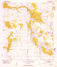
 1956 Zolfo Springs1957 Print · USGSHardee County in the mid-1950s is defined here by the winding Peace River and the transit corridor of the Atlantic Coast Line. Genealogists and historians can trace old settlements at Oak Grove and Moffitt, or locate community centers like Friendship Church.3 unique versions available
 - 1956 Map of Crewsville SW, 1957 Print
 1956 Crewsville SW1957 Print · USGSFlorida's rural heartland near the Hardee and De Soto county line is shown here in the mid-fifties, dominated by vast wetlands and seasonal drainages. Researchers can trace the winding paths of Fish Branch and Joshua Creek, or locate the site of a Flowing Well.3 unique versions available
 - 1956 Map of Duette, 1957 Print
 1956 Duette1957 Print · USGSThe rural Florida interior comes into focus during the mid-fifties, capturing the crossroads at Duette and the surrounding wetlands. Researchers can trace the winding paths of the North Fork Manatee River and Horse Creek across the county line.5 unique versions available
 - 1956 Map of Griffins Corner, 1957 Print
 1956 Griffins Corner1957 Print · USGSHardee County in the mid-1950s is defined by its rural settlements and expansive marshlands before modern development. Researchers can trace local landmarks like Lemon Grove and Griffins Corner, or locate the Rest Haven County Home and Hart Cem.4 unique versions available
 - 1956 Map of Tampa, 1964 Print
 1956 Tampa1964 Print · USGSThe Florida Gulf Coast thrived in the mid-fifties, from the bustling docks of Tampa to the quiet shores of Sanibel. Genealogists and historians can trace old rail lines like the Atlantic Coast Line or find early layouts of Port Charlotte and Bokeelia.2 unique versions available
 - 1956 Map of Fort Pierce, 1965 Print
 1956 Fort Pierce1965 Print · USGSCentral and coastal Florida appear here during a period of rapid post-war growth and industrial expansion. Researchers can trace the mid-century rail-to-highway transition along the Sunshine State Parkway or locate old settlements like Ankona, Walton, and Indrio.4 unique versions available
 - 1958 Map of Fort Pierce
 1958 Fort Pierce1958 Print · USGSCentral and South Florida are captured here in the late fifties as the citrus and ranching interior met the modern highway era. Researchers can trace the early path of the Sunshine State Parkway and locate established rail depots in Sebring, Okeechobee, and Arcadia.
 - 1959 Map of Fort Pierce
 1959 Fort Pierce1959 Print · USGSCentral Florida and the Treasure Coast are shown here in the late fifties, during a period of steady citrus and coastal growth. Trace the historic routes of the Florida East Coast Ry or locate the boundaries of the Seminole Indian Reservation and Highlands Hammock State Park.3 unique versions available
 - 1959 Map of Tampa
 1959 Tampa1959 Print · USGSThe Florida Gulf Coast appears in this late fifties survey during a period of steady coastal growth and established rail commerce. Researchers can trace historic neighborhoods and transit lines from Tampa to St Petersburg, or locate landmarks like Mac Dill AFB and Boca Grande.
End of results
Showing maps 1-25 of 25
Top cities of Hardee County
- Wauchula historical maps
- Bowling Green historical maps
- Zolfo Springs historical maps
- Ona historical maps
Frequently asked questions
- What are the different types of historical maps available for Hardee County?
- What is the oldest map of Hardee County?
- Where can I purchase historical maps of Hardee County for my home or office?
- Where can I download high-res historical maps of Hardee County?
- Are there historical topographic maps available for Hardee County?
- Is there historical aerial imagery available for Hardee County?
- Where are historical maps of Hardee County sourced from?