1950s Maps of Plant City, Hillsborough County
Explore 7 historic maps of Plant City from the 1950s. These maps offer a rare glimpse into what life looked like during the 1950s — showing old roads, neighborhoods, homes, and landmarks that have changed or disappeared over time.
Whether you're researching your family's past, planning a metal detecting trip, or studying how Plant City's landscape evolved across the 1950s, these high-resolution maps are a powerful tool for exploring the history of this region.
- Focus on a specific era: All maps on this page are from the 1950s, giving you a focused view of this time period.
- See what’s changed: Compare century-old streets, trails, and buildings to today's modern landscape using overlays and satellite layers.
- Research with precision: Use these maps for genealogy, historical research, land use analysis, or educational projects.
- View, download, or print: Maps are fully viewable online in high resolution, and can be downloaded or printed for your own records.
Start exploring Plant City's history through authentic maps from the 1950s. This is your window into the past.
Plant City, Hillsborough County maps
(7)- 1955 Map of Nichols, 1956 Print
 1955 Nichols1956 Print · USGSThe industrial and agricultural heart of the Hillsborough-Polk border comes alive in the mid-fifties, dominated by phosphate mining and rail transport. Researchers can trace the heritage of rural communities through Coronet, the Glover Sch, and Springhead Cem.4 unique versions available
 - 1955 Map of Dover, 1956 Print
 1955 Dover1956 Print · USGSHillsborough County phosphate country comes into focus in the mid-fifties as industrial mining expands alongside rural settlements. Researchers can trace the development of the Alafia River basin, locating local landmarks like the Drive-in Theater and Turkey Creek Sch.5 unique versions available
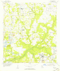
 - 1955 Map of Plant City, 1966 Print
 1955 Plant City1966 Print · USGSMid-century Central Florida comes to life in this survey of the Nature Coast and the inland citrus and rail belt. Genealogists and historians can trace the paths of the Atlantic Coast Line, locate the Anclote Keys Lighthouse, or find old communities like Masaryktown and Lacoochee.6 unique versions available
 - 1956 Map of Tampa, 1964 Print
 1956 Tampa1964 Print · USGSThe Florida Gulf Coast thrived in the mid-fifties, from the bustling docks of Tampa to the quiet shores of Sanibel. Genealogists and historians can trace old rail lines like the Atlantic Coast Line or find early layouts of Port Charlotte and Bokeelia.2 unique versions available
 - 1958 Map of Plant City
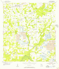
 1958 Plant City1958 Print · USGSFlorida's Gulf Coast and inland ridge country are captured here in the mid-fifties, showing the region before modern sprawl. Genealogists and historians can trace rail-era towns like Richland and Trilby or locate coastal landmarks such as the Anclote Keys Lighthouse.
 - 1959 Map of Plant City
 1959 Plant City1959 Print · USGSThe West Florida coast and inland timberlands are captured here in the late fifties, from the bend of the Gulf to the rail hubs of the interior. Trace the paths of the Atlantic Coast Line through Inverness and find landmarks like the Anclote Keys Lighthouse.
 - 1959 Map of Tampa
 1959 Tampa1959 Print · USGSThe Florida Gulf Coast appears in this late fifties survey during a period of steady coastal growth and established rail commerce. Researchers can trace historic neighborhoods and transit lines from Tampa to St Petersburg, or locate landmarks like Mac Dill AFB and Boca Grande.
End of results
Showing maps 1-7 of 7
Frequently asked questions
- What are the different types of historical maps available for Plant City?
- What is the oldest map of Plant City?
- Where can I purchase historical maps of Plant City for my home or office?
- Where can I download high-res historical maps of Plant City?
- Are there historical topographic maps available for Plant City?
- Is there historical aerial imagery available for Plant City?
- Where are historical maps of Plant City sourced from?