2000s (21st Century) Maps of Orange Bend, Florida
Explore 5 historic maps of Orange Bend from the 2000s (21st Century). These maps offer a rare glimpse into what life looked like during the 2000s — showing old roads, neighborhoods, homes, and landmarks that have changed or disappeared over time.
Whether you're researching your family's past, planning a metal detecting trip, or studying how Orange Bend's landscape evolved across the 2000s, these high-resolution maps are a powerful tool for exploring the history of this region.
- Focus on a specific era: All maps on this page are from the 2000s, giving you a focused view of this time period.
- See what’s changed: Compare century-old streets, trails, and buildings to today's modern landscape using overlays and satellite layers.
- Research with precision: Use these maps for genealogy, historical research, land use analysis, or educational projects.
- View, download, or print: Maps are fully viewable online in high resolution, and can be downloaded or printed for your own records.
Start exploring Orange Bend's history through authentic maps from the 2000s. This is your window into the past.
Orange Bend, FL maps
(5)- 2012 Map of Leesburg East, 2012 Print
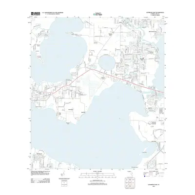 2012 Leesburg East2012 Print · USGSCovers Orange Bend, including Silver Lake, Lisbon, and other nearby areas
 - 2015 Map of Leesburg East, 2015 Print
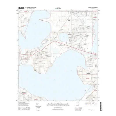 2015 Leesburg East2015 Print · USGSCovers Orange Bend, including Silver Lake, Lisbon, and other nearby areas
 - 2018 Map of Leesburg East, 2018 Print
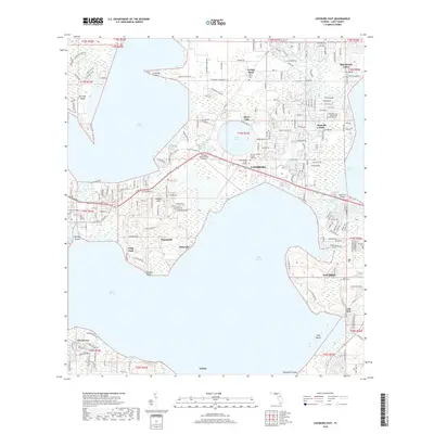 2018 Leesburg East2018 Print · USGSCovers Orange Bend, including Silver Lake, Lisbon, and other nearby areas
 - 2021 Map of Leesburg East, 2021 Print
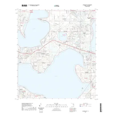 2021 Leesburg East2021 Print · USGSCovers Orange Bend, including Silver Lake, Lisbon, and other nearby areas
 - 2024 Map of Leesburg East, 2024 Print
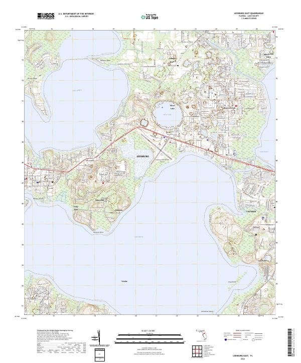 2024 Leesburg East2024 Print · USGSThe Lake County interior is seen here in the mid-2020s, showing a landscape defined by the convergence of major water bodies and growing town centers. Researchers can trace the development of Leesburg and Tavares alongside local landmarks like Tomato Hill and the Leesburg International Airport.
End of results
Showing maps 1-5 of 5
Top cities near Orange Bend
- The Villages historical maps
- Leesburg historical maps
- Eustis historical maps
- Tavares historical maps
- Groveland historical maps
- Mount Dora historical maps
See more
Frequently asked questions
- What are the different types of historical maps available for Orange Bend?
- What is the oldest map of Orange Bend?
- Where can I purchase historical maps of Orange Bend for my home or office?
- Where can I download high-res historical maps of Orange Bend?
- Are there historical topographic maps available for Orange Bend?
- Is there historical aerial imagery available for Orange Bend?
- Where are historical maps of Orange Bend sourced from?