Old Maps of Lakewood Ranch, Florida for Genealogy
Trace your family roots with 14 historic maps of Lakewood Ranch. These high-res maps reveal old neighborhoods, homesites, landmarks, and streets — helping you uncover where your ancestors lived and how the area evolved over time.
- Explore historic neighborhoods: Identify where your relatives may have lived in the 1800s or 1900s.
- Compare maps over time: Trace the changes in streets, buildings, and landmarks for multi-generational research.
- Perfect for genealogy & ancestry research: Used by family historians and researchers to map out lineage and migration.
These maps are an incredible resource for exploring your personal connection to Lakewood Ranch's past.
Lakewood Ranch, FL maps
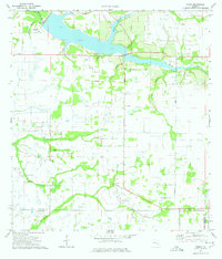
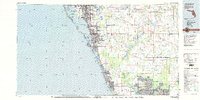
(14)- 1944 Map of Verna
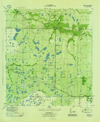 1944 Verna1944 Print · USGSCovers Lakewood Ranch, including Waterbury, Bethany, and other nearby areas2 unique versions available
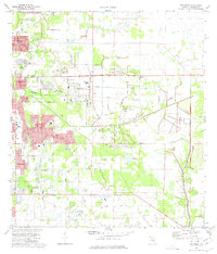
 - 1944 Map of Lorraine
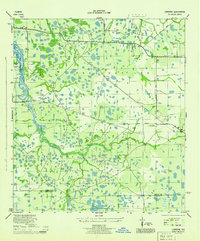 1944 Lorraine1944 Print · USGSCovers Lakewood Ranch, including Bradenton, Foxleigh, and other nearby areas2 unique versions available
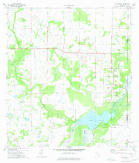
 - 1944 Map of Miakka
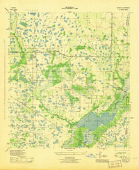 1944 Miakka1944 Print · USGSCovers Lakewood Ranch, including Miakka, Hidden River, and other nearby areas3 unique versions available
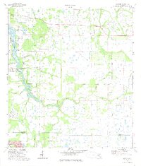
 - 1947 Map of Bee Ridge
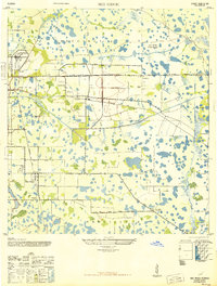 1947 Bee Ridge1947 Print · USGSCovers Lakewood Ranch, including Sarasota, Belspur, and other nearby areas2 unique versions available
 - 1956 Map of Tampa, 1964 Print
 1956 Tampa1964 Print · USGSCovers Lakewood Ranch, including Tampa, Saint Petersburg, and other nearby areas2 unique versions available
 - 1959 Map of Tampa
 1959 Tampa1959 Print · USGSCovers Lakewood Ranch, including Tampa, Saint Petersburg, and other nearby areas
 - 1960 Map of Tampa
 1960 Tampa1960 Print · USGSCovers Lakewood Ranch, including Tampa, Saint Petersburg, and other nearby areas2 unique versions available
 - 1972 Map of Tampa, 1974 Print
 1972 Tampa1974 Print · USGSCovers Lakewood Ranch, including Tampa, Saint Petersburg, and other nearby areas
 - 1973 Map of Verna, 1975 Print
 1973 Verna1975 Print · USGSCovers Lakewood Ranch, including Waterbury, Bethany, and other nearby areas2 unique versions available
 - 1973 Map of Bee Ridge, 1975 Print
 1973 Bee Ridge1975 Print · USGSCovers Lakewood Ranch, including Sarasota, Belspur, and other nearby areas3 unique versions available
 - 1973 Map of Old Myakka, 1975 Print
 1973 Old Myakka1975 Print · USGSCovers Lakewood Ranch, including Miakka, Hidden River, and other nearby areas3 unique versions available
 - 1973 Map of Lorraine, 1975 Print
 1973 Lorraine1975 Print · USGSCovers Lakewood Ranch, including Bradenton, Foxleigh, and other nearby areas3 unique versions available
 - 1979 Map of Sarasota, 1980 Print
 1979 Sarasota1980 Print · USGSCovers Lakewood Ranch, including North Port, Bradenton, and other nearby areas
 - 1988 Map of St Petersburg
 1988 St Petersburg1988 Print · USGSCovers Lakewood Ranch, including Tampa, Saint Petersburg, and other nearby areas
End of results
Showing maps 1-14 of 14
Frequently asked questions
- What are the different types of historical maps available for Lakewood Ranch?
- What is the oldest map of Lakewood Ranch?
- Where can I purchase historical maps of Lakewood Ranch for my home or office?
- Where can I download high-res historical maps of Lakewood Ranch?
- Are there historical topographic maps available for Lakewood Ranch?
- Is there historical aerial imagery available for Lakewood Ranch?
- Where are historical maps of Lakewood Ranch sourced from?