Old Maps of Blocker, Florida for Hiking & Exploration
Hike through history with 13 historic maps of Blocker. Explore old trails, ghost towns, and forgotten backroads — perfect for outdoor adventurers and local explorers.
- Rediscover forgotten places: Map out old mining camps, roads, and footpaths that no longer exist on modern maps.
- Layer with modern tools: Combine with LiDAR or satellite views to plan hikes through historical terrain.
- Made for exploration: Popular among hikers, overlanders, and local history lovers.
Use these maps to find adventure and explore the hidden past of Blocker.
Blocker, FL maps
(13)- 1954 Map of Tallahassee, 1967 Print
 1954 Tallahassee1967 Print · USGSThe Florida Panhandle and South Georgia are captured here during a period of mid-century growth and military expansion. Researchers can trace the development of Panama City, the footprint of Tyndall Air Force Base, and the rail lines of the Atlantic Coast Line.4 unique versions available
 - 1959 Map of Tallahassee
 1959 Tallahassee1959 Print · USGSFlorida's Panhandle and the Big Bend region appear here in the mid-fifties, showing a landscape defined by its great river systems and developing coast. Trace the early layout of Panama City, the expansive Apalachicola National Forest, and the coastal St Marks Lighthouse.
 - 1960 Map of Tallahassee
 1960 Tallahassee1960 Print · USGSThe Florida Panhandle and southern Georgia are captured here in the mid-twentieth century, showing a region defined by its rivers and military installations. Genealogists and historians can trace the growth of Tallahassee or locate coastal landmarks like the St Marks Lighthouse and Tyndall Air Force Base.
 - 1963 Map of Lake Jackson, 1964 Print
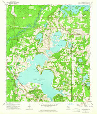 1963 Lake Jackson1964 Print · USGSNorth of Tallahassee in the early sixties, this area shows the initial wave of suburban growth around Lake Jackson. Genealogists and local historians can trace early subdivisions like Harbinwood Estates and rural landmarks such as St Marks Ch and the Seaboard Air Line railroad.
 - 1978 Map of Bainbridge, 1980 Print
 1978 Bainbridge1980 Print · USGSIn the late seventies, this Georgia-Florida borderland was defined by the confluence of the Flint and Chattahoochee rivers. Trace the region's infrastructure via the Seaboard Coast Line Railroad and find sites like Bainbridge State Hospital.
 - 1982 Map of Lake Jackson, 1983 Print
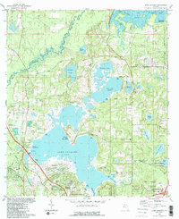 1982 Lake Jackson1983 Print · USGSNorth of Tallahassee in the early eighties, this area balances a growing suburban footprint with its ancient foundations at the Lake Jackson Mounds. Genealogists and historians can locate early family landmarks and estates, from El Destinado to Memory Gardens Cem and St Matthews Ch.2 unique versions available
 - 1988 Map of Tallahassee
 1988 Tallahassee1988 Print · USGSThe Florida Panhandle and South Georgia are captured here in the late eighties, showing the expansion of the regional highway network and coastal growth. Genealogists and historians can trace rail lines like the Seaboard System Railroad or locate family roots in Blountstown, Graceville, or Crawfordville.2 unique versions available
 - 1999 Map of Lake Jackson, 2003 Print
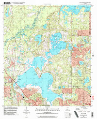 1999 Lake Jackson2003 Print · USGSTallahassee's northward expansion into Leon County is caught here at a moment of transition in the late nineties. Genealogists and researchers can trace local family landmarks and institutional roots at Memory Gardens Cem, El Destinado, and St Pauls Ch.
 - 2012 Map of Lake Jackson, 2012 Print
 2012 Lake Jackson2012 Print · USGSCovers Blocker, including Tallahassee, Oak Knoll Estates, and other nearby areas
 - 2015 Map of Lake Jackson, 2015 Print
 2015 Lake Jackson2015 Print · USGSCovers Blocker, including Tallahassee, Oak Knoll Estates, and other nearby areas
 - 2018 Map of Lake Jackson, 2018 Print
 2018 Lake Jackson2018 Print · USGSCovers Blocker, including Tallahassee, Oak Knoll Estates, and other nearby areas
 - 2021 Map of Lake Jackson, 2021 Print
 2021 Lake Jackson2021 Print · USGSCovers Blocker, including Tallahassee, Oak Knoll Estates, and other nearby areas
 - 2024 Map of Lake Jackson, 2024 Print
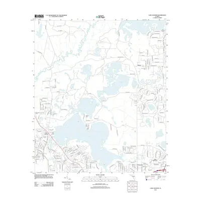
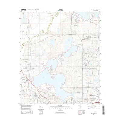
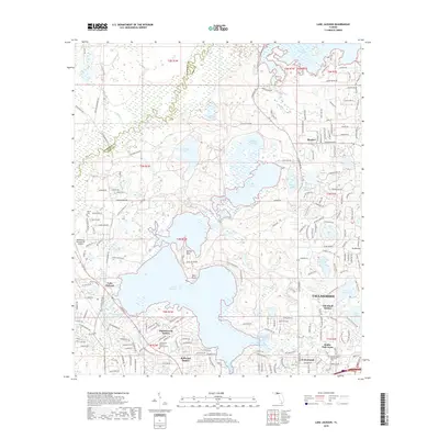
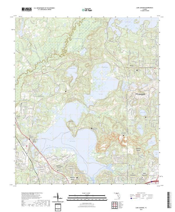 2024 Lake Jackson2024 Print · USGSNorth of Tallahassee in the early 2020s, this area shows a unique blend of lakeside residential growth and preserved historical family sites. Genealogists can trace local roots at the Moore Family Cem, Scott Cem, or the Saint Matthew Primitive Baptist Church Cem near Rollins Point.
End of results
Showing maps 1-13 of 13
Top cities near Blocker
Frequently asked questions
- What are the different types of historical maps available for Blocker?
- What is the oldest map of Blocker?
- Where can I purchase historical maps of Blocker for my home or office?
- Where can I download high-res historical maps of Blocker?
- Are there historical topographic maps available for Blocker?
- Is there historical aerial imagery available for Blocker?
- Where are historical maps of Blocker sourced from?