Old Maps of Miccosukee Land Coop, Leon County for Genealogy
Trace your family roots with 13 historic maps of Miccosukee Land Coop. These high-res maps reveal old neighborhoods, homesites, landmarks, and streets — helping you uncover where your ancestors lived and how the area evolved over time.
- Explore historic neighborhoods: Identify where your relatives may have lived in the 1800s or 1900s.
- Compare maps over time: Trace the changes in streets, buildings, and landmarks for multi-generational research.
- Perfect for genealogy & ancestry research: Used by family historians and researchers to map out lineage and migration.
These maps are an incredible resource for exploring your personal connection to Miccosukee Land Coop's past.
Miccosukee Land Coop, Leon County maps
(13)- 1954 Map of Tallahassee, 1967 Print
 1954 Tallahassee1967 Print · USGSThe Florida Panhandle and South Georgia are captured here during a period of mid-century growth and military expansion. Researchers can trace the development of Panama City, the footprint of Tyndall Air Force Base, and the rail lines of the Atlantic Coast Line.4 unique versions available
 - 1959 Map of Tallahassee
 1959 Tallahassee1959 Print · USGSFlorida's Panhandle and the Big Bend region appear here in the mid-fifties, showing a landscape defined by its great river systems and developing coast. Trace the early layout of Panama City, the expansive Apalachicola National Forest, and the coastal St Marks Lighthouse.
 - 1960 Map of Tallahassee
 1960 Tallahassee1960 Print · USGSThe Florida Panhandle and southern Georgia are captured here in the mid-twentieth century, showing a region defined by its rivers and military installations. Genealogists and historians can trace the growth of Tallahassee or locate coastal landmarks like the St Marks Lighthouse and Tyndall Air Force Base.
 - 1963 Map of Miccosukee, 1964 Print
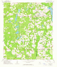 1963 Miccosukee1964 Print · USGSThe Leon and Jefferson county borderlands are shown here in the early sixties, centered on the historic community of Miccosukee. Researchers can trace rural life through landmarks like Wadesboro, the Concord School, and local cemeteries like Centenary Cemetery.
 - 1978 Map of Bainbridge, 1980 Print
 1978 Bainbridge1980 Print · USGSIn the late seventies, this Georgia-Florida borderland was defined by the confluence of the Flint and Chattahoochee rivers. Trace the region's infrastructure via the Seaboard Coast Line Railroad and find sites like Bainbridge State Hospital.
 - 1982 Map of Miccosukee
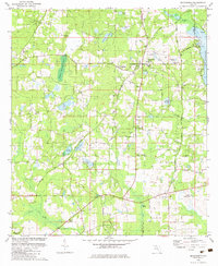 1982 Miccosukee1982 Print · USGSNorth Leon County during the early eighties shows a landscape of established rural hamlets and an intricate network of cypress-lined ponds. Genealogists and local historians can trace family locations near Miccosukee Sch, New Jerusalem Ch, and old routes like Old Miccosukee Road.
 - 1988 Map of Tallahassee
 1988 Tallahassee1988 Print · USGSThe Florida Panhandle and South Georgia are captured here in the late eighties, showing the expansion of the regional highway network and coastal growth. Genealogists and historians can trace rail lines like the Seaboard System Railroad or locate family roots in Blountstown, Graceville, or Crawfordville.2 unique versions available
 - 1994 Map of Miccosukee, 1998 Print
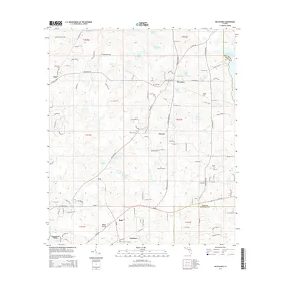
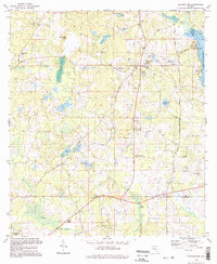 1994 Miccosukee1998 Print · USGSUpper Leon County is shown here in the 1990s, maintaining its character of small settlements and rail-side communities. Researchers can trace family roots at Centenary Ch Cem and Indian Springs Ch or locate landmarks like the Lookout Tower and Wadesboro.
 - 2012 Map of Miccosukee, 2012 Print
 2012 Miccosukee2012 Print · USGSCovers Miccosukee Land Coop, including Felkel, Wadesboro, and other nearby areas
 - 2015 Map of Miccosukee, 2015 Print
 2015 Miccosukee2015 Print · USGSCovers Miccosukee Land Coop, including Felkel, Wadesboro, and other nearby areas
 - 2018 Map of Miccosukee, 2018 Print
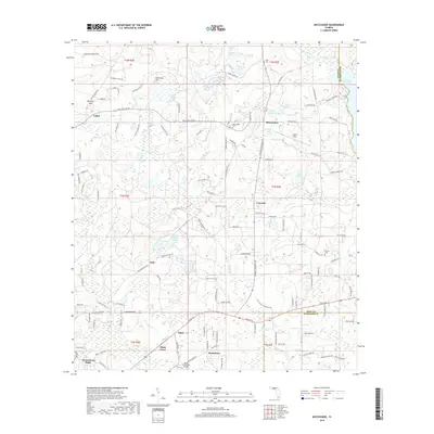 2018 Miccosukee2018 Print · USGSCovers Miccosukee Land Coop, including Felkel, Wadesboro, and other nearby areas
 - 2021 Map of Miccosukee, 2021 Print
 2021 Miccosukee2021 Print · USGSCovers Miccosukee Land Coop, including Felkel, Wadesboro, and other nearby areas
 - 2024 Map of Miccosukee, 2024 Print
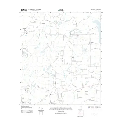
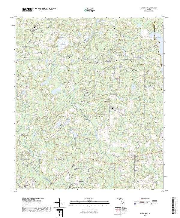 2024 Miccosukee2024 Print · USGSThe Leon and Jefferson county line comes alive in this contemporary record of North Florida’s rural settlements. Genealogists and historians can trace numerous family and community sites, from the Miccosukee Methodist Cem to the old grounds of Peck and Concord.
End of results
Showing maps 1-13 of 13
Frequently asked questions
- What are the different types of historical maps available for Miccosukee Land Coop?
- What is the oldest map of Miccosukee Land Coop?
- Where can I purchase historical maps of Miccosukee Land Coop for my home or office?
- Where can I download high-res historical maps of Miccosukee Land Coop?
- Are there historical topographic maps available for Miccosukee Land Coop?
- Is there historical aerial imagery available for Miccosukee Land Coop?
- Where are historical maps of Miccosukee Land Coop sourced from?