Old Maps of Larkin Fish Camp, Florida for Academic Research
Study the evolution of Larkin Fish Camp with 12 high-resolution historic maps. Whether you're teaching, researching, or modeling changes in land use, these maps provide essential visual documentation of urban, environmental, and geographic change.
- Analyze long-term change: Track patterns in development, transportation, and natural features.
- Ideal for environmental or urban studies: Support academic projects with primary historical map data.
- Use in the classroom or lab: Educators and researchers rely on these maps to bring historical context to life.
These maps are a powerful tool for teaching, research, and visualizing how Larkin Fish Camp has changed over the decades.
Larkin Fish Camp, FL maps
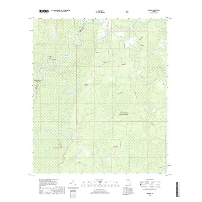
(12)- 1945 Map of Orange
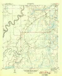 1945 Orange1945 Print · USGSThe Florida panhandle river country comes into focus during the mid-forties as the river and forest dominate the border of Liberty and Calhoun counties. Researchers can trace historic river access at Gunn Landing, locate the Orange Cem, and explore the swampy terrain around Larkin Fish Camp.4 unique versions available
 - 1954 Map of Tallahassee, 1967 Print
 1954 Tallahassee1967 Print · USGSThe Florida Panhandle and South Georgia are captured here during a period of mid-century growth and military expansion. Researchers can trace the development of Panama City, the footprint of Tyndall Air Force Base, and the rail lines of the Atlantic Coast Line.4 unique versions available
 - 1959 Map of Tallahassee
 1959 Tallahassee1959 Print · USGSFlorida's Panhandle and the Big Bend region appear here in the mid-fifties, showing a landscape defined by its great river systems and developing coast. Trace the early layout of Panama City, the expansive Apalachicola National Forest, and the coastal St Marks Lighthouse.
 - 1960 Map of Tallahassee
 1960 Tallahassee1960 Print · USGSThe Florida Panhandle and southern Georgia are captured here in the mid-twentieth century, showing a region defined by its rivers and military installations. Genealogists and historians can trace the growth of Tallahassee or locate coastal landmarks like the St Marks Lighthouse and Tyndall Air Force Base.
 - 1981 Map of Panama City
 1981 Panama City1981 Print · USGSPanama City and the Florida Panhandle coast are captured here in the early eighties, showing the region's balance of military installations and maritime industry. Researchers can trace the Atlanta and St Andrews Bay RR or locate coastal sites like Tyndall Air Force Base and Dead Lake.2 unique versions available
 - 1988 Map of Tallahassee
 1988 Tallahassee1988 Print · USGSThe Florida Panhandle and South Georgia are captured here in the late eighties, showing the expansion of the regional highway network and coastal growth. Genealogists and historians can trace rail lines like the Seaboard System Railroad or locate family roots in Blountstown, Graceville, or Crawfordville.2 unique versions available
 - 1990 Map of Orange
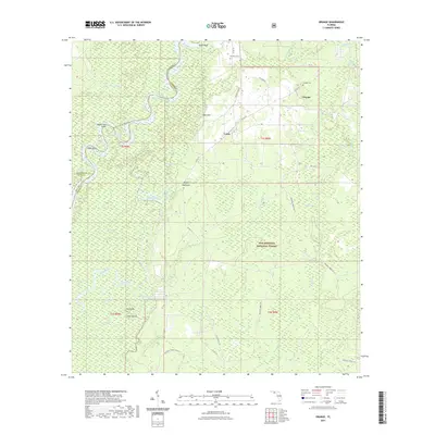
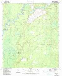 1990 Orange1990 Print · USGSThe riverfront landings and deep swamps of the Panhandle are preserved here as they appeared in the early nineties. Researchers can locate family landmarks like Orange Cem and Humility Cem or trace the river traffic through Porter Ldg and Larkin Fish Camp.
 - 2012 Map of Orange, 2012 Print
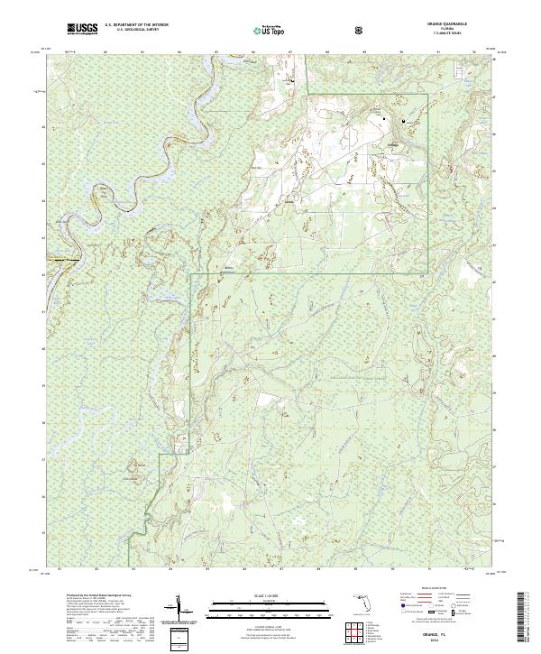
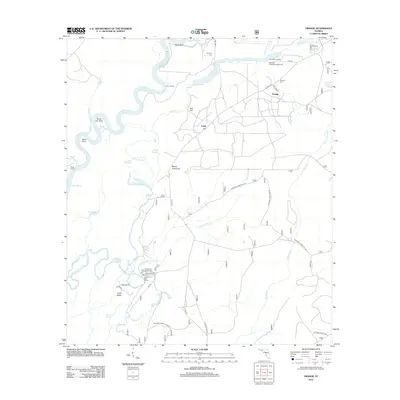 2012 Orange2012 Print · USGSCovers Larkin Fish Camp, including Orange, Gulf County, and other nearby areas
 - 2015 Map of Orange, 2015 Print
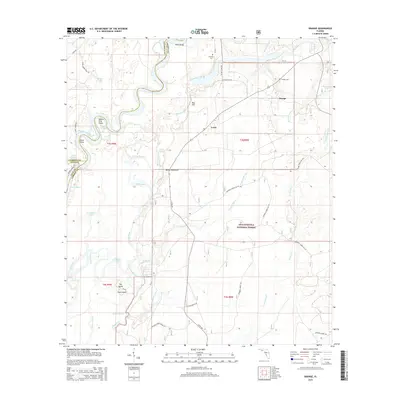 2015 Orange2015 Print · USGSCovers Larkin Fish Camp, including Orange, Gulf County, and other nearby areas
 - 2018 Map of Orange, 2018 Print
 2018 Orange2018 Print · USGSCovers Larkin Fish Camp, including Orange, Gulf County, and other nearby areas
 - 2021 Map of Orange, 2021 Print
 2021 Orange2021 Print · USGSCovers Larkin Fish Camp, including Orange, Gulf County, and other nearby areas
 - 2024 Map of Orange, 2024 Print
 2024 Orange2024 Print · USGSLiberty County, Florida, remains a landscape of dense river swamps and quiet settlements in this contemporary survey. Genealogists can locate family-named sites like the William H Gunn Cem and landmarks such as Queen City Point along the Apalachicola River.
End of results
Showing maps 1-12 of 12
Top cities near Larkin Fish Camp
Frequently asked questions
- What are the different types of historical maps available for Larkin Fish Camp?
- What is the oldest map of Larkin Fish Camp?
- Where can I purchase historical maps of Larkin Fish Camp for my home or office?
- Where can I download high-res historical maps of Larkin Fish Camp?
- Are there historical topographic maps available for Larkin Fish Camp?
- Is there historical aerial imagery available for Larkin Fish Camp?
- Where are historical maps of Larkin Fish Camp sourced from?