Old Maps of Homestead, Florida
Explore 19 old maps of Homestead, spanning from 1950 to today. These high-resolution historic maps reveal how streets, neighborhoods, landmarks, and natural features evolved over time — perfect for genealogy, metal detecting, research, and local history exploration.
What you can do with these maps:
- See how Homestead changed over time: Compare historical maps to modern-day views to trace roads, homesites, rail lines & more.
- View detailed metadata: Each map includes creators, publishers, year, scale, and archive source.
- Overlay maps with satellite & LiDAR: Visualize the past alongside modern tools to explore terrain & human change.
- Trusted historical sources: Maps sourced from the USGS, Library of Congress, and other archives.
- Access maps your way: View online, download high-res files, or order prints for personal or research use.
Start exploring old maps of Homestead to uncover forgotten places, hidden landmarks, and the deep history beneath your feet.
Homestead, FL maps
(19)- 1950 Map of Homestead
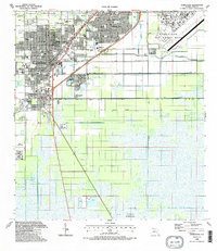
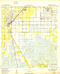 1950 Homestead1950 Print · USGSSouth Florida's agricultural heartland is documented here just after the war, showing the expansion of Homestead and Florida City. Genealogists and historians can trace the early road network of Avocado Drive and the vital Florida East Coast railway.
 - 1956 Map of Homestead, 1957 Print
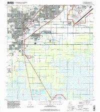
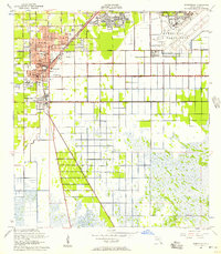 1956 Homestead1957 Print · USGSMid-century South Florida comes alive in this survey of a region transitioning from citrus groves to suburban and military hubs. Trace the parallel routes of the Florida East Coast Railway and Old Dixie Highway past Sacred Heart Sch and the massive Homestead Air Force Base.3 unique versions available
 - 1956 Map of Royal Palm Ranger Station, 1957 Print
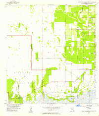 1956 Royal Palm Ranger Station1957 Print · USGSThe South Florida wild meets the encroaching agricultural grid in the mid-fifties. Trace the transition from Taylor Slough wetlands to developed land along Biscayne Drive, Kings Highway, and the Landing Field.4 unique versions available
 - 1956 Map of Miami, 1963 Print
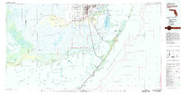
 1956 Miami1963 Print · USGSSouthern Florida experiences post-war expansion in the 1950s, even as the wilderness remains dominant across the southern peninsula. Genealogists and historians can trace suburban growth in Opa-locka and Perrine or locate remote sites like the Tamiami Ranger Station.5 unique versions available
 - 1958 Map of Miami
 1958 Miami1958 Print · USGSSoutheast Florida in the late fifties reveals a coastal boom held in balance with the wild sawgrass and mangroves of Everglades National Park. Trace the paths of the Florida East Coast RR through Homestead or locate the U S Marine Corps Air Station during the height of the Cold War.
 - 1982 Map of Homestead, 1983 Print
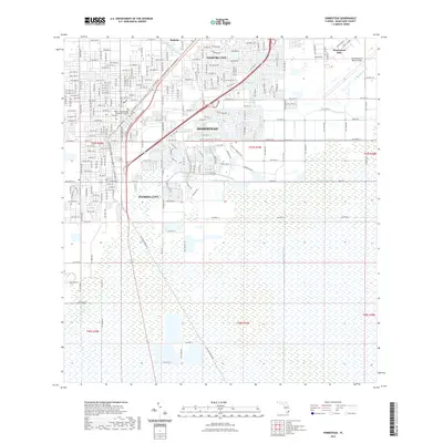
 1982 Homestead1983 Print · USGSThe transition from South Florida's citrus and military hubs to the wilderness of the Everglades is captured here in the early eighties. Researchers can trace the development of Homestead Air Force Base and find remote sites like the Royal Palm Ranger Station and Flamingo.2 unique versions available
 - 1988 Map of Miami
 1988 Miami1988 Print · USGSSouth Florida in the late eighties shows the sharp edge between the growing urban Atlantic coast and the vast wetlands of Everglades National Park. Researchers can trace the path of the Tamiami Trail and locate coastal settlements like Ochopee or Chokoloskee.
 - 1988 Map of Homestead
 1988 Homestead1988 Print · USGSSouthern Florida at the end of the eighties shows a landscape of rapid suburban growth defined by military installations and vital drainage canals. Genealogists and historians can locate specific neighborhood sites like Sacred Heart Ch, Modello, and the original footprint of Homestead Air Force Base.2 unique versions available
 - 1994 Map of Homestead, 1999 Print
 1994 Homestead1999 Print · USGSSouthern Florida at the end of the twentieth century shows a landscape defined by rapid suburban growth and massive military installations. Local researchers can trace the development of Leisure City or locate community anchors like Sacred Heart Ch and Harris Field.
 - 2012 Map of Royal Palm Ranger Station, 2012 Print
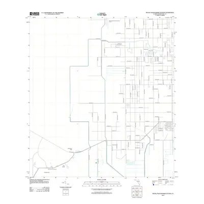 2012 Royal Palm Ranger Station2012 Print · USGSCovers Homestead, including Florida City, Miami-Dade County, and other nearby areas
 - 2012 Map of Homestead, 2012 Print
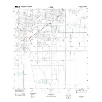 2012 Homestead2012 Print · USGSCovers Homestead, including Leisure City, Florida City, and other nearby areas
 - 2015 Map of Homestead, 2015 Print
 2015 Homestead2015 Print · USGSCovers Homestead, including Leisure City, Florida City, and other nearby areas
 - 2015 Map of Royal Palm Ranger Station, 2015 Print
 2015 Royal Palm Ranger Station2015 Print · USGSCovers Homestead, including Florida City, Miami-Dade County, and other nearby areas
 - 2018 Map of Royal Palm Ranger Station, 2018 Print
 2018 Royal Palm Ranger Station2018 Print · USGSCovers Homestead, including Florida City, Miami-Dade County, and other nearby areas
 - 2018 Map of Homestead, 2018 Print
 2018 Homestead2018 Print · USGSCovers Homestead, including Leisure City, Florida City, and other nearby areas
 - 2021 Map of Royal Palm Ranger Station, 2021 Print
 2021 Royal Palm Ranger Station2021 Print · USGSCovers Homestead, including Florida City, Miami-Dade County, and other nearby areas
 - 2021 Map of Homestead, 2021 Print
 2021 Homestead2021 Print · USGSCovers Homestead, including Leisure City, Florida City, and other nearby areas
 - 2024 Map of Homestead, 2024 Print
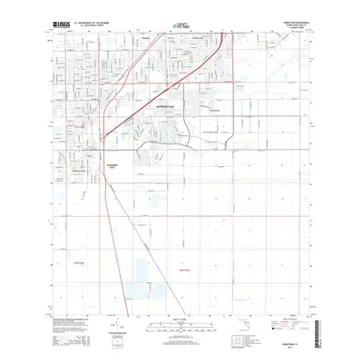
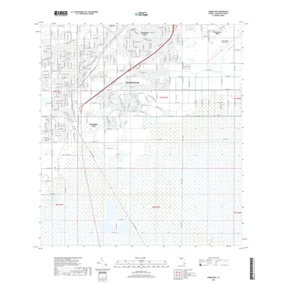
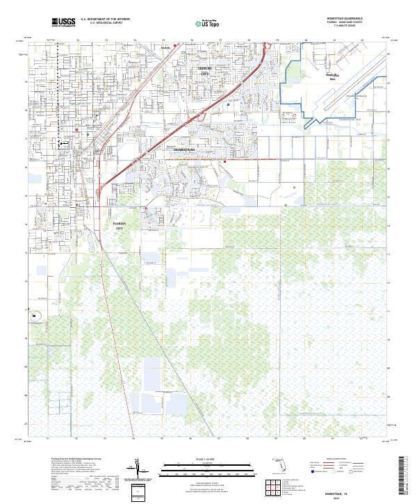 2024 Homestead2024 Print · USGSSouthern Florida at the edge of the Everglades is defined here by its intersection of military infrastructure and tropical agriculture. You can trace the lineage of travel from Old Dixie Hwy to the S Miami-Dade Busway and locate the vast Homestead ARB.
 - 2024 Map of Royal Palm Ranger Station, 2024 Print
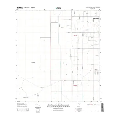
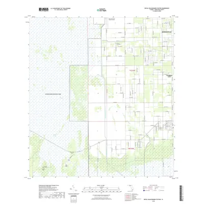
 2024 Royal Palm Ranger Station2024 Print · USGSThe Florida Everglades and the southern agricultural fringe of Miami-Dade are captured here in recent years. Researchers can trace the intersection of managed waterways like Canal 111E with natural features such as Taylor Slough, Paradise Key, and Parachute Key.
End of results
Showing maps 1-19 of 19
Top cities near Homestead
- Kendall historical maps
- Cutler Bay historical maps
- Palmetto Bay historical maps
- Leisure City historical maps
- Princeton historical maps
- Pinecrest historical maps
See more
Top neighborhoods of Homestead
- Four Seasons Mobile Home Park historical maps
- Aquarius Mobile Home Park historical maps
- The Board Walk Mobile Home Park historical maps
- Homestead Trailer Park historical maps
Frequently asked questions
- What are the different types of historical maps available for Homestead?
- What is the oldest map of Homestead?
- Where can I purchase historical maps of Homestead for my home or office?
- Where can I download high-res historical maps of Homestead?
- Are there historical topographic maps available for Homestead?
- Is there historical aerial imagery available for Homestead?
- Where are historical maps of Homestead sourced from?