Old Maps of Miami-Dade County, Florida
Explore 309 old maps of Miami-Dade County, spanning from 1947 to today. These high-resolution historic maps reveal how streets, neighborhoods, landmarks, and natural features evolved over time — perfect for genealogy, metal detecting, research, and local history exploration.
What you can do with these maps:
- See how Miami-Dade County changed over time: Compare historical maps to modern-day views to trace roads, homesites, rail lines & more.
- View detailed metadata: Each map includes creators, publishers, year, scale, and archive source.
- Overlay maps with satellite & LiDAR: Visualize the past alongside modern tools to explore terrain & human change.
- Trusted historical sources: Maps sourced from the USGS, Library of Congress, and other archives.
- Access maps your way: View online, download high-res files, or order prints for personal or research use.
Start exploring old maps of Miami-Dade County to uncover forgotten places, hidden landmarks, and the deep history beneath your feet.
Miami-Dade County, FL maps
(309)- 1947 Map of North Miami, 1959 Print
 1947 North Miami1959 Print · USGSCoastal Florida is shown in a period of significant post-war expansion between Hollywood and Miami Shores. Researchers can trace the layout of early communities and landmarks like the U S Naval Air Station, MacArthur Airport, and the Hollywood Kennel Club.
 - 1947 Map of Key Biscayne, 1961 Print
 1947 Key Biscayne1961 Print · USGSKey Biscayne and the Miami waterfront are shown here just after the war, as the new causeway began to transform the islands. Researchers can trace early infrastructure like the US Coast Guard Air Station, Crandon Park, and the grounds of the Fla Adirondack Prep Sch.
 - 1947 Map of Blackwater Sound, 1967 Print
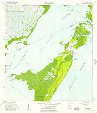
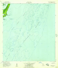
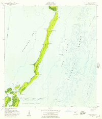
 1947 Blackwater Sound1967 Print · USGSThe upper Florida Keys and the southeastern reaches of the Everglades are mapped here just after the war. Researchers can trace the early path of the Overseas Highway across Cross Key and locate early coastal landmarks like Jewfish Creek and Largo Point.3 unique versions available
 - 1948 Map of Soldier Key
 1948 Soldier Key1948 Print · USGSBiscayne Bay and the upper Florida Keys are captured here just after the war, showing the islands in their natural state. Maritime researchers can locate navigational aids and geographic landmarks like Soldier Key, the Ragged Keys, and a coastal Light.2 unique versions available
 - 1949 Map of Blackwater Sound
 1949 Blackwater Sound1949 Print · USGSThe Upper Florida Keys appear here in the late 1940s, showing the early infrastructure of the Overseas Highway. Researchers can trace the original route through Cross Key and locate early coastal sites like Anglers Park and Jewfish Creek.
 - 1949 Map of Opalocka
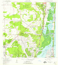
 1949 Opalocka1949 Print · USGSNorth Miami-Dade was a hub of military aviation and early suburban expansion in the years following World War II. Researchers can trace the layout of the U S Naval Air Station and several regional airfields like Master Field and Municipal Field.2 unique versions available
 - 1949 Map of South Miami NW
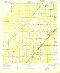
 1949 South Miami NW1949 Print · USGSIn the late 1940s, the western edge of Miami-Dade County was a landscape of emerging infrastructure and military footprints. Genealogists and local historians can trace the early development of Richmond, the Tamiami Airport, and the Seaboard Air Line corridor.2 unique versions available
 - 1949 Map of Elliott Key
 1949 Elliott Key1949 Print · USGSBiscayne Bay and the Florida Keys are shown in the late 1940s as a chain of remote island settlements and maritime navigational aids. Researchers can trace historic points and outposts like Elliott, Adams Key, and the lighthouses at Bache Shoal Lt.
 - 1949 Map of Key Biscayne
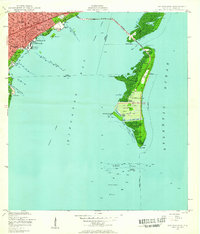
 1949 Key Biscayne1949 Print · USGSBiscayne Bay and its barrier islands are captured here in the late 1940s, just as the Rickenbacker Causeway opened new access to the keys. Researchers can trace early infrastructure like Airline Road and landmarks like the Fla Adirondack Prep Sch or Cape Florida.2 unique versions available
 - 1949 Map of Card Sound
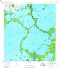
 1949 Card Sound1949 Print · USGSUpper Key Largo and the sounds of Monroe County are shown here in the late 1940s before major modern expansion. Trace the early layout of the Key Largo Club, the settlement of Grayvik, and the natural labyrinth of Crocodile Lake and Angelfish Creek.
 - 1949 Map of Pacific Reef
 1949 Pacific Reef1949 Print · USGSThe Florida Keys and the reef line appear just after the war as a network of critical maritime passages and navigational aids. Maritime historians can trace the deep-water Turtle Harbor Channel and locate the iconic Pacific Reef Lighthouse near Old Rhodes Key.2 unique versions available
 - 1949 Map of Arsenicker Keys
 1949 Arsenicker Keys1949 Print · USGSBiscayne Bay and the Dade County shoreline appear here just after the war, showing a wilder landscape of mangrove keys and drainage canals. You can trace early coastal roads like Mowry Drive and locate historic island features like Long Arsenicker and Totten Key.
 - 1949 Map of Goulds
 1949 Goulds1949 Print · USGSThe Dade County interior was defined by the intersection of major railroads and aviation centers in the late forties. Trace the development of agricultural communities like Silver Palm and Aladdin City alongside the Naranja Cemetery.2 unique versions available
 - 1949 Map of Perrine
 1949 Perrine1949 Print · USGSCoastal Miami-Dade County comes alive in the late 1940s as the railway and early road networks began to shape the south Florida suburbs. Genealogists and historians can trace the growth of Perrine, the rural roads like Eureka Drive, and the path of the Florida East Coast railroad.2 unique versions available
 - 1950 Map of Hialeah
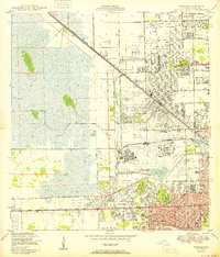 1950 Hialeah1950 Print · USGSMid-century Miami-Dade County is shown here during a period of rapid suburban and industrial expansion. Researchers can trace the early layout of Hialeah, the grounds of Hialeah Park, and numerous family burial sites like Mt Nebo Cem.
 - 1950 Map of Homestead
 1950 Homestead1950 Print · USGSSouth Florida's agricultural heartland is documented here just after the war, showing the expansion of Homestead and Florida City. Genealogists and historians can trace the early road network of Avocado Drive and the vital Florida East Coast railway.
 - 1950 Map of Glades
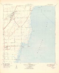
 1950 Glades1950 Print · USGSThe Florida coast at mid-century reveals a landscape defined by the intersection of marsh and sea. Researchers can trace the path of the Old Dixie Highway and locate coastal landmarks like Narrow Point and Manatee Bay.
 - 1950 Map of Miami
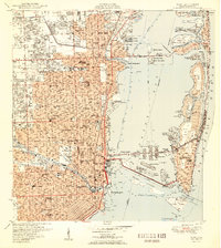 1950 Miami1950 Print · USGSGreater Miami at the midpoint of the century reveals a landscape of dredging and development across Biscayne Bay. Genealogists and researchers can trace neighborhood growth through dozens of named sites like Liberty Square, Bethel Ch, and the Burdine Stadium.2 unique versions available
 - 1950 Map of North Miami
 1950 North Miami1950 Print · USGSMid-century Miami-Dade County comes to life as coastal settlements like Bal Harbour and Surfside begin to take shape. Genealogists and historians can trace the foundations of Opa-locka and the sprawling U S Naval Air Station during this era of rapid growth.
 - 1950 Map of South Miami
 1950 South Miami1950 Print · USGSCoastal Miami-Dade County was undergoing a massive post-war transformation at mid-century as suburbs pushed west from the bay. Researchers can find early layouts for CORAL GABLES, the fledgling campus of the University of Miami, and the site of Browns Airport.2 unique versions available
 - 1955 Map of South Miami NW, 1957 Print
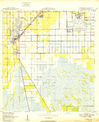
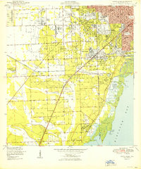
 1955 South Miami NW1957 Print · USGSSuburban development begins to push into the Everglades in the mid-1950s, showing the early layouts of Westwood Lake and Richmond Heights. Genealogists and historians can trace the foundations of the University of Miami and the US Naval Air Station.4 unique versions available
 - 1956 Map of Goulds, 1957 Print
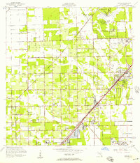 1956 Goulds1957 Print · USGSSouthern Dade County during the mid-fifties shows a landscape of expansive citrus groves and growing aviation hubs. Researchers can trace the layout of early communities like Aladdin City and Princeton alongside the Florida East Coast railway.4 unique versions available
 - 1956 Map of Card Sound, 1957 Print
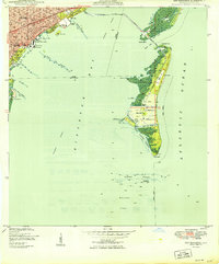
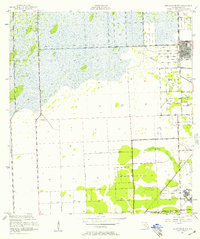
 1956 Card Sound1957 Print · USGSMonroe County and the northern tip of Key Largo are captured here in the mid-fifties, showing the early infrastructure of the Upper Keys. Researchers can trace the development of the Ocean Reef Club, the Grayvik settlement, and the remote Landing Field among the mangroves.5 unique versions available
 - 1956 Map of Pacific Reef, 1957 Print
 1956 Pacific Reef1957 Print · USGSThe northern Florida Keys in the mid-fifties reveal a world of coral heads and shallow channels where Dade and Monroe counties meet. Trace the hazardous coastal navigation routes past the Pacific Reef Lighthouse, Turtle Reef, and Old Rhodes Point.2 unique versions available
 - 1956 Map of Elliott Key, 1957 Print
 1956 Elliott Key1957 Print · USGSThe northern Florida Keys remain a wild archipelago of mangroves and coral reefs during the mid-fifties. Maritime historians and researchers can trace the intricate shorelines of Elliott Key and Adams Key alongside seafaring markers like Bache Shoal.3 unique versions available
Showing maps 1-25 of 309
Top cities of Miami-Dade County
- Miami historical maps
- Hialeah historical maps
- Kendall historical maps
- Miami Gardens historical maps
- Miami Beach historical maps
- Homestead historical maps
See more
Frequently asked questions
- What are the different types of historical maps available for Miami-Dade County?
- What is the oldest map of Miami-Dade County?
- Where can I purchase historical maps of Miami-Dade County for my home or office?
- Where can I download high-res historical maps of Miami-Dade County?
- Are there historical topographic maps available for Miami-Dade County?
- Is there historical aerial imagery available for Miami-Dade County?
- Where are historical maps of Miami-Dade County sourced from?