
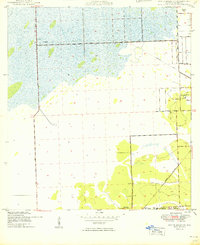
1949 Map of South Miami NW
USGS Topo · Published 1949About this map
Tamiami Airport and the surrounding Everglades transition lands define this late-1940s landscape on the western fringe of South Miami. The area is characterized by a developing grid of major roads such as Bird Drive, Coral Way, and Krome Avenue, which cut through large tracts of undeveloped land and wetlands. Significant institutional and military sites are established here, including the Dade County Home and Hospital and the sprawling U S Naval Air Station near the settlement of Richmond.
Find a feature on this map
20 named features on this map. Tap any name to fly to it.
Don’t see what you’re looking for? This feature index may not catch every label — zoom into the map to look around manually.
Map Details
Editions of this 1949 South Miami NW Map
2 editions found
Other maps of this area

1949 · Goulds
USGS Topo · 1:24,000

1949 · Perrine
USGS Topo · 1:24,000

1950 · Hialeah
USGS Topo · 1:24,000

1950 · South Miami
USGS Topo · 1:24,000

1955 · South Miami NW
USGS Topo · 1:24,000

1956 · Goulds
USGS Topo · 1:24,000

1956 · Perrine
USGS Topo · 1:24,000

1956 · South Miami
USGS Topo · 1:24,000

1956 · Grossman Hammock
USGS Topo · 1:24,000

1956 · Miami
USGS Topo · 1:250,000