
1948 Map of Soldier Key
USGS Topo · Published 1948About this map
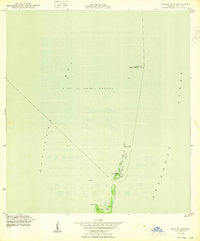
Biscayne Bay and the Atlantic Ocean meet along this string of coral outcroppings just after the war. This survey focuses on the maritime boundary and the early jurisdictional reach of the City of Coral Gables as it extended into the sea. The map documents the natural shoreline and navigational aids of the era, including a Tower and a Light stationed near the southern end of the Ragged Keys.
Find a feature on this map
11 named features on this map. Tap any name to fly to it.
Don’t see what you’re looking for? This feature index may not catch every label — zoom into the map to look around manually.
Map Details
Editions of this 1948 Soldier Key Map
2 editions found
Other maps of this area

1947 · Key Biscayne
USGS Topo · 1:24,000

1949 · Elliott Key
USGS Topo · 1:24,000

1949 · Key Biscayne
USGS Topo · 1:24,000

1949 · Arsenicker Keys
USGS Topo · 1:24,000

1949 · Perrine
USGS Topo · 1:24,000

1950 · South Miami
USGS Topo · 1:24,000
1956 · Elliott Key
USGS Topo · 1:24,000

1956 · Perrine
USGS Topo · 1:24,000

1956 · South Miami
USGS Topo · 1:24,000
1956 · Arsenicker Keys
USGS Topo · 1:24,000