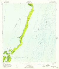
1948 Map of Soldier Key
USGS Topo · Published 1948About this map
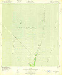
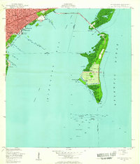
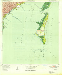
Soldier Key and the surrounding chain of islands emerge from the waters of Biscayne Bay and the Atlantic Ocean in this coastal survey based on 1945 aerial photography. The map reveals a strictly maritime environment where terrestrial life is confined to narrow outcroppings like the Ragged Keys and the northern reaches of Sands Key. Despite its distance from the mainland, a portion of the map falls within the jurisdictional boundaries of the City of Coral Gables, illustrating the early 20th-century expansion of municipal limits far into the bay. Navigation and coastal defense are emphasized through landmarks like the Tower, a Light, and several tidal benchmarks including BM 4 Tidal (C). This map documents the pristine, pre-development state of these keys, largely dominated by Mangrove wetlands and rocky points like Sands Point (E).
Find a feature on this map
15 named features on this map. Tap any name to fly to it.
Don’t see what you’re looking for? This feature index may not catch every label — zoom into the map to look around manually.
Map Details
Editions of this 1948 Soldier Key Map
2 editions found
Other maps of this area
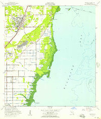
1947 · Key Biscayne
USGS Topo · 1:24,000

1948 · Soldier Key
USGS Topo · 1:24,000

1949 · Elliott Key
USGS Topo · 1:24,000
1949 · Key Biscayne
USGS Topo · 1:24,000

1949 · Arsenicker Keys
USGS Topo · 1:24,000
1949 · Perrine
USGS Topo · 1:24,000
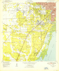
1950 · South Miami
USGS Topo · 1:24,000
1956 · Elliott Key
USGS Topo · 1:24,000
1956 · Perrine
USGS Topo · 1:24,000

1956 · South Miami
USGS Topo · 1:24,000