1970s Maps of Miami-Dade County, Florida
Explore 19 historic maps of Miami-Dade County from the 1970s. These maps offer a rare glimpse into what life looked like during the 1970s — showing old roads, neighborhoods, homes, and landmarks that have changed or disappeared over time.
Whether you're researching your family's past, planning a metal detecting trip, or studying how Miami-Dade County's landscape evolved across the 1970s, these high-resolution maps are a powerful tool for exploring the history of this region.
- Focus on a specific era: All maps on this page are from the 1970s, giving you a focused view of this time period.
- See what’s changed: Compare century-old streets, trails, and buildings to today's modern landscape using overlays and satellite layers.
- Research with precision: Use these maps for genealogy, historical research, land use analysis, or educational projects.
- View, download, or print: Maps are fully viewable online in high resolution, and can be downloaded or printed for your own records.
Start exploring Miami-Dade County's history through authentic maps from the 1970s. This is your window into the past.
Miami-Dade County, FL maps
(19)- 1972 Map of Mahogany Hammock, 1975 Print
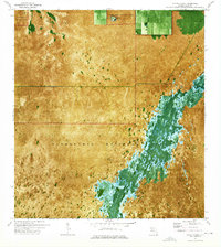
 1972 Mahogany Hammock1975 Print · USGSEverglades National Park in the early 1970s reveals a delicate balance of wetland ecology and water management. Trace early travel routes along the Airboat Trail or locate remote landmarks like Mahogany Hammock and Pearl Bay.
 - 1972 Map of Taylor Slough, 1975 Print
 1972 Taylor Slough1975 Print · USGSThe Florida Everglades in the early 1970s are captured here during a period of intense hydrologic study and park management. Trace the path of Taylor Slough and the Ingraham Highway, alongside landmarks like Areca and the Military Res.2 unique versions available
 - 1972 Map of Shark Valley Lookout Tower, 1976 Print
 1972 Shark Valley Lookout Tower1976 Print · USGSThe heart of the Everglades comes into focus in the early seventies, showcasing the watery expanse of the river of grass. You can trace the path of the Shark Valley Loop Road, identify remote tree islands like Dogwood Hammock, and locate the iconic Shark Valley Lookout Tower.2 unique versions available
 - 1972 Map of Madeira Bay, 1976 Print
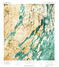
 1972 Madeira Bay1976 Print · USGSThe southern tip of Florida in the early 1970s reveals a raw coastal wilderness where fresh and salt water mingle. Follow the intricate shoreline of Madeira Bay and Florida Bay to find landmarks like Joe Hammock and the Crocodile Dragover.
 - 1972 Map of Chekika Island, 1976 Print
 1972 Chekika Island1976 Print · USGSThe Everglades of the early seventies are captured here in photographic detail, showing the intricate tree islands and marshes. Trace the paths of the Airboat Trail and explore named hardwood hammocks like Chekika Island and Vulture Hammock.
 - 1972 Map of West Lake, 1976 Print
 1972 West Lake1976 Print · USGSThe Florida Everglades and the edges of Florida Bay come into sharp focus in the early seventies, illustrating a world of mangroves and tidal bights. Outdoor historians and coastal researchers can trace the Canoe Trail and identify specific landmarks like Noble Hammock and The Lungs.
 - 1972 Map of Long Pine Key, 1976 Print
 1972 Long Pine Key1976 Print · USGSMiami-Dade County in the early seventies is documented here through a specialized orthophotomap of the Everglades National Park interior. Trace the layout of Long Pine Key and identify the specific locations of the Military Res and Long Pine Key Lookout Tower.
 - 1972 Map of Panther Mound, 1976 Print
 1972 Panther Mound1976 Print · USGSFlorida's river of grass is documented here in the early 1970s, showing the intricate landscape of the Everglades National Park. Researchers can trace the path of the Airboat Trail past Panther Mound and Cane Mill Hammock.
 - 1972 Map of Joe Bay, 1976 Print
 1972 Joe Bay1976 Print · USGSCoastal Florida in the early 1970s is captured in this detailed aerial-based survey of the southernmost Everglades. Trace the natural transition from marsh to open sea through Stump Pass and navigate the intricate waters of Joe Bay and Eagle Key Pass.
 - 1972 Map of Pa Hay Okee Lookout Tower, 1976 Print
 1972 Pa Hay Okee Lookout Tower1976 Print · USGSMiami-Dade and Monroe counties are captured in the early 1970s, showcasing the intricate water patterns and island hammocks of the southern Glades. Researchers can trace the path of the Airboat Trail and locate the Pa-Hay-Okee Lookout Tower and Papaya Hammock.
 - 1972 Map of South Of Coopertown, 1976 Print
 1972 South Of Coopertown1976 Print · USGSMiami-Dade County was a landscape of deep wetlands and expanding agricultural boundaries in the early seventies. Trace the path of the Blue Shanty Canal and follow an Airboat Trail into the sawgrass reaches near Howard Drive.2 unique versions available
 - 1972 Map of Black Hammock, 1976 Print
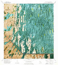
 1972 Black Hammock1976 Print · USGSThe Florida Everglades in the early seventies are captured here through aerial photography and topographic data. Researchers can trace the path of the Shark Valley Slough and locate isolated landmarks like Johnny Buck Hammock and Black Hammock.
 - 1973 Map of Fortymile Bend, 1975 Print
 1973 Fortymile Bend1975 Print · USGSThe Florida Everglades in the early 1970s reveal a landscape of ancestral hammocks and modern infrastructure. Genealogists and historians can trace specific family locations such as Pete Osceolas Farm, Jessie Willies Camp, and Smallpox Tommies Camp.3 unique versions available
 - 1973 Map of Custard Apple Hammock, 1976 Print
 1973 Custard Apple Hammock1976 Print · USGSThe Florida Everglades in the early seventies reveal a landscape of seasonal water flow and scattered tree islands along the Dade and Broward line. Trace the path of the Melaleuca Airboat Trail or locate the namesake Custard Apple Hammock in the Shark Valley Slough.2 unique versions available
 - 1973 Map of West Of Pennsuco, 1976 Print
 1973 West Of Pennsuco1976 Print · USGSThe Florida Everglades in the early 1970s are captured here as a landscape of sawgrass and water management infrastructure. Researchers can trace the path of an Airboat Trail and examine the engineering of the L-67A Levee and L-67C Levee.
 - 1973 Map of Long Island, 1976 Print
 1973 Long Island1976 Print · USGSThe central Everglades in the early 1970s reveal a landscape of seasonal wetlands and indigenous settlements. Local historians can locate John Buck Seminole Village and Sam Willies Camp among the hammocks and Airboat Trails.
 - 1973 Map of Coopertown, 1976 Print
 1973 Coopertown1976 Print · USGSThe Florida Everglades in the early seventies are captured here through detailed aerial photography and topography. Researchers can locate roadside landmarks like Coopertown and Frog City along the Tamiami Trail and the Tamiami Canal.
 - 1973 Map of Hialeah SW, 1976 Print
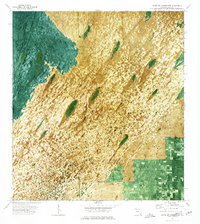
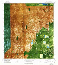 1973 Hialeah SW1976 Print · USGSIn the early 1970s, the western edge of Miami-Dade County balanced between the wild Everglades and rapid suburban expansion. Trace the development of Sweetwater and the early Florida International University campus alongside the historic Tamiami Trail.2 unique versions available
 - 1973 Map of North of Fortymile Bend, 1976 Print
 1973 North of Fortymile Bend1976 Print · USGSThe Florida Everglades in the early seventies are seen here in detail through aerial photography and topographic mapping. Researchers can trace historic land use at Mari Law Seminole Village and Sam Franks Old Farm while observing the water management of Conservation Area No 3A.2 unique versions available
End of results
Showing maps 1-19 of 19
Top cities of Miami-Dade County
- Miami historical maps
- Hialeah historical maps
- Kendall historical maps
- Miami Gardens historical maps
- Miami Beach historical maps
- Homestead historical maps
See more
Frequently asked questions
- What are the different types of historical maps available for Miami-Dade County?
- What is the oldest map of Miami-Dade County?
- Where can I purchase historical maps of Miami-Dade County for my home or office?
- Where can I download high-res historical maps of Miami-Dade County?
- Are there historical topographic maps available for Miami-Dade County?
- Is there historical aerial imagery available for Miami-Dade County?
- Where are historical maps of Miami-Dade County sourced from?