
1972 Map of Chekika Island
USGS Topo · Published 1976About this map
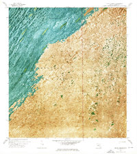
Everglades National Park covers this landscape, characterized by the distinct linear vegetation patterns of the Shark Valley Slough. In the early 1970s, this area of Miami-Dade County remained a complex of sawgrass marshes and hardwood hammocks, including Chekika Island and Vulture Hammock. The orthophotomap format preserves the visual texture of the environment, showing the alignment of tree islands along the flow of water. Human interaction with the swamp is evidenced by infrastructure like the Blue Shanty Canal and a designated Airboat Trail. Natural landmarks such as Gumbo Limbo Hammock and Irongrape Hammock stand out as elevated terrain features amidst the wetlands. Significant hydrological data points, including a Gaging Sta, indicate the ongoing management of water levels through the slough and across Grossman Ridge.
Find a feature on this map
14 named features on this map. Tap any name to fly to it.
Don’t see what you’re looking for? This feature index may not catch every label — zoom into the map to look around manually.
Map Details
Editions of this 1972 Chekika Island Map
This is the sole edition of this map. No revisions or reprints were ever made.
Other maps of this area

1956 · Grossman Hammock
USGS Topo · 1:24,000

1956 · Miami
USGS Topo · 1:250,000

1958 · Miami
USGS Topo · 1:250,000

1972 · Shark Valley Lookout Tower
USGS Topo · 1:24,000

1972 · Panther Mound
USGS Topo · 1:24,000

1972 · South Of Coopertown
USGS Topo · 1:24,000
1972 · Black Hammock
USGS Topo · 1:24,000

1973 · Fortymile Bend
USGS Topo · 1:24,000

1973 · Long Island
USGS Topo · 1:24,000
1973 · Coopertown
USGS Topo · 1:24,000