
1972 Map of Shark Valley Lookout Tower
USGS Topo · Published 1976About this map
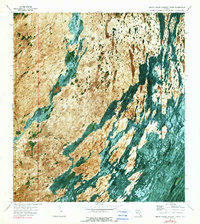
Everglades National Park is captured here during the early 1970s, revealing the intricate water patterns of the southern Florida interior. This orthophotomap uses aerial photography to detail the hydrology of Shark Valley Slough and East Slough, where water flows through dense sawgrass marshes and around limestone outcrops. Human access to this environment is defined by the Shark Valley Loop Road and several Airboat Trails that cut through the muck and marl. Notable elevation increases are found at tree islands known as hammocks, including Dogwood Hammock, Iron Pot Hammock, and Seagrape Hammock. At the center of the park's management and visitor experience is the Shark Valley Lookout Tower, which provides a vantage point over the sawgrass prairie. The map also records a Landing Strip and the border between Monroe Co and Dade Co during a period of intense ecological study.
Find a feature on this map
12 named features on this map. Tap any name to fly to it.
Don’t see what you’re looking for? This feature index may not catch every label — zoom into the map to look around manually.
Map Details
Editions of this 1972 Shark Valley Lookout Tower Map
2 editions found
Other maps of this area

1956 · Miami
USGS Topo · 1:250,000

1958 · Miami
USGS Topo · 1:250,000

1972 · Lostmans Trail
USGS Topo · 1:24,000

1972 · Chekika Island
USGS Topo · 1:24,000

1972 · Panther Mound
USGS Topo · 1:24,000

1972 · Indian Camp Creek
USGS Topo · 1:24,000
1972 · Black Hammock
USGS Topo · 1:24,000

1973 · Fortymile Bend
USGS Topo · 1:24,000

1973 · Fiftymile Bend
USGS Topo · 1:24,000

1973 · Long Island
USGS Topo · 1:24,000