
1972 Map of West Lake
USGS Topo · Published 1976About this map
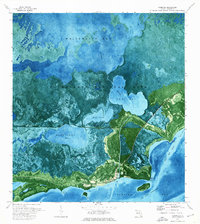
Everglades National Park dominates this early 1970s orthophotomap, showing the intricate boundary where the Florida mainland dissolves into Florida Bay. This specific survey, which combines aerial imagery with topographic data, reveals a complex labyrinth of mangrove shorelines and interior brackish waters. The map highlights the transition from larger inland bodies like West Lake and Cuthbert Lake to the tidal influence of Garfield Bight and Snake Bight.
Find a feature on this map
27 named features on this map. Tap any name to fly to it.
Don’t see what you’re looking for? This feature index may not catch every label — zoom into the map to look around manually.
Map Details
Editions of this 1972 West Lake Map
This is the sole edition of this map. No revisions or reprints were ever made.
Other maps of this area

1956 · Miami
USGS Topo · 1:250,000

1958 · Miami
USGS Topo · 1:250,000

1972 · Whitewater Bay East
USGS Topo · 1:24,000

1972 · Mahogany Hammock
USGS Topo · 1:24,000

1972 · Taylor Slough
USGS Topo · 1:24,000

1972 · Madeira Bay
USGS Topo · 1:24,000

1972 · Pelican Keys
USGS Topo · 1:24,000

1972 · Calusa Keys
USGS Topo · 1:24,000

1972 · Clive Key
USGS Topo · 1:24,000
1973 · Flamingo
USGS Topo · 1:24,000