
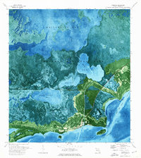
1972 Map of Clive Key
USGS Topo · Published 1976About this map
Everglades National Park encompasses this expansive marine environment within Florida Bay, as documented in the early 1970s. The landscape is defined by a complex network of shallow banks and tidal channels, such as Conchie Channel and the Man of War Channel, which navigate between isolated mangrove keys. This orthophotomap provides a clear view of the underwater topography, highlighting features like Sandy Key Basin and Dildo Key Bank. Human presence is minimal, limited to a remote Picnic Area on Man of War Key. The proximity of named islands like Murray Key and Palm Key near Joe Kemp Channel illustrates the intricate navigation required in these subtropical waters. This survey captures the pristine state of the southern Florida coastline before subsequent decades of environmental change, offering a precise record of the bay's natural shoals and basins.
Find a feature on this map
18 named features on this map. Tap any name to fly to it.
Don’t see what you’re looking for? This feature index may not catch every label — zoom into the map to look around manually.
Map Details
Editions of this 1972 Clive Key Map
This is the sole edition of this map. No revisions or reprints were ever made.
Other maps of this area

1956 · Miami
USGS Topo · 1:250,000

1958 · Miami
USGS Topo · 1:250,000

1972 · Schooner Bank
USGS Topo · 1:24,000

1972 · East Bahia Honda Key NE
USGS Topo · 1:24,000

1972 · Lake Ingraham East
USGS Topo · 1:24,000

1972 · Pelican Keys
USGS Topo · 1:24,000

1972 · West Lake
USGS Topo · 1:24,000

1972 · Sandy Key
USGS Topo · 1:24,000

1972 · Buchanan Keys
USGS Topo · 1:24,000
1973 · Flamingo
USGS Topo · 1:24,000