
1973 Map of Custard Apple Hammock
USGS Topo · Published 1976About this map
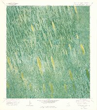
Everglades Wildlife Management Area and Conservation Area No 3A dominate this early 1970s orthophotomap, revealing the intricate water-and-island morphology of the Florida Everglades. The landscape is defined by the flow of the Shark Valley Slough, where distinct tear-drop shaped hammocks rise above the seasonally flooded sawgrass. The namesake Custard Apple Hammock stands as a prominent tree island in this hydrological system, indicating the subtle elevation changes that support woody vegetation. Human activity in this wet environment is marked by specialized transport routes like the Melaleuca Airboat Trail and a simple Camp. This survey, created from 1971 aerial photography, documents the region where water impounded periodically in this area reflects the managed plumbing of the modern Everglades along the Broward and Dade county line.
Find a feature on this map
10 named features on this map. Tap any name to fly to it.
Don’t see what you’re looking for? This feature index may not catch every label — zoom into the map to look around manually.
Map Details
Editions of this 1973 Custard Apple Hammock Map
2 editions found
Other maps of this area

1956 · Miami
USGS Topo · 1:250,000

1956 · West Palm Beach
USGS Topo · 1:250,000

1957 · West Palm Beach
USGS Topo · 1:250,000

1958 · West Palm Beach
USGS Topo · 1:250,000

1958 · Miami
USGS Topo · 1:250,000

1973 · Fortymile Bend
USGS Topo · 1:24,000

1973 · West Of Pennsuco
USGS Topo · 1:24,000

1973 · Everglades 4 SE
USGS Topo · 1:24,000

1973 · Long Island
USGS Topo · 1:24,000
1973 · Coopertown
USGS Topo · 1:24,000