
1950 Map of Glades
USGS Topo · Published 1950About this map
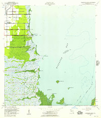
Everglades National Park dominates this subtropical landscape at the mid-century, where the vast sawgrass marshes meet the mangrove-lined shores of the Atlantic. The boundary between Dade and Monroe counties bisects the terrain, illustrating the jurisdictional divide in this remote coastal environment. Transport is defined by the Old Dixie Highway, which cuts a straight path across the marshland toward the southern keys. This era captures the area before modern coastal development reshaped the Florida shoreline, showing a network of natural features like Narrow Point and Flat Point jutting into the waters of Manatee Bay. The presence of the Glades Canal and a lone Quarry signify the early human efforts to drain and utilize this wetland fringe, while the offshore island chain including Main Key and Short Key remains largely untouched.
Find a feature on this map
13 named features on this map. Tap any name to fly to it.
Don’t see what you’re looking for? This feature index may not catch every label — zoom into the map to look around manually.
Map Details
Editions of this 1950 Glades Map
This is the sole edition of this map. No revisions or reprints were ever made.
Other maps of this area

1947 · Garden Cove
USGS Topo · 1:24,000

1947 · Blackwater Sound
USGS Topo · 1:24,000

1949 · Blackwater Sound
USGS Topo · 1:24,000

1949 · Garden Cove
USGS Topo · 1:24,000

1949 · Card Sound
USGS Topo · 1:24,000

1949 · Arsenicker Keys
USGS Topo · 1:24,000

1950 · Homestead
USGS Topo · 1:24,000

1956 · Card Sound
USGS Topo · 1:24,000

1956 · Homestead
USGS Topo · 1:24,000
1956 · Arsenicker Keys
USGS Topo · 1:24,000