Old Maps of Becker, Florida for Metal Detecting
Plan your next treasure hunt with 17 historic maps of Becker. Find old homesites, ghost towns, trails, and gathering spots that may be lost to time — perfect for identifying promising metal detecting locations.
- Locate forgotten sites: Uncover places like long-lost settlements, abandoned rail lines, or gathering spots.
- Plan better hunts: Use map overlays combined with LiDAR or satellite views to narrow in on historically rich areas.
- Made for detectorists: Thousands of hobbyists use these maps to discover relics, coins, and hidden history.
Use these historic maps to boost your research and find new opportunities beneath the surface of Becker.
Becker, FL maps
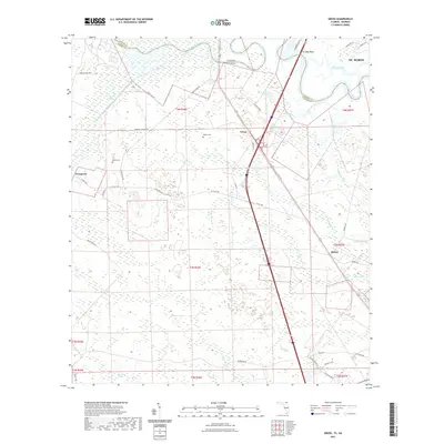
(17)- 1918 Map of St Marys
 1918 St Marys1918 Print · USGSCoastal Nassau County and the Georgia border are seen here just after the Great War, during a period of peak railroad expansion. Trace family roots and old landings at St Marys, Wild's Ferry, and the Evergreen School house.
 - 1919 Map of St Marys
 1919 St Marys1919 Print · USGSThe Georgia-Florida borderlands near the coast were a patchwork of tidal marshes and rail towns just after the Great War. You can trace early river landings and rural schools like Evergreen School, Wilds Ferry, and the Seaboard Air Line rail stops.5 unique versions available
 - 1948 Map of Jacksonville
 1948 Jacksonville1948 Print · USGSNortheast Florida and Southeast Georgia's coastal waterways and railroad towns are captured here in the years following the war. Genealogists can trace family connections through river towns like St Marys or identify long-standing military landmarks like Jacksonville NAS.
 - 1957 Map of Jacksonville, 1967 Print
 1957 Jacksonville1967 Print · USGSCoastal Florida and Georgia meet in the late fifties, showcasing a landscape of naval aviation, deep-water terminals, and barrier island communities. Researchers can trace the mid-century footprints of NAS Jacksonville, find small communities like Franklintown, and locate the historic Fort Clinch State Park.3 unique versions available
 - 1958 Map of Gross, 1959 Print
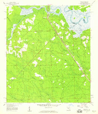 1958 Gross1959 Print · USGSNassau County's river-and-rail corridor is captured in the late 1950s, showing the winding St Marys River border. Genealogists can trace family landmarks like St James Ch in Evergreen or old stops at Gross and Becker.2 unique versions available
 - 1959 Map of Jacksonville
 1959 Jacksonville1959 Print · USGSNortheast Florida and Southeast Georgia are seen here in the late fifties, dominated by the maritime activity of the St Johns River and the Atlantic coast. Researchers can trace the mid-century layout of Jacksonville and identify sprawling military sites like Camp Blanding Military Reservation and Kings Bay Ammunition Terminal.
 - 1960 Map of Jacksonville
 1960 Jacksonville1960 Print · USGSCoastal Florida and Georgia meet in this mid-century portrait of a region shaped by naval power and the winding St Johns River. Researchers can trace the development of military sites like Cecil Field or locate historic rural landmarks such as Jerusalem Ch and Kings Ferry.
 - 1979 Map of Gross, 1980 Print
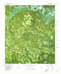 1979 Gross1980 Print · USGSNassau County, Florida, sits at the Georgia border in the late seventies, where the St Marys River winds through a landscape of timber and swamp. Genealogists can locate small rural centers like Evergreen and Gross, alongside old landmarks like St James Ch and the Seaboard Coast Line railway.
 - 1981 Map of Fernandina Beach, 1982 Print
 1981 Fernandina Beach1982 Print · USGSThe coastal borderlands of Georgia and Florida are captured here in the early eighties, from the barrier islands to the rail towns of the interior. Genealogists and historians can trace family-named bluffs and sites like Franklintown, Dungeness Wharf, and St Marys Historical Park.3 unique versions available
 - 1988 Map of Jacksonville
 1988 Jacksonville1988 Print · USGSCoastal Florida and Georgia are captured here during the late eighties, documenting the rapid growth of the First Coast and its vital military installations. Researchers can trace the development of beach communities like Fernandina Beach and Atlantic Beach or locate family landmarks near Mickler Landing and Orange Park.
 - 1993 Map of Gross, 1995 Print
 1993 Gross1995 Print · USGSNassau County's border with Georgia is defined by the winding course of the St Marys River in the early nineties. Genealogists and local historians can trace family roots through landmarks like Wildes Cem, By Faith Ch, and the community of Becker.2 unique versions available
 - 2011 Map of Gross, 2011 Print
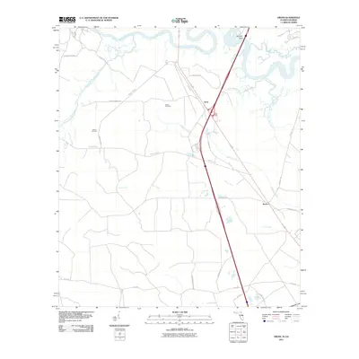 2011 Gross2011 Print · USGSCovers Becker, including St. Marys, Gross, and other nearby areas
 - 2012 Map of Gross, 2012 Print
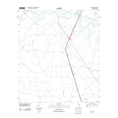 2012 Gross2012 Print · USGSCovers Becker, including St. Marys, Gross, and other nearby areas
 - 2015 Map of Gross, 2015 Print
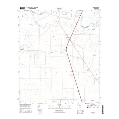 2015 Gross2015 Print · USGSCovers Becker, including St. Marys, Gross, and other nearby areas
 - 2018 Map of Gross, 2018 Print
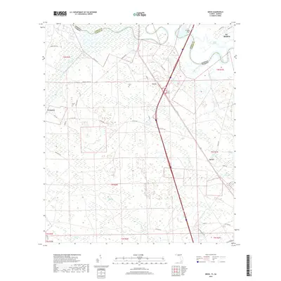 2018 Gross2018 Print · USGSCovers Becker, including St. Marys, Gross, and other nearby areas
 - 2021 Map of Gross, 2021 Print
 2021 Gross2021 Print · USGSCovers Becker, including St. Marys, Gross, and other nearby areas
 - 2024 Map of Gross, 2024 Print
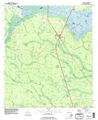
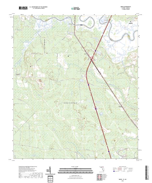 2024 Gross2024 Print · USGSNassau County's river-border landscape is detailed here in recent years, showing the intersection of Florida and Georgia along the winding Saint Marys River. Researchers can locate family landmarks like Wildes Cem and Owens Cem or trace old crossings at Wilds Ferry.
End of results
Showing maps 1-17 of 17
Top cities near Becker
- Jacksonville historical maps
- St. Marys historical maps
- Kingsland historical maps
- Fernandina Beach historical maps
- Kings Bay Base historical maps
- Callahan historical maps
Frequently asked questions
- What are the different types of historical maps available for Becker?
- What is the oldest map of Becker?
- Where can I purchase historical maps of Becker for my home or office?
- Where can I download high-res historical maps of Becker?
- Are there historical topographic maps available for Becker?
- Is there historical aerial imagery available for Becker?
- Where are historical maps of Becker sourced from?