Old Maps of Nassau County, Florida
Explore 172 old maps of Nassau County, spanning from 1917 to today. These high-resolution historic maps reveal how streets, neighborhoods, landmarks, and natural features evolved over time — perfect for genealogy, metal detecting, research, and local history exploration.
What you can do with these maps:
- See how Nassau County changed over time: Compare historical maps to modern-day views to trace roads, homesites, rail lines & more.
- View detailed metadata: Each map includes creators, publishers, year, scale, and archive source.
- Overlay maps with satellite & LiDAR: Visualize the past alongside modern tools to explore terrain & human change.
- Trusted historical sources: Maps sourced from the USGS, Library of Congress, and other archives.
- Access maps your way: View online, download high-res files, or order prints for personal or research use.
Start exploring old maps of Nassau County to uncover forgotten places, hidden landmarks, and the deep history beneath your feet.
Nassau County, FL maps
(172)- 1917 Map of Cambon, 1960 Print
 1917 Cambon1960 Print · USGSWest of Jacksonville during the First World War, this landscape is defined by its critical railroad junctions and pine-flat timberlands. Genealogists can trace family names at Higginbotham School or explore rural stations like Dahoma, Inglehome, and Otis.2 unique versions available
 - 1917 Map of Boulogne, 1966 Print
 1917 Boulogne1966 Print · USGSCoastal Georgia and Florida meet at the turn of the century along the winding banks of the Satilla and St Marys Rivers. Genealogists can trace family roots through numerous river landings like Gum Stump Landing and old community hubs such as Owens Ferry and Colerain.
 - 1917 Map of Macclenny, 1967 Print
 1917 Macclenny1967 Print · USGSThe Florida-Georgia borderlands come to life in the years before the Great War, showing the rail junctions and river crossings that shaped Baker County. Genealogists can trace family roots through numerous local landmarks like Sings Still, Macedon Church, and Garrett School.
 - 1917 Map of Hilliard, 1967 Print
 1917 Hilliard1967 Print · USGSNassau County at the start of the twentieth century was a landscape of timber camps and rail junctions. Genealogists can trace old homesteads near Hilliard and Callahan, or find vanished rural school sites like Romulus School and New Hope School.
 - 1918 Map of St Marys
 1918 St Marys1918 Print · USGSCoastal Nassau County and the Georgia border are seen here just after the Great War, during a period of peak railroad expansion. Trace family roots and old landings at St Marys, Wild's Ferry, and the Evergreen School house.
 - 1918 Map of Folkston
 1918 Folkston1918 Print · USGSSoutheast Georgia and the Florida borderlands are captured here during the height of the regional timber and rail era. Genealogists can trace family footprints at Traders Hill, old schools like Davis School, and the early rail stations at Uptonville and Mattox.3 unique versions available
 - 1918 Map of Moniac
 1918 Moniac1918 Print · USGSThe borderlands of Georgia and Florida come alive in this 1917 survey of the Okeefenokee fringe and the St. Marys River. Researchers can trace the railroad economy through St George and Moniac, or locate family sites like Olivers Mill and the Chesser School.2 unique versions available
 - 1918 Map of Cambon
 1918 Cambon1918 Print · USGSDuval County is captured here at a peak moment of railway expansion and timber harvesting during the Great War era. Genealogy researchers can locate early homesteads near Baldwin, find family-named sites like Higginbotham School, and trace the path of the Heber Tramroad.3 unique versions available
 - 1918 Map of Kingsland
 1918 Kingsland1918 Print · USGSCamden County, Georgia, at the Florida border, is shown here during the First World War era when river landings and rail junctions shaped local life. Genealogists can trace family footprints at Ruhamah School, Fairview Church, and the riverfront settlement of Ceylon.3 unique versions available
 - 1918 Map of Macclenny
 1918 Macclenny1918 Print · USGSThe Florida-Georgia borderlands come to life in this World War I-era survey of the pine flatwoods and river prongs. Researchers can trace early family sites like Macclenny and Glen St Mary, alongside rural landmarks such as Hicks Church and Suggs Still.4 unique versions available
 - 1919 Map of Fernandina
 1919 Fernandina1919 Print · USGSCoastal Florida and Georgia meet at the mouth of the St Marys River in this survey from the late nineteen-teens. Historians can trace the early waterfront at Fernandina, the military grounds of Ft Clinch, and the remote settlement of Franklintown.4 unique versions available
 - 1919 Map of St Marys
 1919 St Marys1919 Print · USGSThe Georgia-Florida borderlands near the coast were a patchwork of tidal marshes and rail towns just after the Great War. You can trace early river landings and rural schools like Evergreen School, Wilds Ferry, and the Seaboard Air Line rail stops.5 unique versions available
 - 1919 Map of Hilliard
 1919 Hilliard1919 Print · USGSNassau County's timber and rail economy is on full display in this post-WWI era survey of the Florida interior. Genealogists and historians can trace old homesteads and local institutions like New Hope School, Hodges Mill, and the rail junction at Callahan.3 unique versions available
 - 1919 Map of Boulogne
 1919 Boulogne1919 Print · USGSCoastal Georgia and Florida meet along the river-carved timberlands of the late nineteen-teens. Genealogists and historians can trace defunct river landings and rural landmarks like Owens Ferry, Germantown School, and the industrial site at Baileys Mills.3 unique versions available
 - 1942 Map of Moniac
 1942 Moniac1942 Print · USGSThe Georgia-Florida borderlands were defined by the wilderness of the Okefenokee Swamp and the tracks of the Georgia Southern and Florida railroad. Genealogists and historians can locate old landmarks like Olivers Mill, Deep Creek Church, and several rural schools including Chesser School and Dunn Creek School.2 unique versions available
 - 1944 Map of Fernandina
 1944 Fernandina1944 Print · USGSThe Florida-Georgia borderlands come to life in this mid-forties coastal survey of Nassau County and its barrier islands. Genealogists and historians can trace the early footprints of Old Fernandina and Franklintown or locate landmarks like Ft Clinch and the U S Quarantine Sta.
 - 1948 Map of Jacksonville
 1948 Jacksonville1948 Print · USGSNortheast Florida and Southeast Georgia's coastal waterways and railroad towns are captured here in the years following the war. Genealogists can trace family connections through river towns like St Marys or identify long-standing military landmarks like Jacksonville NAS.
 - 1954 Map of Valdosta, 1967 Print
 1954 Valdosta1967 Print · USGSThe South Georgia and North Florida borderlands are captured here in the mid-fifties, showing the deep timber and wetland networks of the coastal plain. Researchers can trace the path of the Atlantic Coast Line through Valdosta or explore the interior of the Okefenokee Swamp.2 unique versions available
 - 1957 Map of Jacksonville, 1967 Print
 1957 Jacksonville1967 Print · USGSCoastal Florida and Georgia meet in the late fifties, showcasing a landscape of naval aviation, deep-water terminals, and barrier island communities. Researchers can trace the mid-century footprints of NAS Jacksonville, find small communities like Franklintown, and locate the historic Fort Clinch State Park.3 unique versions available
 - 1958 Map of Valdosta
 1958 Valdosta1958 Print · USGSSouth Georgia and North Florida are captured here in the mid-fifties, showing the vast Okefenokee Swamp and the vital timber and rail corridors connecting the two states. Researchers can locate the footprint of Moody Air Force Base, trace the Live Oak Perry and Gulf railroad, or find early community sites like Bakers Mill and Paradise Church.
 - 1958 Map of Fernandina Beach, 1959 Print
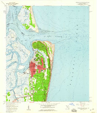 1958 Fernandina Beach1959 Print · USGSCoastal Nassau County comes alive in the late fifties, showcasing the intricate tidal marshes and maritime boundaries of the Florida-Georgia line. Researchers can trace the layout of Fernandina Beach, from St Josephs Academy to the historic Amelia Island Lighthouse.2 unique versions available
 - 1958 Map of Gross, 1959 Print
 1958 Gross1959 Print · USGSNassau County's river-and-rail corridor is captured in the late 1950s, showing the winding St Marys River border. Genealogists can trace family landmarks like St James Ch in Evergreen or old stops at Gross and Becker.2 unique versions available
 - 1958 Map of Italia, 1959 Print
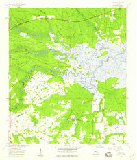 1958 Italia1959 Print · USGSThe Nassau and Duval county line in the late 1950s was a landscape of tide-influenced river bends and expansive wetlands. Researchers can trace historic river access at Joels Landing or locate local landmarks like Harpers Chapel and Ogilvie Cem.4 unique versions available
 - 1958 Map of Hedges, 1959 Print
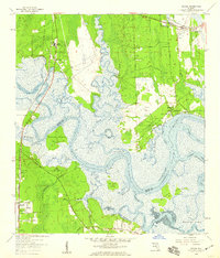 1958 Hedges1959 Print · USGSCoastal Nassau and Duval counties are captured in the late fifties as a landscape of tidal marshes and emerging railside settlements. Genealogists and researchers can trace local family landmarks like Bowles Cem and the landings at Jerry Landing and Henderson Landing.6 unique versions available
 - 1958 Map of St. Marys, 1959 Print
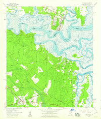 1958 St. Marys1959 Print · USGSThe Georgia-Florida borderlands come to life in this late fifties portrait of the tidal rivers and wetlands surrounding St Marys. Genealogists and historians can trace family roots through landmarks like Bryant Academy, Oak Grove Cem, and the tracks of the Seaboard Air Line.3 unique versions available
Showing maps 1-25 of 172
Top cities of Nassau County
Frequently asked questions
- What are the different types of historical maps available for Nassau County?
- What is the oldest map of Nassau County?
- Where can I purchase historical maps of Nassau County for my home or office?
- Where can I download high-res historical maps of Nassau County?
- Are there historical topographic maps available for Nassau County?
- Is there historical aerial imagery available for Nassau County?
- Where are historical maps of Nassau County sourced from?