1940s Maps of Greenacres, Palm Beach County
Explore 6 historic maps of Greenacres from the 1940s. These maps offer a rare glimpse into what life looked like during the 1940s — showing old roads, neighborhoods, homes, and landmarks that have changed or disappeared over time.
Whether you're researching your family's past, planning a metal detecting trip, or studying how Greenacres's landscape evolved across the 1940s, these high-resolution maps are a powerful tool for exploring the history of this region.
- Focus on a specific era: All maps on this page are from the 1940s, giving you a focused view of this time period.
- See what’s changed: Compare century-old streets, trails, and buildings to today's modern landscape using overlays and satellite layers.
- Research with precision: Use these maps for genealogy, historical research, land use analysis, or educational projects.
- View, download, or print: Maps are fully viewable online in high resolution, and can be downloaded or printed for your own records.
Start exploring Greenacres's history through authentic maps from the 1940s. This is your window into the past.
Greenacres, Palm Beach County maps
(6)- 1945 Map of Greenacres City, 1961 Print
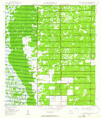 1945 Greenacres City1961 Print · USGSGreenacres City and the surrounding Palm Beach County interior are captured in the mid-1940s during a transformation of the Florida wetlands. Genealogists and researchers can trace early infrastructure like the Sunshine State Parkway and local sites like Convict or various Borrow Pits.4 unique versions available
 - 1945 Map of Lake Worth, 1962 Print
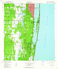 1945 Lake Worth1962 Print · USGSThe Florida coast near Lake Worth is documented here just after the war, showing the expansion of rail and water infrastructure. Genealogists and local historians can trace early residential footprints in Lantana, Boynton Beach, and across Hypoluxo Island.4 unique versions available
 - 1946 Map of Palm Beach Farms, 1958 Print
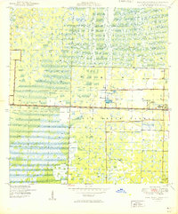
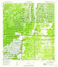 1946 Palm Beach Farms1958 Print · USGSPalm Beach County's interior wetlands meet early post-war development in the 1940s, showing the struggle to drain and define the landscape. Researchers can trace the early grids of Greenacres City and West Palm Beach Farms alongside the critical West Palm Beach Canal.3 unique versions available
 - 1946 Map of Palm Beach, 1964 Print
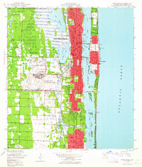 1946 Palm Beach1964 Print · USGSPalm Beach and its inland neighbors are captured here during a period of rapid post-war growth and military activity. Local historians can trace the footprint of the Morrison Field Air Base or locate family sites near Woodlawn Cem and the Military Trail Sch.6 unique versions available
 - 1949 Map of Lake Worth
 1949 Lake Worth1949 Print · USGSPalm Beach County’s shoreline and inland rail corridors are documented in the late 1940s during a pivotal era of South Florida development. Genealogists and historians can trace the early footprints of Lantana and Boynton Beach, or locate landmarks like Hypoluxo Island and the Palm Beach County Airport.
 - 1949 Map of Palm Beach Farms
 1949 Palm Beach Farms1949 Print · USGSThe Palm Beach interior in the late 1940s reveals a landscape of massive wetlands and early agricultural expansion. Researchers can trace the development of Greenacres City, identify the Military Reservation, and follow the West Palm Beach Canal.2 unique versions available
End of results
Showing maps 1-6 of 6
Frequently asked questions
- What are the different types of historical maps available for Greenacres?
- What is the oldest map of Greenacres?
- Where can I purchase historical maps of Greenacres for my home or office?
- Where can I download high-res historical maps of Greenacres?
- Are there historical topographic maps available for Greenacres?
- Is there historical aerial imagery available for Greenacres?
- Where are historical maps of Greenacres sourced from?