Old Maps of Foxwood, Trinity for Academic Research
Study the evolution of Foxwood with 15 high-resolution historic maps. Whether you're teaching, researching, or modeling changes in land use, these maps provide essential visual documentation of urban, environmental, and geographic change.
- Analyze long-term change: Track patterns in development, transportation, and natural features.
- Ideal for environmental or urban studies: Support academic projects with primary historical map data.
- Use in the classroom or lab: Educators and researchers rely on these maps to bring historical context to life.
These maps are a powerful tool for teaching, research, and visualizing how Foxwood has changed over the decades.
Foxwood, Trinity maps
(15)- 1943 Map of Elfers, 1957 Print
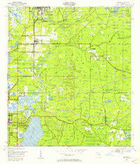 1943 Elfers1957 Print · USGSThe Florida Gulf Coast comes alive in the 1940s as settlements like New Port Richey and Tarpon Springs begin to take shape. Genealogists and researchers can trace the historic Dixie Highway and locate rural landmarks such as Elfers and Seven Springs.2 unique versions available
 - 1944 Map of Elfers
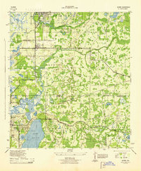 1944 Elfers1944 Print · USGSThe Florida Gulf coast comes into focus during the mid-1940s as the communities of New Port Richey and Elfers begin to expand. Genealogists and local historians can trace family locations near Seven Springs, the Anclote River, and early rail lines like the Seaboard Air Line.
 - 1948 Map of Elfers
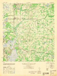 1948 Elfers1948 Print · USGSThe Florida Gulf Coast near the Pasco and Pinellas border comes alive in this post-war survey. Genealogists and researchers can trace early settlements at New Port Richey, Elfers, and Seven Springs while following the Seaboard Air Line through the cypress swamps.
 - 1955 Map of Plant City, 1966 Print
 1955 Plant City1966 Print · USGSMid-century Central Florida comes to life in this survey of the Nature Coast and the inland citrus and rail belt. Genealogists and historians can trace the paths of the Atlantic Coast Line, locate the Anclote Keys Lighthouse, or find old communities like Masaryktown and Lacoochee.6 unique versions available
 - 1958 Map of Plant City
 1958 Plant City1958 Print · USGSFlorida's Gulf Coast and inland ridge country are captured here in the mid-fifties, showing the region before modern sprawl. Genealogists and historians can trace rail-era towns like Richland and Trilby or locate coastal landmarks such as the Anclote Keys Lighthouse.
 - 1959 Map of Plant City
 1959 Plant City1959 Print · USGSThe West Florida coast and inland timberlands are captured here in the late fifties, from the bend of the Gulf to the rail hubs of the interior. Trace the paths of the Atlantic Coast Line through Inverness and find landmarks like the Anclote Keys Lighthouse.
 - 1964 Map of Plant City
 1964 Plant City1964 Print · USGSThe West Florida coast and its interior rail corridors come alive in this mid-sixties survey, spanning from the gulf marshes to the agricultural heartland. Researchers can trace the routes of the Atlantic Coast Line through settlements like Bushnell, Inverness, and Plant City.
 - 1974 Map of Elfers, 1975 Print
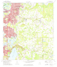 1974 Elfers1975 Print · USGSThe West Florida coast in the mid-seventies shows a landscape in transition as suburbs replaced rural sloughs and bayous. Genealogists and historians can trace the growth of New Port Richey, locate several burial grounds like East Elfers Cem, and follow the Seaboard Coast Line through Seven Springs.2 unique versions available
 - 1978 Map of Tarpon Springs, 1982 Print
 1978 Tarpon Springs1982 Print · USGSCoastal Florida is shown during its late-century period of rapid growth, from the Gulf shores to the deep inland swamps. Researchers can trace the development of the Intracoastal Waterway and locate regional landmarks like the Anclote Missile Tracking Annex and Lake Tarpon.
 - 1998 Map of Elfers, 2001 Print
 1998 Elfers2001 Print · USGSCoastal Pasco and Pinellas counties are seen here in the late twentieth century as suburban growth filled the corridors between historic river settlements. Trace local family roots at East Elfers Cem or locate community landmarks like Riverside Chapel and the Tampa Bay Executive Airport.
 - 2012 Map of Elfers, 2012 Print
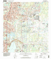
 2012 Elfers2012 Print · USGSCovers Foxwood, including Tarpon Springs, Holiday, and other nearby areas
 - 2015 Map of Elfers, 2015 Print
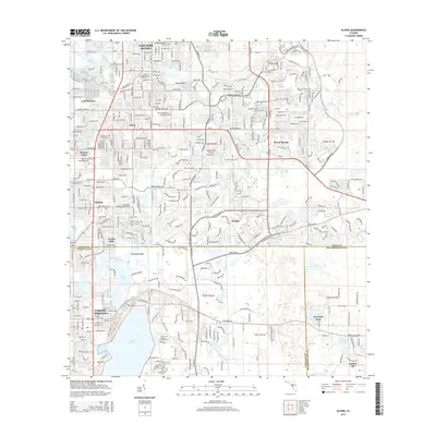 2015 Elfers2015 Print · USGSCovers Foxwood, including Tarpon Springs, Holiday, and other nearby areas
 - 2018 Map of Elfers, 2018 Print
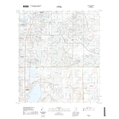
 2018 Elfers2018 Print · USGSCovers Foxwood, including Tarpon Springs, Holiday, and other nearby areas
 - 2021 Map of Elfers, 2021 Print
 2021 Elfers2021 Print · USGSCovers Foxwood, including Tarpon Springs, Holiday, and other nearby areas
 - 2024 Map of Elfers, 2024 Print
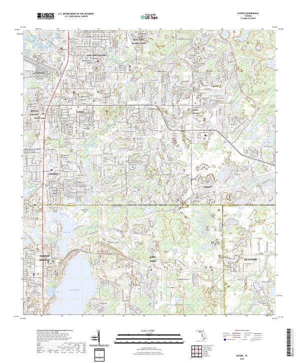 2024 Elfers2024 Print · USGSThe Florida Gulf Coast near Tarpon Springs and Elfers is shown in this modern era of suburban expansion and waterway preservation. Researchers can trace the layout of local cemeteries like Rose Cem and explore the geography of Lake Tarpon.
End of results
Showing maps 1-15 of 15
Frequently asked questions
- What are the different types of historical maps available for Foxwood?
- What is the oldest map of Foxwood?
- Where can I purchase historical maps of Foxwood for my home or office?
- Where can I download high-res historical maps of Foxwood?
- Are there historical topographic maps available for Foxwood?
- Is there historical aerial imagery available for Foxwood?
- Where are historical maps of Foxwood sourced from?