Old Maps of Westlake Village, Pinellas County for Genealogy
Trace your family roots with 12 historic maps of Westlake Village. These high-res maps reveal old neighborhoods, homesites, landmarks, and streets — helping you uncover where your ancestors lived and how the area evolved over time.
- Explore historic neighborhoods: Identify where your relatives may have lived in the 1800s or 1900s.
- Compare maps over time: Trace the changes in streets, buildings, and landmarks for multi-generational research.
- Perfect for genealogy & ancestry research: Used by family historians and researchers to map out lineage and migration.
These maps are an incredible resource for exploring your personal connection to Westlake Village's past.
Westlake Village, Pinellas County maps
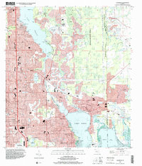
(12)- 1943 Map of Dunedin
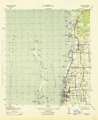 1943 Dunedin1943 Print · USGSCovers Westlake Village, including Clearwater, Palm Harbor, and other nearby areas3 unique versions available
 - 1943 Map of Oldsmar, 1961 Print
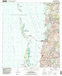
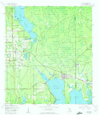 1943 Oldsmar1961 Print · USGSCovers Westlake Village, including Clearwater, East Lake, and other nearby areas2 unique versions available
 - 1944 Map of Oldsmar
 1944 Oldsmar1944 Print · USGSCovers Westlake Village, including Clearwater, East Lake, and other nearby areas
 - 1955 Map of Plant City, 1966 Print
 1955 Plant City1966 Print · USGSCovers Westlake Village, including Tampa, Lakeland, and other nearby areas6 unique versions available
 - 1958 Map of Plant City
 1958 Plant City1958 Print · USGSCovers Westlake Village, including Tampa, Lakeland, and other nearby areas
 - 1959 Map of Plant City
 1959 Plant City1959 Print · USGSCovers Westlake Village, including Tampa, Lakeland, and other nearby areas
 - 1964 Map of Plant City
 1964 Plant City1964 Print · USGSCovers Westlake Village, including Tampa, Lakeland, and other nearby areas
 - 1974 Map of Oldsmar, 1976 Print
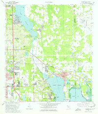 1974 Oldsmar1976 Print · USGSCovers Westlake Village, including Clearwater, East Lake, and other nearby areas2 unique versions available
 - 1974 Map of Dunedin, 1977 Print
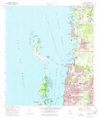 1974 Dunedin1977 Print · USGSCovers Westlake Village, including Clearwater, Palm Harbor, and other nearby areas3 unique versions available
 - 1978 Map of Tarpon Springs, 1982 Print
 1978 Tarpon Springs1982 Print · USGSCovers Westlake Village, including Tampa, Lakeland, and other nearby areas2 unique versions available
 - 1995 Map of Oldsmar, 2000 Print
 1995 Oldsmar2000 Print · USGSCovers Westlake Village, including Clearwater, East Lake, and other nearby areas
 - 1998 Map of Dunedin, 2001 Print
 1998 Dunedin2001 Print · USGSCovers Westlake Village, including Clearwater, Palm Harbor, and other nearby areas
End of results
Showing maps 1-12 of 12
Frequently asked questions
- What are the different types of historical maps available for Westlake Village?
- What is the oldest map of Westlake Village?
- Where can I purchase historical maps of Westlake Village for my home or office?
- Where can I download high-res historical maps of Westlake Village?
- Are there historical topographic maps available for Westlake Village?
- Is there historical aerial imagery available for Westlake Village?
- Where are historical maps of Westlake Village sourced from?