Old Maps of Pinellas County, Florida
Explore 138 old maps of Pinellas County, spanning from 1921 to today. These high-resolution historic maps reveal how streets, neighborhoods, landmarks, and natural features evolved over time — perfect for genealogy, metal detecting, research, and local history exploration.
What you can do with these maps:
- See how Pinellas County changed over time: Compare historical maps to modern-day views to trace roads, homesites, rail lines & more.
- View detailed metadata: Each map includes creators, publishers, year, scale, and archive source.
- Overlay maps with satellite & LiDAR: Visualize the past alongside modern tools to explore terrain & human change.
- Trusted historical sources: Maps sourced from the USGS, Library of Congress, and other archives.
- Access maps your way: View online, download high-res files, or order prints for personal or research use.
Start exploring old maps of Pinellas County to uncover forgotten places, hidden landmarks, and the deep history beneath your feet.
Pinellas County, FL maps
(138)- 1921 Map of Sand Key
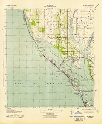
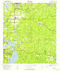
 1921 Sand Key1921 Print · USGSThe Pinellas peninsula comes alive in this early tactical survey of the gulf coast at the dawn of the Roaring Twenties. Genealogists and historians can trace early settlement patterns in Largo, Clearwater, and Anona before the post-war building boom.
 - 1921 Map of Fort De Soto
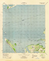
 1921 Fort De Soto1921 Print · USGSThe Florida coast at the start of the twenties reveals a landscape of isolated military outposts and emerging rail towns along the Gulf. Genealogists and historians can trace early families in Bradentown, locate the U.S. Quarantine Station, and follow the Seaboard Air Line tracks.2 unique versions available
 - 1921 Map of St Petersburg
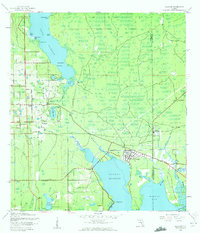
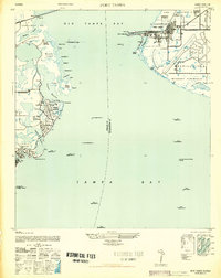
 1921 St Petersburg1921 Print · USGSThe Pinellas Peninsula just after the First World War shows a world of mangrove swamps, tidal bayous, and emerging settlements. Genealogists and local historians can trace early neighborhood footprints and coastal landmarks from Pinellas Park and Lealman to the growing streets of St. Petersburg.2 unique versions available
 - 1942 Map of Cockroach Bay
 1942 Cockroach Bay1942 Print · USGSThe eastern shores of Tampa Bay are captured here in the early 1940s, highlighting the undeveloped coastal wetlands and islands of the region. Researchers can trace early infrastructure and landmarks such as the Big Cockroach Mound, the Atlantic Coast Line rail corridor, and the small community at Piney Point.
 - 1943 Map of St Petersburg
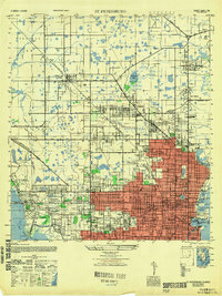
 1943 St Petersburg1943 Print · USGSThe Pinellas peninsula thrived during the mid-forties as a center for aviation and maritime training. Researchers can trace early urban development and transit lines like Tyrone Blvd, or locate local landmarks including Albert Whitted Airport and Royal Palm Cem.
 - 1943 Map of Gandy Bridge
 1943 Gandy Bridge1943 Print · USGSHillsborough County's shoreline during the wartime mobilization shows a landscape of military ranges and emerging suburbs. Trace the development of Beach Park, the footprint of Drew Field, and the rail infrastructure of the Atlantic Coast Line.
 - 1943 Map of Pass-A-Grille
 1943 Pass-A-Grille1943 Print · USGSCoastal Pinellas County comes into focus during the war years, revealing a landscape of nascent beach communities and protected island refuges. Trace the early footprints of Don Cesar Beach and Lakewood Estates, or locate the historic Piney Point Ferry landing.
 - 1943 Map of Bay Pines
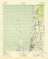
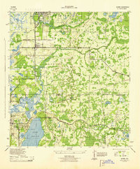
 1943 Bay Pines1943 Print · USGSThe Pinellas County coast was a mix of quiet precinct settlements and emerging beach towns during the mid-forties. Genealogists and historians can locate early institutions like the US Veterans Hospital, the Seminole Sch, and the old Seaboard Air Line rail corridor.3 unique versions available
 - 1943 Map of Safety Harbor
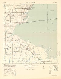
 1943 Safety Harbor1943 Print · USGSThe Pinellas County coast in the early 1940s is captured here during a period of wartime growth and coastal development. Genealogists and historians can trace old homesteads near Coachman, the expansion of Pinellas Army Airfield, and the route of the Davis Causeway.
 - 1943 Map of Dunedin
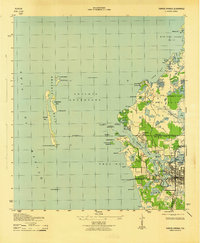
 1943 Dunedin1943 Print · USGSCoastal Pinellas County comes into focus during the early 1940s, documenting the shoreline from Dunedin north to Palm Harbor. Genealogists and historians can trace the Atlantic Coast Line railroad through small communities like Ozona, Wall Springs, and Crystal Beach.3 unique versions available
 - 1943 Map of Port Tampa
 1943 Port Tampa1943 Print · USGSThe Tampa Bay shoreline during World War II reveals a mix of wartime military expansion and early suburban development. Genealogists and historians can trace the foundations of Snell Isle, the industrial works at Port Tampa, and the early layout of MacDill Field.
 - 1943 Map of Tarpon Springs
 1943 Tarpon Springs1943 Print · USGSThe Gulf coast at the height of the war reveals a maritime landscape centered on the sponge docks and bayous. Researchers can trace the early layout of Tarpon Springs, the historic Anclote Keys Lighthouse, and old landmarks like Baileys Bluff.3 unique versions available
 - 1943 Map of Clearwater, 1952 Print
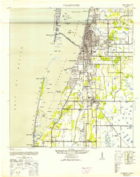 1943 Clearwater1952 Print · USGSCoastal Pinellas County comes alive in the mid-1940s, showing the early footprints of coastal resorts and citrus-era rail towns. Trace the old rail lines of the Seaboard Air Line or locate landmarks like the Biltmore Hotel and the Pinellas Co Fair Grounds.3 unique versions available
 - 1943 Map of Elfers, 1957 Print
 1943 Elfers1957 Print · USGSThe Florida Gulf Coast comes alive in the 1940s as settlements like New Port Richey and Tarpon Springs begin to take shape. Genealogists and researchers can trace the historic Dixie Highway and locate rural landmarks such as Elfers and Seven Springs.2 unique versions available
 - 1943 Map of Oldsmar, 1961 Print
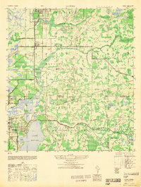
 1943 Oldsmar1961 Print · USGSUpper Pinellas County was a quiet region of citrus groves and coastal inlets during the early 1940s. Genealogists and historians can trace old community centers like Curlew, locate the Curlew Ch, and see the early layout of Oldsmar along the Seaboard Air Line railroad.2 unique versions available
 - 1944 Map of Anna Maria
 1944 Anna Maria1944 Print · USGSCoastal Manatee County is captured during the mid-forties, showing the early layout of Anna Maria and the mainland groves of Palma Sola. Trace the old shoreline landmarks from the Municipal Pier to the ancient Portavant Mound and the isolated Passage Key.2 unique versions available
 - 1944 Map of Elfers
 1944 Elfers1944 Print · USGSThe Florida Gulf coast comes into focus during the mid-1940s as the communities of New Port Richey and Elfers begin to expand. Genealogists and local historians can trace family locations near Seven Springs, the Anclote River, and early rail lines like the Seaboard Air Line.
 - 1944 Map of Oldsmar
 1944 Oldsmar1944 Print · USGSCoastal Pinellas and Hillsborough counties are shown here during the Second World War as the region's citrus and rail economy began to meet modern highway expansion. Genealogists and local historians can locate early landmarks like Curlew Ch, the Indian Mounds, and the Seaboard Air Line corridor.
 - 1945 Map of Cockroach Bay
 1945 Cockroach Bay1945 Print · USGSCoastal Hillsborough and Manatee counties are captured here in the mid-1940s as an intricate system of keys, passes, and rail lines. You can trace early transit routes like the Atlantic Coast Line and locate the Ferry Ldg at Piney Point.
 - 1947 Map of Cockroach Bay
 1947 Cockroach Bay1947 Print · USGSThe eastern shore of Tampa Bay appears in the late 1940s as a labyrinth of mangrove keys and tidal passes. Genealogists and local historians can trace the early infrastructure of Piney Point, the Atlantic Coast Line railroad, and the landmark Big Cockroach Mound.
 - 1947 Map of Port Tampa
 1947 Port Tampa1947 Print · USGSThe Florida coast just after the war shows the expansion of military and maritime infrastructure along Old Tampa Bay. Genealogists and historians can trace the early layouts of Shore Acres and Snell Isle or locate landmarks like the Port Tampa Dock.3 unique versions available
 - 1947 Map of Gandy Bridge
 1947 Gandy Bridge1947 Print · USGSHillsborough County's coastline and military landscape are captured here in the years following World War II. Researchers can trace the development of Drew Field and early residential subdivisions like Beach Park and Bel Mar along Old Tampa Bay.2 unique versions available
 - 1947 Map of St Petersburg
 1947 St Petersburg1947 Print · USGSThe Pinellas peninsula emerged into a new era of growth following the war, as urban limits expanded toward Pinellas Park and Gulfport. Local historians can trace early neighborhood schools like Euclid School and landmark institutions such as Albert Whitted Airport or the Dog Track.
 - 1947 Map of Safety Harbor, 1952 Print
 1947 Safety Harbor1952 Print · USGSThe western shores of Old Tampa Bay appear here in the mid-1940s, highlighting a landscape transitioning from agricultural precincts to a strategic military hub. Researchers can locate the sprawling Pinellas Army Airfield, the town of Safety Harbor, and the path of the Davis Causeway.2 unique versions available
 - 1948 Map of Elfers
 1948 Elfers1948 Print · USGSThe Florida Gulf Coast near the Pasco and Pinellas border comes alive in this post-war survey. Genealogists and researchers can trace early settlements at New Port Richey, Elfers, and Seven Springs while following the Seaboard Air Line through the cypress swamps.
Showing maps 1-25 of 138
Top cities of Pinellas County
- Saint Petersburg historical maps
- Clearwater historical maps
- Largo historical maps
- Palm Harbor historical maps
- Pinellas Park historical maps
- Dunedin historical maps
See more
Frequently asked questions
- What are the different types of historical maps available for Pinellas County?
- What is the oldest map of Pinellas County?
- Where can I purchase historical maps of Pinellas County for my home or office?
- Where can I download high-res historical maps of Pinellas County?
- Are there historical topographic maps available for Pinellas County?
- Is there historical aerial imagery available for Pinellas County?
- Where are historical maps of Pinellas County sourced from?