1900s (20th Century) Maps of Baywood, Florida
Explore 10 historic maps of Baywood from the 1900s (20th Century). These maps offer a rare glimpse into what life looked like during the 1900s — showing old roads, neighborhoods, homes, and landmarks that have changed or disappeared over time.
Whether you're researching your family's past, planning a metal detecting trip, or studying how Baywood's landscape evolved across the 1900s, these high-resolution maps are a powerful tool for exploring the history of this region.
- Focus on a specific era: All maps on this page are from the 1900s, giving you a focused view of this time period.
- See what’s changed: Compare century-old streets, trails, and buildings to today's modern landscape using overlays and satellite layers.
- Research with precision: Use these maps for genealogy, historical research, land use analysis, or educational projects.
- View, download, or print: Maps are fully viewable online in high resolution, and can be downloaded or printed for your own records.
Start exploring Baywood's history through authentic maps from the 1900s. This is your window into the past.
Baywood, FL maps
(10)- 1915 Map of Interlachen
 1915 Interlachen1915 Print · USGSThe Florida interior around the lake-heavy Putnam and Marion county lines is shown here in the years before widespread drainage and development. Researchers can trace the early rail stops at Florahome and Mannville or locate rural landmarks like Magnolia Church and the Cedar Landing Ferry.
 - 1916 Map of Interlachen
 1916 Interlachen1916 Print · USGSFlorida's lake-filled interior at the start of the Great War is a landscape of scattered rail towns and expansive wetlands. Genealogists and local historians can trace family roots through old settlements like Interlachen, Putnam Hall, and Kenwood Heights, or locate the rural Roscola School and Conch School.6 unique versions available
 - 1944 Map of Interlachen
 1944 Interlachen1944 Print · USGSNorth-central Florida's rail-and-water network is captured here in the 1940s, centered on the bustling junction at Interlachen. Genealogists and historians can trace riverside activity at Cedar Landing Ferry and early rural education sites like Congo Sch.
 - 1949 Map of Baywood, 1953 Print
 1949 Baywood1953 Print · USGSPutnam County in the late 1940s reveals a Florida landscape of cypress swamps and railway settlements. Researchers can trace family history at Mannville Cem or locate the early industry of Peat Cuttings near the Southern and Atlantic Coast Line railroads.3 unique versions available
 - 1949 Map of Interlachen, 1955 Print
 1949 Interlachen1955 Print · USGSPutnam County's lake-rich interior is captured here just after the war, showing the distinct citrus and rail-centered settlements of the era. Genealogists can locate family landmarks like Mt Bethel Ch, Johnson Park Sch, and the unique Peat Cuttings near Florahome.3 unique versions available
 - 1954 Map of Daytona Beach, 1974 Print
 1954 Daytona Beach1974 Print · USGSNortheast Florida is captured in the mid-1950s, showing the transition from river-based commerce to coastal tourism. Researchers can trace the Florida East Coast rail lines and find historic sites like Castillo de San Marcos Nat Mon and Palatka.
 - 1958 Map of Daytona Beach
 1958 Daytona Beach1958 Print · USGSThe Florida coast and St. Johns River valley are captured in the late 1950s, showing a landscape defined by citrus-belt rail towns and Atlantic shorelines. Genealogists can trace family roots through riverside settlements like Palatka and Welaka or coastal hubs like Daytona Beach.2 unique versions available
 - 1964 Map of Daytona Beach
 1964 Daytona Beach1964 Print · USGSCoastal Florida in the mid-1960s shows a fascinating balance between burgeoning beach tourism and the deep interior wilderness of the Ocala National Forest. Researchers can trace the path of the Florida East Coast railway through historic settlements like St. Augustine, Marineland, and Palatka.
 - 1981 Map of Saint Augustine, 1982 Print
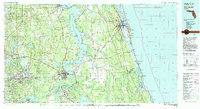 1981 Saint Augustine1982 Print · USGSNortheast Florida in the early eighties shows a landscape of deep river commerce and coastal growth. Genealogists and historians can trace the inland rail network of the Seaboard Coast Line through rural Hastings or explore the military footprint of Camp Blanding.2 unique versions available
 - 1993 Map of Baywood
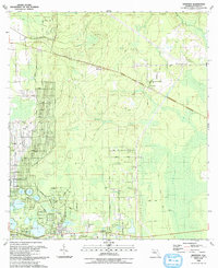 1993 Baywood1993 Print · USGSIn the early nineties, this northern Florida region shows a landscape of interconnected wetlands and small rural outposts like Baywood and Carraway. Genealogists can locate family landmarks such as Naomi Ch, Pine Lawn Cem, and the path of the Old RR Grade.
End of results
Showing maps 1-10 of 10
Top cities near Baywood
- Palatka historical maps
- Interlachen historical maps
- Keystone Heights historical maps
- Pomona Park historical maps
Frequently asked questions
- What are the different types of historical maps available for Baywood?
- What is the oldest map of Baywood?
- Where can I purchase historical maps of Baywood for my home or office?
- Where can I download high-res historical maps of Baywood?
- Are there historical topographic maps available for Baywood?
- Is there historical aerial imagery available for Baywood?
- Where are historical maps of Baywood sourced from?