Old Maps of Port Saint Lucie, Florida for Academic Research
Study the evolution of Port Saint Lucie with 14 high-resolution historic maps. Whether you're teaching, researching, or modeling changes in land use, these maps provide essential visual documentation of urban, environmental, and geographic change.
- Analyze long-term change: Track patterns in development, transportation, and natural features.
- Ideal for environmental or urban studies: Support academic projects with primary historical map data.
- Use in the classroom or lab: Educators and researchers rely on these maps to bring historical context to life.
These maps are a powerful tool for teaching, research, and visualizing how Port Saint Lucie has changed over the decades.
Port Saint Lucie, FL maps
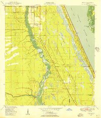
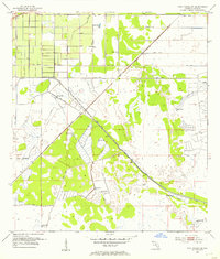
(14)- 1948 Map of Palm City, 1956 Print
 1948 Palm City1956 Print · USGSCovers Port Saint Lucie, including Stuart, Jensen Beach, and other nearby areas5 unique versions available
 - 1948 Map of Ankona, 1956 Print
 1948 Ankona1956 Print · USGSCovers Port Saint Lucie, including Jensen Beach, River Park, and other nearby areas4 unique versions available
 - 1948 Map of Eden, 1965 Print
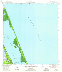 1948 Eden1965 Print · USGSCovers Port Saint Lucie, including Jensen Beach, Eden, and other nearby areas3 unique versions available
 - 1950 Map of Ankona
 1950 Ankona1950 Print · USGSCovers Port Saint Lucie, including Jensen Beach, River Park, and other nearby areas
 - 1950 Map of Palm City
 1950 Palm City1950 Print · USGSCovers Port Saint Lucie, including Stuart, Jensen Beach, and other nearby areas
 - 1950 Map of Eden
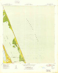 1950 Eden1950 Print · USGSCovers Port Saint Lucie, including Jensen Beach, Eden, and other nearby areas
 - 1953 Map of Indian Town NW, 1955 Print
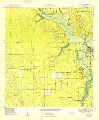
 1953 Indian Town NW1955 Print · USGSCovers Port Saint Lucie, including Saint Lucie County, Martin County, and other nearby areas6 unique versions available
 - 1953 Map of Fort Pierce SW, 1955 Print
 1953 Fort Pierce SW1955 Print · USGSCovers Port Saint Lucie, including Cana, Saint Lucie County, and other nearby areas4 unique versions available
 - 1956 Map of Fort Pierce, 1965 Print
 1956 Fort Pierce1965 Print · USGSCovers Port Saint Lucie, including Palm Bay, Lakeland, and other nearby areas4 unique versions available
 - 1958 Map of Fort Pierce
 1958 Fort Pierce1958 Print · USGSCovers Port Saint Lucie, including Palm Bay, Lakeland, and other nearby areas
 - 1959 Map of Fort Pierce
 1959 Fort Pierce1959 Print · USGSCovers Port Saint Lucie, including Palm Bay, Lakeland, and other nearby areas3 unique versions available
 - 1981 Map of Fort Pierce, 1982 Print
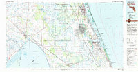 1981 Fort Pierce1982 Print · USGSCovers Port Saint Lucie, including Fort Pierce, Stuart, and other nearby areas
 - 1986 Map of Fort Pierce
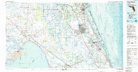 1986 Fort Pierce1986 Print · USGSCovers Port Saint Lucie, including Fort Pierce, Stuart, and other nearby areas
 - 1988 Map of Fort Pierce
 1988 Fort Pierce1988 Print · USGSCovers Port Saint Lucie, including Palm Bay, Lakeland, and other nearby areas
End of results
Showing maps 1-14 of 14
Top cities near Port Saint Lucie
- Fort Pierce historical maps
- Stuart historical maps
- Jensen Beach historical maps
- Port Salerno historical maps
- River Park historical maps
- White City historical maps
See more
Frequently asked questions
- What are the different types of historical maps available for Port Saint Lucie?
- What is the oldest map of Port Saint Lucie?
- Where can I purchase historical maps of Port Saint Lucie for my home or office?
- Where can I download high-res historical maps of Port Saint Lucie?
- Are there historical topographic maps available for Port Saint Lucie?
- Is there historical aerial imagery available for Port Saint Lucie?
- Where are historical maps of Port Saint Lucie sourced from?