Old Maps of Saint Lucie Village, Florida for Hiking & Exploration
Hike through history with 16 historic maps of Saint Lucie Village. Explore old trails, ghost towns, and forgotten backroads — perfect for outdoor adventurers and local explorers.
- Rediscover forgotten places: Map out old mining camps, roads, and footpaths that no longer exist on modern maps.
- Layer with modern tools: Combine with LiDAR or satellite views to plan hikes through historical terrain.
- Made for exploration: Popular among hikers, overlanders, and local history lovers.
Use these maps to find adventure and explore the hidden past of Saint Lucie Village.
Saint Lucie Village, FL maps
(16)- 1948 Map of Indrio, 1968 Print
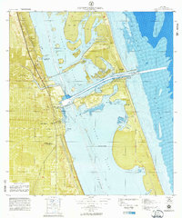
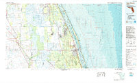
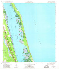 1948 Indrio1968 Print · USGSThe Florida coast near the Indian River and St. Lucie line appears here in the late 1940s, just as the postwar era began to reach these shores. Genealogists and local historians can trace the Florida East Coast railroad through Viking and Indrio, or locate the old Cem near the riverfront.4 unique versions available
 - 1949 Map of Fort Pierce, 1960 Print
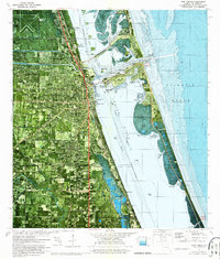
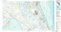
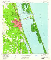 1949 Fort Pierce1960 Print · USGSFort Pierce and the Atlantic coast are captured here in the late nineteen-forties as the region's citrus and maritime identity took shape. Researchers can trace the development of White City, locate Gem Church, and study the early layout of Hutchinson Island.6 unique versions available
 - 1950 Map of Fort Pierce
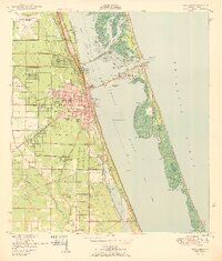 1950 Fort Pierce1950 Print · USGSFort Pierce and the surrounding St. Lucie County coast come alive in this mid-century survey. Genealogists and local historians can trace the development of White City, locate the White City Cem, and explore the rail corridor of the Florida East Coast.
 - 1950 Map of Indrio
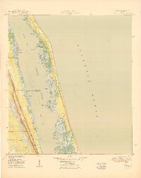 1950 Indrio1950 Print · USGSThe Florida Atlantic coast and Indian River lagoon are shown here in the late 1940s as citrus groves and coastal hamlets began to expand. You can trace early transport routes and the small settlement of Viking or explore the marshy banks of Prang Island Cr.
 - 1956 Map of Fort Pierce, 1965 Print
 1956 Fort Pierce1965 Print · USGSCentral and coastal Florida appear here during a period of rapid post-war growth and industrial expansion. Researchers can trace the mid-century rail-to-highway transition along the Sunshine State Parkway or locate old settlements like Ankona, Walton, and Indrio.4 unique versions available
 - 1958 Map of Fort Pierce
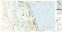
 1958 Fort Pierce1958 Print · USGSCentral and South Florida are captured here in the late fifties as the citrus and ranching interior met the modern highway era. Researchers can trace the early path of the Sunshine State Parkway and locate established rail depots in Sebring, Okeechobee, and Arcadia.
 - 1959 Map of Fort Pierce
 1959 Fort Pierce1959 Print · USGSCentral Florida and the Treasure Coast are shown here in the late fifties, during a period of steady citrus and coastal growth. Trace the historic routes of the Florida East Coast Ry or locate the boundaries of the Seminole Indian Reservation and Highlands Hammock State Park.3 unique versions available
 - 1972 Map of Fort Pierce
 1972 Fort Pierce1972 Print · USGSFort Pierce and the Indian River shoreline are captured in detail during the early seventies, showcasing a landscape of barrier islands and emerging infrastructure. Trace the early layout of Paradise Park or locate landmarks like the Fort Pierce Causeway and the Florida East Coast Railroad.
 - 1972 Map of Fort Pierce, 1975 Print
 1972 Fort Pierce1975 Print · USGSThe Florida Treasure Coast comes into focus in the early seventies as the urban grid of Fort Pierce expands toward the sea. Researchers can trace the legacy of coastal engineering along the Intracoastal Waterway and locate landmarks like the Florida East Coast rail line and Paradise Park.2 unique versions available
 - 1981 Map of Vero Beach, 1982 Print
 1981 Vero Beach1982 Print · USGSThe Florida Atlantic coast and the upper St. Johns River basin are shown here in the early 1980s during a period of steady coastal growth. Researchers can trace the development of Vero Beach and Palm Bay or locate inland landmarks like Blue Cypress Lake and the Valkaria Missile Tracking Station.
 - 1981 Map of Fort Pierce, 1982 Print
 1981 Fort Pierce1982 Print · USGSFlorida's Treasure Coast and the northern rim of the Everglades are caught in a period of significant growth during the early eighties. Genealogists and historians can trace the rail-side development of White City and Eden or the water-management history of the St Lucie Canal.
 - 1985 Map of Vero Beach, 1986 Print
 1985 Vero Beach1986 Print · USGSThe Florida coast and St. Johns River headwaters are captured here in the mid-eighties, from the Atlantic shoreline to the interior marshes. You can trace the Florida East Coast RR through Sebastian or locate the Valkaria Missile Tracking Station near the coast.
 - 1986 Map of Fort Pierce
 1986 Fort Pierce1986 Print · USGSSoutheast Florida’s Atlantic coast and inland waterways are captured in the mid-1980s as suburban development began to press against the agricultural interior. Trace the path of the Florida East Coast Railway through Fort Pierce or locate family sites near Evergreen Cem and White City.
 - 1988 Map of Fort Pierce
 1988 Fort Pierce1988 Print · USGSThe Atlantic coast and Florida’s interior lakelands are captured in the late eighties, just as the Treasure Coast was experiencing rapid development. Genealogists and historians can trace the rail lines of the Florida East Coast and explore the bounds of the Brighton Indian Reservation.
 - 2024 Map of Indrio, 2024 Print
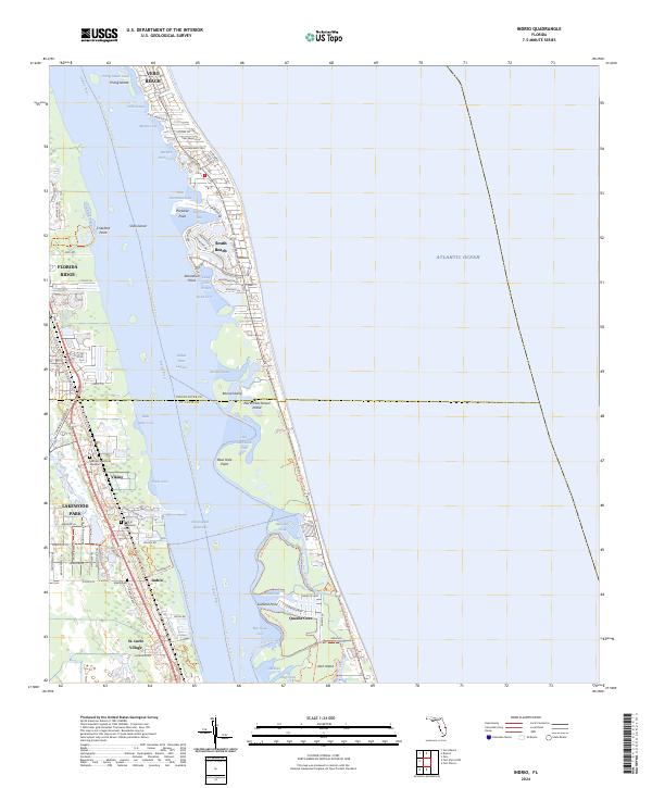 2024 Indrio2024 Print · USGSThe St. Lucie coastline and Indian River lagoon are shown here in detail during the early twenty-first century. Researchers can locate the Viking Cem, trace the Florida Circumavigational Paddling Trl, and explore the island coves around Indrio.
 - 2024 Map of Fort Pierce, 2024 Print
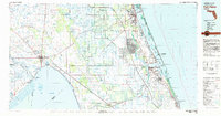
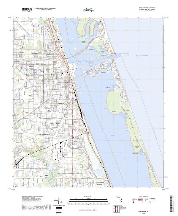 2024 Fort Pierce2024 Print · USGSThe Atlantic coast and its intricate inland waterways come to life in this recent study of the St. Lucie County shoreline. Researchers can trace the layout of St. Lucie Village, locate family plots in the Garden of Heavenly Rest Cem, or explore the maritime reaches of Hutchinson Island.
End of results
Showing maps 1-16 of 16
Top cities near Saint Lucie Village
- Port Saint Lucie historical maps
- Fort Pierce historical maps
- Vero Beach historical maps
- Lakewood Park historical maps
- Gifford historical maps
- West Vero Corridor historical maps
See more
Frequently asked questions
- What are the different types of historical maps available for Saint Lucie Village?
- What is the oldest map of Saint Lucie Village?
- Where can I purchase historical maps of Saint Lucie Village for my home or office?
- Where can I download high-res historical maps of Saint Lucie Village?
- Are there historical topographic maps available for Saint Lucie Village?
- Is there historical aerial imagery available for Saint Lucie Village?
- Where are historical maps of Saint Lucie Village sourced from?