Old Maps of Gulf Breeze, Florida
Explore 39 old maps of Gulf Breeze, spanning from 1921 to today. These high-resolution historic maps reveal how streets, neighborhoods, landmarks, and natural features evolved over time — perfect for genealogy, metal detecting, research, and local history exploration.
What you can do with these maps:
- See how Gulf Breeze changed over time: Compare historical maps to modern-day views to trace roads, homesites, rail lines & more.
- View detailed metadata: Each map includes creators, publishers, year, scale, and archive source.
- Overlay maps with satellite & LiDAR: Visualize the past alongside modern tools to explore terrain & human change.
- Trusted historical sources: Maps sourced from the USGS, Library of Congress, and other archives.
- Access maps your way: View online, download high-res files, or order prints for personal or research use.
Start exploring old maps of Gulf Breeze to uncover forgotten places, hidden landmarks, and the deep history beneath your feet.
Gulf Breeze, FL maps
(39)- 1921 Map of Pensacola
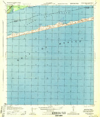
 1921 Pensacola1921 Print · USGSCoastal Florida in the early twentieth century reveals a landscape of maritime industry and military reserves. Map collectors and genealogists can trace the waterfront piers of Muscogee Wharf, the historic U. S. Live Oak Plantation, and early settlements like Bohemia.
 - 1941 Map of Pensacola, 1956 Print
 1941 Pensacola1956 Print · USGSPensacola and its surrounding bays are seen here just before the mid-century boom, detailing a landscape defined by naval aviation and maritime rail. Trace the historic city grid, explore the U S Naval Reservation, or locate Oakland Ch and Black Hammock Cem.
 - 1942 Map of Pensacola
 1942 Pensacola1942 Print · USGSCoastal Florida is captured here in the early years of the war, showing the maritime and rail infrastructure that shaped the Panhandle. Genealogists and historians can trace family locations near Oakland Ch, the Black Hammock Cem, and the busy Muscogee Wharf.2 unique versions available
 - 1944 Map of Oriole Beach
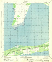
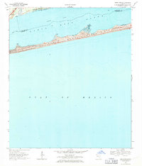
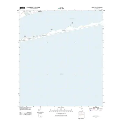
 1944 Oriole Beach1944 Print · USGSThe Florida Panhandle's barrier islands remain largely undeveloped during the mid-1940s, dominated by the Santa Rosa National Monument. Local historians can trace early maritime markers and coastal settlements like Oriole Beach and the U S Naval Res.
 - 1944 Map of Gulf Breeze
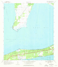
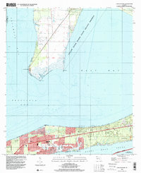
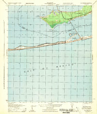 1944 Gulf Breeze1944 Print · USGSCoastal Florida and its military defenses are surveyed here during the mid-forties, showing the transition from naval outposts to early recreation. Researchers can trace the layout of the U S Naval Reservation and find the location of the Pensacola Quarantine Station (Abandoned) or the old Casino.
 - 1944 Map of Garcon Point
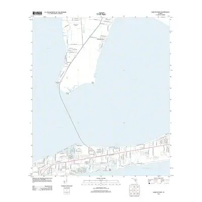
 1944 Garcon Point1944 Print · USGSThe Santa Rosa County coastline and the Garcon Point peninsula are captured here during the mid-forties. Genealogists and local historians can trace the early development of Woodlawn Beach or locate the northern Black Hammock Cem and several 1930s benchmarks.
 - 1944 Map of Pensacola
 1944 Pensacola1944 Print · USGSWorld War II era Pensacola reveals a bustling harbor defined by industrial piers and emerging suburbs. Trace the waterfront rail terminals like L & N Railroad Piers and follow the bluffs past Magnolia Bluff to the Bohemia Brick Chimney.
 - 1957 Map of Pensacola, 1967 Print
 1957 Pensacola1967 Print · USGSThe Florida Panhandle and Alabama coast are seen here at the height of the Cold War, showcasing a unique mix of military aviation and emerging beach tourism. Genealogists and local historians can trace legacy sites like Old Corry Field, the lumber town of Bagdad, and the coastal reaches of Santa Rosa Island.3 unique versions available
 - 1959 Map of Pensacola
 1959 Pensacola1959 Print · USGSThe Florida Panhandle and Alabama coast come alive in this late fifties survey of military aviation and maritime life. Genealogists can trace family roots in Bagdad, Loxley, and Milton while mapping the rails of the Louisville and Nashville.
 - 1960 Map of Pensacola
 1960 Pensacola1960 Print · USGSThe Florida Panhandle and Alabama's eastern shore are shown during a period of rapid military and coastal growth. Genealogists and historians can trace the mid-century footprints of Warrington, the Pensacola NAS (Chevalier), and the Blackwater River timber lands.
 - 1969 Map of Gulf Breeze, 1971 Print
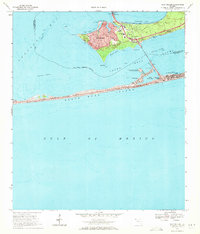 1969 Gulf Breeze1971 Print · USGSThe Florida Panhandle coast near Pensacola comes alive in this late-sixties study of a growing peninsula community. Researchers can trace the Andrew Jackson Trail, find the St Anna Ch, and explore the shoreline from Grassy Point to Fort Pickens State Park.3 unique versions available
 - 1969 Map of Oriole Beach, 1971 Print
 1969 Oriole Beach1971 Print · USGSThe Florida Panhandle coastline shows its mid-century character as the residential hubs of Gulf Breeze and Oriole Beach expand. Trace the early development of Santa Rosa Island along Via Deluna and the sand dunes of Big Sabine Point.4 unique versions available
 - 1970 Map of Garcon Point, 1971 Print
 1970 Garcon Point1971 Print · USGSThe Santa Rosa coastline appears in the early seventies as residential pockets began to expand along the sound. Researchers can trace local landmarks like Black Hammock Cem, St Pauls Ch, and the Midway Landing Strip.4 unique versions available
 - 1970 Map of Pensacola, 1972 Print
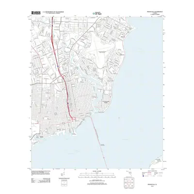
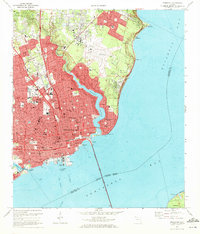 1970 Pensacola1972 Print · USGSPensacola's waterfront and growing suburbs are captured here just as the city's modern footprint was solidifying. Genealogists and historians can trace neighborhood development through numerous local schools and cemeteries like St Johns Cem and Holy Cross Cemetery.3 unique versions available
 - 1978 Map of Pensacola, 1980 Print
 1978 Pensacola1980 Print · USGSThe Gulf Coast at the end of the 1970s reveals a landscape shaped by maritime industry and a heavy naval presence. Researchers can trace the development of Pensacola alongside quiet coastal hamlets like Magnolia Springs and the historic Fort Pickens State Park.3 unique versions available
 - 1994 Map of Pensacola, 1999 Print
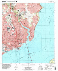 1994 Pensacola1999 Print · USGSPensacola and its waterfront neighborhoods are shown during the mid-nineties, capturing the city's development from the bay shore to the regional airport. Genealogists and historians can trace local landmarks like Holy Cross Cemetery, the historic Muscogee Wharf, and St Josephs Ch.
 - 1994 Map of Garcon Point, 2000 Print
 1994 Garcon Point2000 Print · USGSSanta Rosa County's coastal reaches are documented here during a period of residential growth between the great bays in the mid-nineties. Local historians can trace established neighborhoods like Oriole Beach and Woodlawn Beach or locate sites like St Pauls Ch and Black Hammock Cem.
 - 2012 Map of Pensacola, 2012 Print
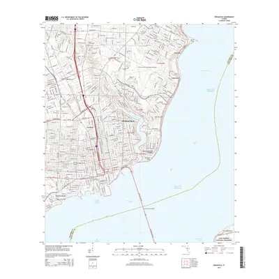
 2012 Pensacola2012 Print · USGSCovers Gulf Breeze, including Pensacola, Goulding, and other nearby areas
 - 2012 Map of Oriole Beach, 2012 Print
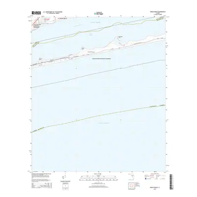
 2012 Oriole Beach2012 Print · USGSCovers Gulf Breeze, including Oriole Beach, Escambia County, and other nearby areas
 - 2012 Map of Garcon Point, 2012 Print
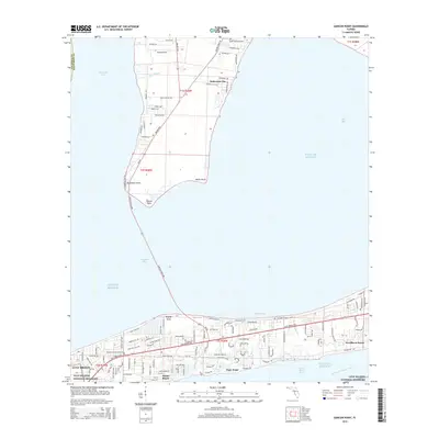
 2012 Garcon Point2012 Print · USGSCovers Gulf Breeze, including Tiger Point, Escambia County, and other nearby areas
 - 2012 Map of Gulf Breeze, 2012 Print
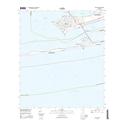
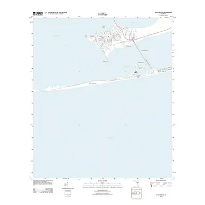 2012 Gulf Breeze2012 Print · USGSCovers Gulf Breeze, including Villa Sabine, Pensacola Beach, and other nearby areas
 - 2015 Map of Pensacola, 2015 Print
 2015 Pensacola2015 Print · USGSCovers Gulf Breeze, including Pensacola, Goulding, and other nearby areas
 - 2015 Map of Garcon Point, 2015 Print
 2015 Garcon Point2015 Print · USGSCovers Gulf Breeze, including Tiger Point, Escambia County, and other nearby areas
 - 2015 Map of Oriole Beach, 2015 Print
 2015 Oriole Beach2015 Print · USGSCovers Gulf Breeze, including Oriole Beach, Escambia County, and other nearby areas
 - 2015 Map of Gulf Breeze, 2015 Print
 2015 Gulf Breeze2015 Print · USGSCovers Gulf Breeze, including Villa Sabine, Pensacola Beach, and other nearby areas
Showing maps 1-25 of 39
Top cities near Gulf Breeze
Frequently asked questions
- What are the different types of historical maps available for Gulf Breeze?
- What is the oldest map of Gulf Breeze?
- Where can I purchase historical maps of Gulf Breeze for my home or office?
- Where can I download high-res historical maps of Gulf Breeze?
- Are there historical topographic maps available for Gulf Breeze?
- Is there historical aerial imagery available for Gulf Breeze?
- Where are historical maps of Gulf Breeze sourced from?