Old Maps of Freeport, Florida
Explore 15 old maps of Freeport, spanning from 1935 to today. These high-resolution historic maps reveal how streets, neighborhoods, landmarks, and natural features evolved over time — perfect for genealogy, metal detecting, research, and local history exploration.
What you can do with these maps:
- See how Freeport changed over time: Compare historical maps to modern-day views to trace roads, homesites, rail lines & more.
- View detailed metadata: Each map includes creators, publishers, year, scale, and archive source.
- Overlay maps with satellite & LiDAR: Visualize the past alongside modern tools to explore terrain & human change.
- Trusted historical sources: Maps sourced from the USGS, Library of Congress, and other archives.
- Access maps your way: View online, download high-res files, or order prints for personal or research use.
Start exploring old maps of Freeport to uncover forgotten places, hidden landmarks, and the deep history beneath your feet.
Freeport, FL maps
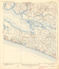
(15)- 1935 Map of De Funiak Springs
 1935 De Funiak Springs1935 Print · USGSCovers Freeport, including DeFuniak Springs, Steele Church, and other nearby areas2 unique versions available
 - 1936 Map of Point Washington
 1936 Point Washington1936 Print · USGSCovers Freeport, including Santa Rosa Beach, Santa Rosa Beach, and other nearby areas2 unique versions available
 - 1938 Map of De Funiak Springs
 1938 De Funiak Springs1938 Print · USGSCovers Freeport, including DeFuniak Springs, Steele Church, and other nearby areas4 unique versions available
 - 1939 Map of Point Washington
 1939 Point Washington1939 Print · USGSCovers Freeport, including Santa Rosa Beach, Santa Rosa Beach, and other nearby areas4 unique versions available
 - 1957 Map of Pensacola, 1967 Print
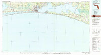
 1957 Pensacola1967 Print · USGSCovers Freeport, including Mobile, Pensacola, and other nearby areas3 unique versions available
 - 1959 Map of Pensacola
 1959 Pensacola1959 Print · USGSCovers Freeport, including Mobile, Pensacola, and other nearby areas
 - 1960 Map of Pensacola
 1960 Pensacola1960 Print · USGSCovers Freeport, including Mobile, Pensacola, and other nearby areas
 - 1970 Map of Bunker, 1972 Print
 1970 Bunker1972 Print · USGSCovers Freeport, including Old Bay View, Bunker, and other nearby areas2 unique versions available
 - 1970 Map of Portland, 1972 Print
 1970 Portland1972 Print · USGSCovers Freeport, including Portland, New Home, and other nearby areas3 unique versions available
 - 1970 Map of Freeport, 1972 Print
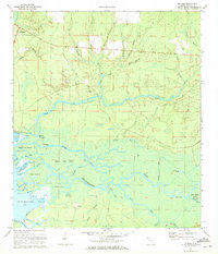
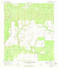
 1970 Freeport1972 Print · USGSCovers Freeport, including Santa Rosa Beach, Fluffy Landing, and other nearby areas2 unique versions available
 - 1970 Map of Rock Hill, 1972 Print
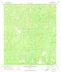
 1970 Rock Hill1972 Print · USGSCovers Freeport, including Rock Hill, Walton County, and other nearby areas3 unique versions available
 - 1974 Map of Point Washington
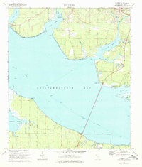
 1974 Point Washington1974 Print · USGSCovers Freeport, including Santa Rosa Beach, Santa Rosa Beach, and other nearby areas
 - 1978 Map of Fort Walton Beach, 1980 Print
 1978 Fort Walton Beach1980 Print · USGSCovers Freeport, including Navarre, Fort Walton Beach, and other nearby areas2 unique versions available
 - 1978 Map of Crestview, 1982 Print
 1978 Crestview1982 Print · USGSCovers Freeport, including Crestview, Niceville, and other nearby areas2 unique versions available
 - 1996 Map of Point Washington
 1996 Point Washington1996 Print · USGSCovers Freeport, including Santa Rosa Beach, Santa Rosa Beach, and other nearby areas
End of results
Showing maps 1-15 of 15
Top cities near Freeport
- Panama City Beach historical maps
- Santa Rosa Beach historical maps
- Miramar Beach historical maps
- DeFuniak Springs historical maps
- Ponce de Leon historical maps
Top neighborhoods of Freeport
Frequently asked questions
- What are the different types of historical maps available for Freeport?
- What is the oldest map of Freeport?
- Where can I purchase historical maps of Freeport for my home or office?
- Where can I download high-res historical maps of Freeport?
- Are there historical topographic maps available for Freeport?
- Is there historical aerial imagery available for Freeport?
- Where are historical maps of Freeport sourced from?