Old Maps of Freeport, Florida for Metal Detecting
Plan your next treasure hunt with 35 historic maps of Freeport. Find old homesites, ghost towns, trails, and gathering spots that may be lost to time — perfect for identifying promising metal detecting locations.
- Locate forgotten sites: Uncover places like long-lost settlements, abandoned rail lines, or gathering spots.
- Plan better hunts: Use map overlays combined with LiDAR or satellite views to narrow in on historically rich areas.
- Made for detectorists: Thousands of hobbyists use these maps to discover relics, coins, and hidden history.
Use these historic maps to boost your research and find new opportunities beneath the surface of Freeport.
Freeport, FL maps
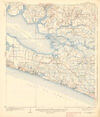
(35)- 1935 Map of De Funiak Springs
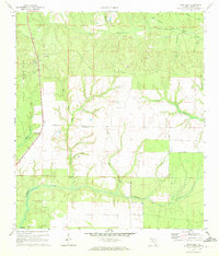
 1935 De Funiak Springs1935 Print · USGSWalton County in the mid-1930s shows a landscape of rural schools and family homesteads centered around the rail hub of De Funiak Springs. Genealogists can trace family locations near Magnolia Cem, Seckinger Mill, and the many one-room schoolhouses like Indian Head Sch.2 unique versions available
 - 1936 Map of Point Washington
 1936 Point Washington1936 Print · USGSCoastal Walton County in the mid-1930s reveals a maritime landscape defined by river deltas and emerging beach communities. Genealogists and historians can trace the early footprints of Seagrove Beach and Point Washington, or locate the Bunker Cem and Pt. Washington Light House.2 unique versions available
 - 1938 Map of De Funiak Springs
 1938 De Funiak Springs1938 Print · USGSWalton County in the late thirties is a landscape of creek-side mills and timberlands stretching from the Louisville and Nashville RR down to the bay. Genealogists can locate family landmarks like Oak Ridge Cem, trace old routes at Old Walton Bridge, and find rural school sites like Eucheanna Sch.4 unique versions available
 - 1939 Map of Point Washington
 1939 Point Washington1939 Print · USGSThe Florida Panhandle coast near Walton County shows its quiet pre-development character during the late 1930s. Genealogists and local historians can trace the foundations of early beach settlements at Grayton Beach and Point Washington, or locate the Liberty Sch and Black Creek Chs inland.3 unique versions available
 - 1957 Map of Pensacola, 1967 Print
 1957 Pensacola1967 Print · USGSThe Florida Panhandle and Alabama coast are seen here at the height of the Cold War, showcasing a unique mix of military aviation and emerging beach tourism. Genealogists and local historians can trace legacy sites like Old Corry Field, the lumber town of Bagdad, and the coastal reaches of Santa Rosa Island.3 unique versions available
 - 1959 Map of Pensacola
 1959 Pensacola1959 Print · USGSThe Florida Panhandle and Alabama coast come alive in this late fifties survey of military aviation and maritime life. Genealogists can trace family roots in Bagdad, Loxley, and Milton while mapping the rails of the Louisville and Nashville.
 - 1960 Map of Pensacola
 1960 Pensacola1960 Print · USGSThe Florida Panhandle and Alabama's eastern shore are shown during a period of rapid military and coastal growth. Genealogists and historians can trace the mid-century footprints of Warrington, the Pensacola NAS (Chevalier), and the Blackwater River timber lands.
 - 1970 Map of Bunker, 1972 Print
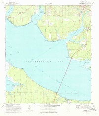
 1970 Bunker1972 Print · USGSThe Walton County coastline in the early seventies shows the intricate delta where Black Creek meets the bay. Researchers can trace family roots at Black Creek Ch or explore the marsh islands of Bunker Island and Indian Island.2 unique versions available
 - 1970 Map of Portland, 1972 Print
 1970 Portland1972 Print · USGSCoastal Walton County in the early seventies shows a landscape where military activity meets rural tradition. Researchers can locate the New Home Cem, trace the waters of Alaqua Creek, and explore the southern outskirts of Portland.3 unique versions available
 - 1970 Map of Freeport, 1972 Print
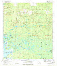
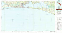
 1970 Freeport1972 Print · USGSThe Walton County coast in the early seventies shows a landscape of tidal bayous and growing shoreline communities. Genealogists and historians can trace the early footprints of Freeport, Santa Rosa Beach, and the uniquely named Fluffy Landing.2 unique versions available
 - 1970 Map of Rock Hill, 1972 Print
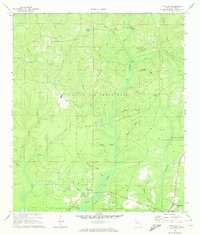
 1970 Rock Hill1972 Print · USGSWalton County as it appeared in the early 1970s shows the sprawling intersection of military training grounds and rural creek basins. Genealogists and historians can locate family landmarks near Owls Head or trace the drainage of Seven Runs and Lafayette Creek.3 unique versions available
 - 1974 Map of Point Washington
 1974 Point Washington1974 Print · USGSThe Florida Panhandle's Emerald Coast is captured in the mid-seventies, showing the growth of coastal communities between the Gulf and the bay. Genealogists and local historians can locate Black Creek Church, Santa Rosa Cemetery, and the early footprints of Grayton Beach and Point Washington.
 - 1978 Map of Fort Walton Beach, 1980 Print
 1978 Fort Walton Beach1980 Print · USGSThe Florida Panhandle in the late seventies reveals a landscape defined by the growth of Eglin Air Force Base and the shoreline of Choctawhatchee Bay. Genealogists and historians can trace the early footprints of Fort Walton Beach, Destin, and remote coastal outposts like Point Washington.2 unique versions available
 - 1978 Map of Crestview, 1982 Print
 1978 Crestview1982 Print · USGSThe Florida Panhandle and southern Alabama borderlands appear here in the late seventies as the military and timber industries shaped the landscape. Genealogists can trace family roots through small settlements like Cannon Town or Svea, and locate old sites like Aux Field No 4 (Abandoned).2 unique versions available
 - 1996 Map of Point Washington
 1996 Point Washington1996 Print · USGSThe Walton County coast and Choctawhatchee delta are shown here in the mid-nineties as the beach communities began to expand. Trace the intricate river channels near Opossum Island or locate established landmarks like Point Washington and Grayton Beach State Park.
 - 2012 Map of Bunker, 2012 Print
 2012 Bunker2012 Print · USGSCovers Freeport, including Bunker, Old Bay View, and other nearby areas
 - 2012 Map of Freeport, 2012 Print
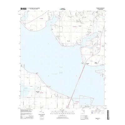
 2012 Freeport2012 Print · USGSCovers Freeport, including La Grange Point, Fluffy Landing, and other nearby areas
 - 2012 Map of Portland, 2012 Print
 2012 Portland2012 Print · USGSCovers Freeport, including New Home, Portland, and other nearby areas
 - 2012 Map of Rock Hill, 2012 Print
 2012 Rock Hill2012 Print · USGSCovers Freeport, including Rock Hill, Walton County, and other nearby areas
 - 2015 Map of Bunker, 2015 Print
 2015 Bunker2015 Print · USGSCovers Freeport, including Bunker, Old Bay View, and other nearby areas
 - 2015 Map of Portland, 2015 Print
 2015 Portland2015 Print · USGSCovers Freeport, including New Home, Portland, and other nearby areas
 - 2015 Map of Rock Hill, 2015 Print
 2015 Rock Hill2015 Print · USGSCovers Freeport, including Rock Hill, Walton County, and other nearby areas
 - 2015 Map of Freeport, 2015 Print
 2015 Freeport2015 Print · USGSCovers Freeport, including La Grange Point, Fluffy Landing, and other nearby areas
 - 2018 Map of Rock Hill, 2018 Print
 2018 Rock Hill2018 Print · USGSCovers Freeport, including Rock Hill, Walton County, and other nearby areas
 - 2018 Map of Portland, 2018 Print
 2018 Portland2018 Print · USGSCovers Freeport, including New Home, Portland, and other nearby areas
Showing maps 1-25 of 35
Top cities near Freeport
- Panama City Beach historical maps
- Santa Rosa Beach historical maps
- Miramar Beach historical maps
- DeFuniak Springs historical maps
- Ponce de Leon historical maps
Top neighborhoods of Freeport
Frequently asked questions
- What are the different types of historical maps available for Freeport?
- What is the oldest map of Freeport?
- Where can I purchase historical maps of Freeport for my home or office?
- Where can I download high-res historical maps of Freeport?
- Are there historical topographic maps available for Freeport?
- Is there historical aerial imagery available for Freeport?
- Where are historical maps of Freeport sourced from?