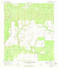
1970 Map of Rock Hill
USGS Topo · Published 1972About this map
Eglin Air Force Base dominates the western edge of this Florida panhandle landscape, marking a clear boundary between military territory and the surrounding rural terrain. The topography is defined by an intricate network of waterways, including the winding Seven Runs and the convergence of Magnolia Creek and Steep Head as they flow toward Lafayette Creek. Small pockets of human activity are evident at Owls Head and the elevated point of Rock Hill, which features a Lookout Tower. Further east, a Landing Strip and the small settlement of Claypit sit among the many branches of Bruce Creek. The map documents a sparsely populated area where the natural drainage of the swampy lowlands dictates the placement of early roads and isolated homesteads.
Find a feature on this map
23 named features on this map. Tap any name to fly to it.
Don’t see what you’re looking for? This feature index may not catch every label — zoom into the map to look around manually.
Map Details
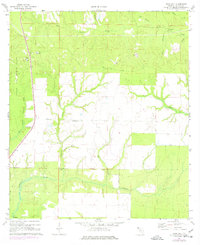
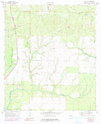
Editions of this 1970 Rock Hill Map
3 editions found
Other maps of this area

1935 · De Funiak Springs
USGS Topo · 1:48,000

1936 · Point Washington
USGS Topo · 1:48,000

1938 · De Funiak Springs
USGS Topo · 1:62,500

1939 · Point Washington
USGS Topo · 1:62,500

1944 · Bruce
USGS Topo · 1:24,000

1945 · Bruce
USGS Topo · 1:31,680

1948 · Ponce De Leon
USGS Topo · 1:24,000

1949 · Redbay
USGS Topo · 1:24,000

1950 · Ponce De Leon
USGS Topo · 1:24,000

1950 · Redbay
USGS Topo · 1:24,000