2020s Maps of Cochran, Georgia
Explore 4 historic maps of Cochran from the 2020s. These maps offer a rare glimpse into what life looked like during the 2020s — showing old roads, neighborhoods, homes, and landmarks that have changed or disappeared over time.
Whether you're researching your family's past, planning a metal detecting trip, or studying how Cochran's landscape evolved across the 2020s, these high-resolution maps are a powerful tool for exploring the history of this region.
- Focus on a specific era: All maps on this page are from the 2020s, giving you a focused view of this time period.
- See what’s changed: Compare century-old streets, trails, and buildings to today's modern landscape using overlays and satellite layers.
- Research with precision: Use these maps for genealogy, historical research, land use analysis, or educational projects.
- View, download, or print: Maps are fully viewable online in high resolution, and can be downloaded or printed for your own records.
Start exploring Cochran's history through authentic maps from the 2020s. This is your window into the past.
Cochran, GA maps
(4)- 2020 Map of Cochran, 2020 Print
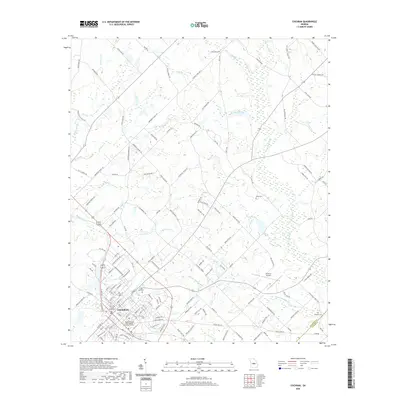 2020 Cochran2020 Print · USGSCovers Cochran, including Five Points, Dodge County, and other nearby areas
 - 2020 Map of Empire, 2020 Print
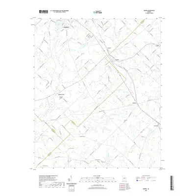 2020 Empire2020 Print · USGSCovers Cochran, including Empire, Roddy, and other nearby areas
 - 2024 Map of Cochran, 2024 Print
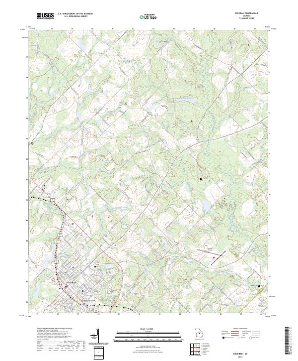 2024 Cochran2024 Print · USGSCochran and its surrounding Georgia timberlands are captured here in the early twenty-first century as the region balances its collegiate and agricultural identities. Researchers can locate Middle Georgia State College - Cochran Campus and trace family-named routes like Daisy Adams Rd near Hill Cem.
 - 2024 Map of Empire, 2024 Print
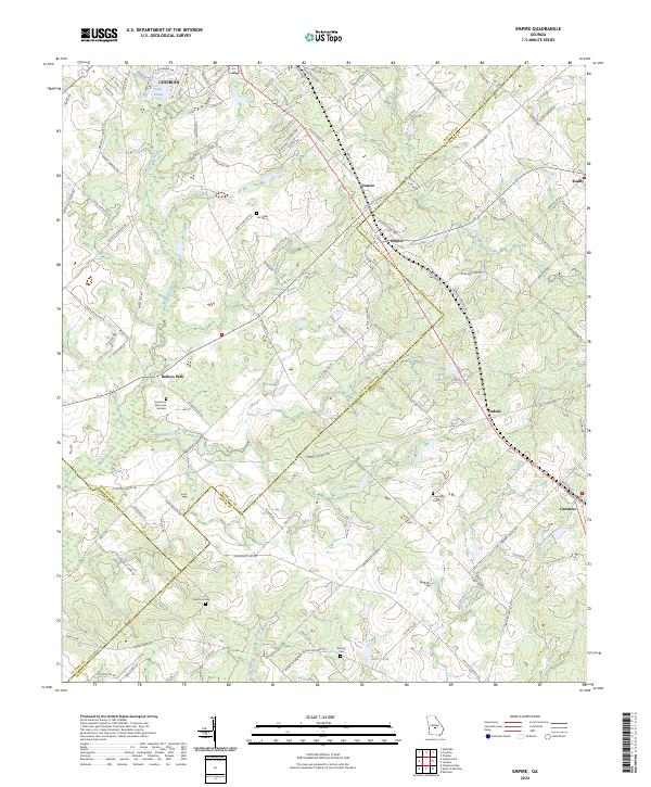 2024 Empire2024 Print · USGSThe rural borders of Bleckley and Dodge counties come alive in this recent survey of Middle Georgia. Genealogists can trace family footprints across numerous sites including Hart Cem, Limestone Memorial Gardens, and the small community of Baileys Park.
End of results
Showing maps 1-4 of 4
Top cities near Cochran
- Eastman historical maps
- Hawkinsville historical maps
- Chester historical maps
- Danville historical maps
- Montrose historical maps
- Allentown historical maps
Frequently asked questions
- What are the different types of historical maps available for Cochran?
- What is the oldest map of Cochran?
- Where can I purchase historical maps of Cochran for my home or office?
- Where can I download high-res historical maps of Cochran?
- Are there historical topographic maps available for Cochran?
- Is there historical aerial imagery available for Cochran?
- Where are historical maps of Cochran sourced from?